This item has been sold, but you can get on the Waitlist to be notified if another example becomes available, or purchase a digital scan.
1906 Congreso Geologico Plan of Mexico City, Mexico
CiudaddeMexico-congresogeologico-1906$475.00


Title
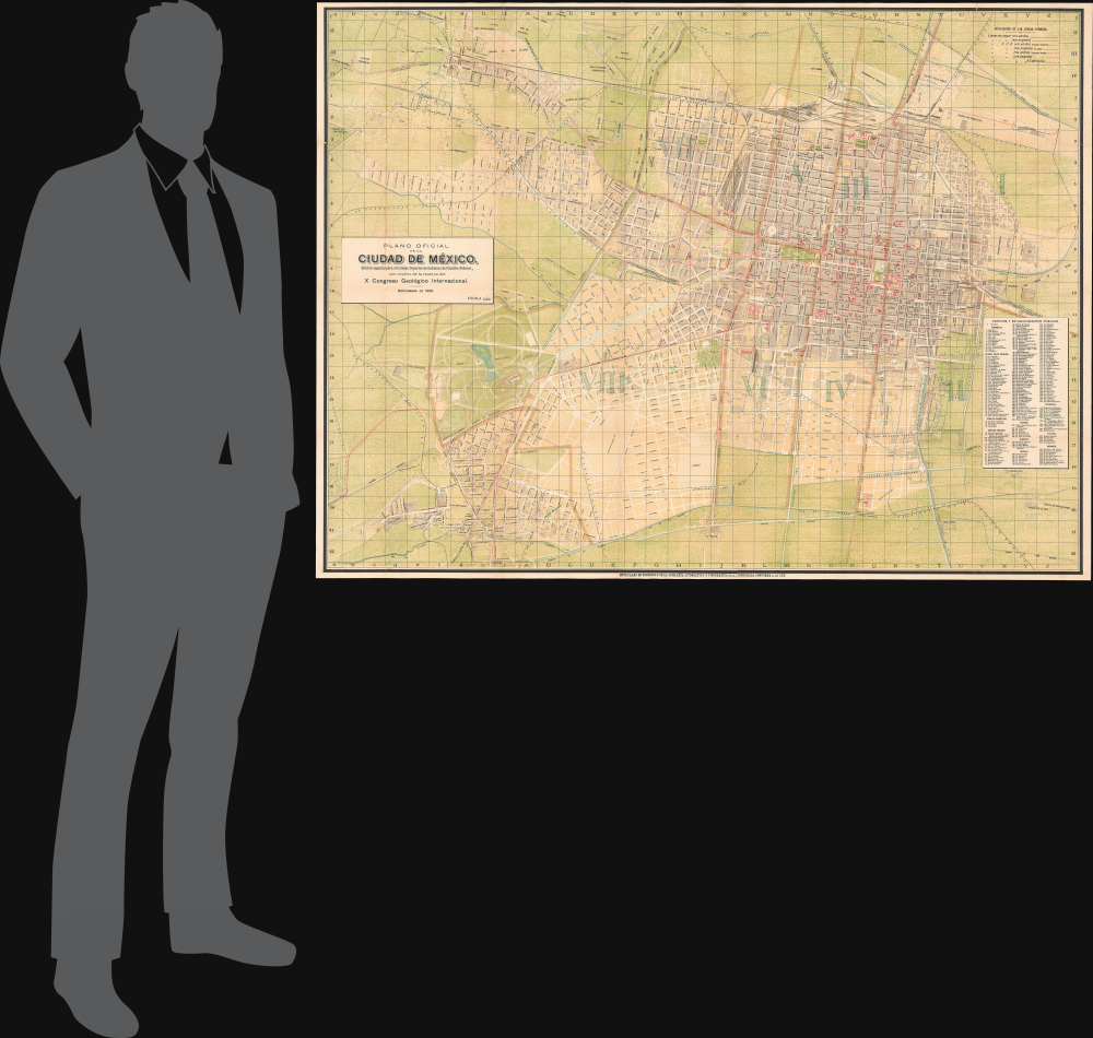
Plano oficial de la ciudad de México. Edición especial para el Consejo Superior de Gobierno del Distrito Federal, con motivo de la reunión del X Congreso Geológico Internacional.
1906 (dated) 31.5 x 42 in (80.01 x 106.68 cm) 1 : 10000
1906 (dated) 31.5 x 42 in (80.01 x 106.68 cm) 1 : 10000
Description
This is a colorful 1910 map of Mexico City produced by the Compañia Litografica y Tipografica for the 10th International Geological Congress. Far from a dry academic gathering, the Congress provided the Mexican government an opportunity to impress visiting geologists and attract interest (and investment) in the country's growing mining operations.
When this map was produced, Mexico City had recently undergone some drastic changes in line with the policies of the Porfiriato (1876 - 1911), when Porfirio Díaz dominated the country's national politics. Díaz championed the construction of railways, resulting in roughly a dozen lines converging on the city into a similar number of stations, including three built right next to each other, as seen towards the top center here. A grand avenue, the Paseo de la Reforma, similar to the Champs-Élysées in Paris, was constructed, along with dozens of monuments and new government buildings. New suburbs ('colonias') were also built in the contemporary European style along the periphery of the city, catering to the growing urban middle and upper classes.
A Closer Look
Coverage includes the entirety of Mexico City. Districts of the city are numbered with large Roman numerals. A legend at the top-right indicates different types of railways and trams operating in and around the city, including steam, electric, and some remnant horsecars. Major streets are labeled throughout. The public buildings listed in the index at the right include parishes, churches, government buildings, hotels, theaters, telegraph offices, and prisons. Aside from the index, some neighborhoods, businesses, ranchos, and other features are labeled directly on the map.When this map was produced, Mexico City had recently undergone some drastic changes in line with the policies of the Porfiriato (1876 - 1911), when Porfirio Díaz dominated the country's national politics. Díaz championed the construction of railways, resulting in roughly a dozen lines converging on the city into a similar number of stations, including three built right next to each other, as seen towards the top center here. A grand avenue, the Paseo de la Reforma, similar to the Champs-Élysées in Paris, was constructed, along with dozens of monuments and new government buildings. New suburbs ('colonias') were also built in the contemporary European style along the periphery of the city, catering to the growing urban middle and upper classes.
The Tenth International Geological Congress
The Tenth International Geological Congress was held in Mexico City in September 1906, hosted by the Geological Institute of Mexico (el Instituto Geológico de México), which was the first such institute in Latin America, founded in 1895. Both the institute and the conference were heavily supported by the modernizing government of Porfirio Díaz, which was primarily interested in mining. Attendees were astonished at the lavish entertainment, accommodations, and victuals provided, as well as the fact that the government covered half their transportation costs. There were so many banquets, talks, and excursions (thirty-one in all) to different geologically significant sites, utilizing Mexico's increasingly dense railway network, that the entire Congress lasted nearly two months. The Congress certainly left a good impression on attendees, but any resulting windfall in investments in Mexican mines and railways would have been disrupted shortly thereafter by the Mexican Revolution.Publication History and Census
This map was prepared and printed by the Compañia Litografica y Tipografica in Mexico City in 1906. It is a special edition of the Compañia's 1906 'Plano Oficial de la Ciudad de México' that was made for the Geological Congress. This special edition of the map is noted among the holdings of 10 institutions in the OCLC.Cartographer
Compañia Litografica y Tipografica, S.A. (fl. c. 1891 - 1911) was a Mexican lithographic firm based in Mexico City specializing in map printing and publishing. In particular, the firm published several editions of a large-format 'Official Plan' of Mexico City, as well as a reduced version of the same. The company maintained a special relationship with the municipal government and was commissioned to print its Official Plan in 1891, as well as an updated plan in 1900 that changed many of the city streets' names. It continued to print updated maps of Mexico City until 1911, but appears to have ceased operations thereafter, possibly due to the Mexican Revolution. More by this mapmaker...
Condition
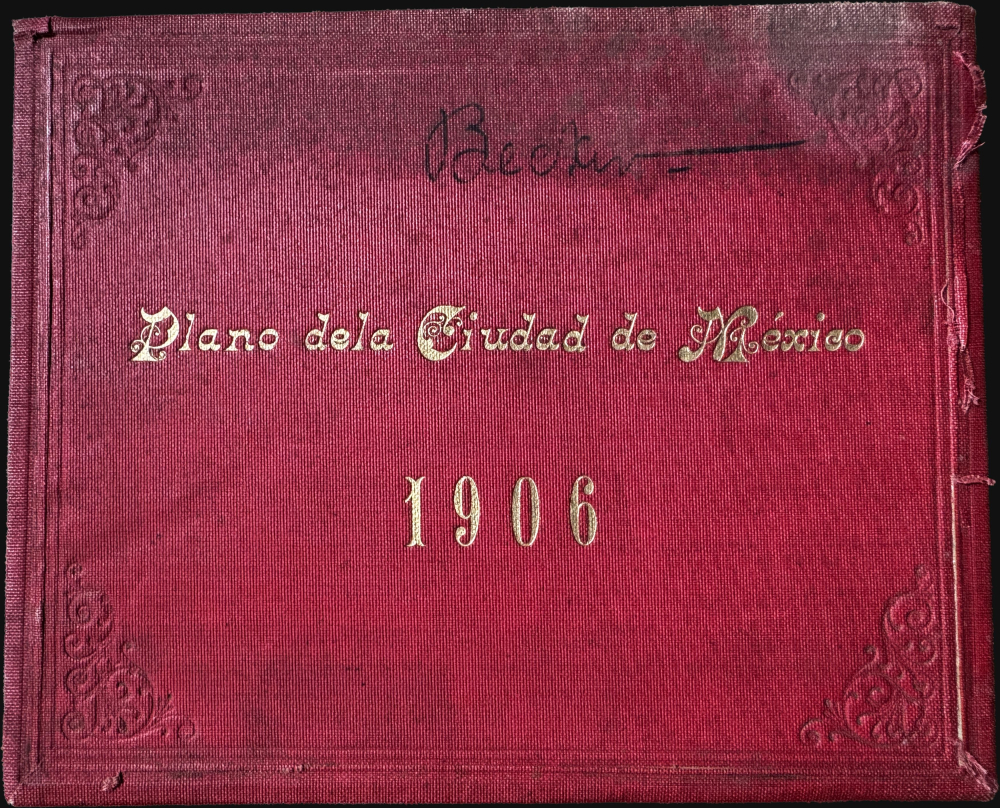
Very good. Some wear and verso reinforcement to closed fold spits. Slight stabilized loss a few fold intersections. Pea sized reinstatement of chip located to the north of 'P' in 'Plano'. Folds into original blind-stamped red linen slipcase.
References
OCLC 46336855, 1181050384.