This item has been sold, but you can get on the Waitlist to be notified if another example becomes available, or purchase a digital scan.
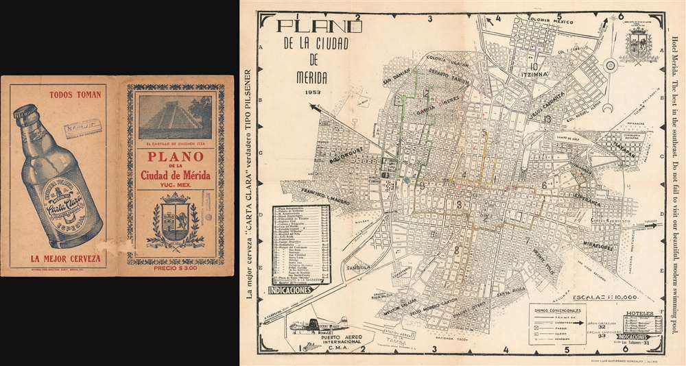
1953 Gonzalez City Plan or Map of Mérida, Yucatán, Mexico
CiudadMerida-gonzalez-1953$100.00

Title
Plano de la Ciudad de Merida.
1953 (dated) 15.75 x 19.25 in (40.005 x 48.895 cm) 1 : 10000
1953 (dated) 15.75 x 19.25 in (40.005 x 48.895 cm) 1 : 10000
Description
This is a 1953 Luis Gutierrez Gonzales city plan or map of Mérida, Yucatán, Mexico, the capital and largest city in Yucatán. In central Mérida, the streets are numbered, much like streets and avenues in major cities throughout the world. Neighborhoods are labeled and districts are numbered. Very few locations are labeled around the city, but those that are include the Cerveceria Yucateca, the Centro Social Turistico Los Tulipanes, and the cementerio general. Thirty-three locations are numerically identified, including numerous parks, the university, the archaeological museum, and the prison. Thirty of these locations are listed in a table situated along the left border, which also provides their grid location on the map, while a handful of hotels and three other locations are identified in the lower right corner. An arrow along the right border points the way to the Mayan ruins at Chichen Itza.
Publication History and Census
This map was created and published by Luis Gutierrez Gonzalez. We are aware of at least one later edition of this map that was published in 1956, which is present in one institutional collection. This is the only known example of the 1953 edition.Condition
Very good. Exhibits some toning. Blank on verso. Accompanied by original binder which bears stamps from the Biblioteca Provincia.