This item has been sold, but you can get on the Waitlist to be notified if another example becomes available.
1974 Taylor Map of Clearwater and Largo, Florida
ClearwaterLargo-taylor-1974$62.50

Title
Clearwater Largo Dunedin Area map and street guide.
1974 (dated) 28.75 x 22.75 in (73.025 x 57.785 cm) 1 : 34560
1974 (dated) 28.75 x 22.75 in (73.025 x 57.785 cm) 1 : 34560
Description
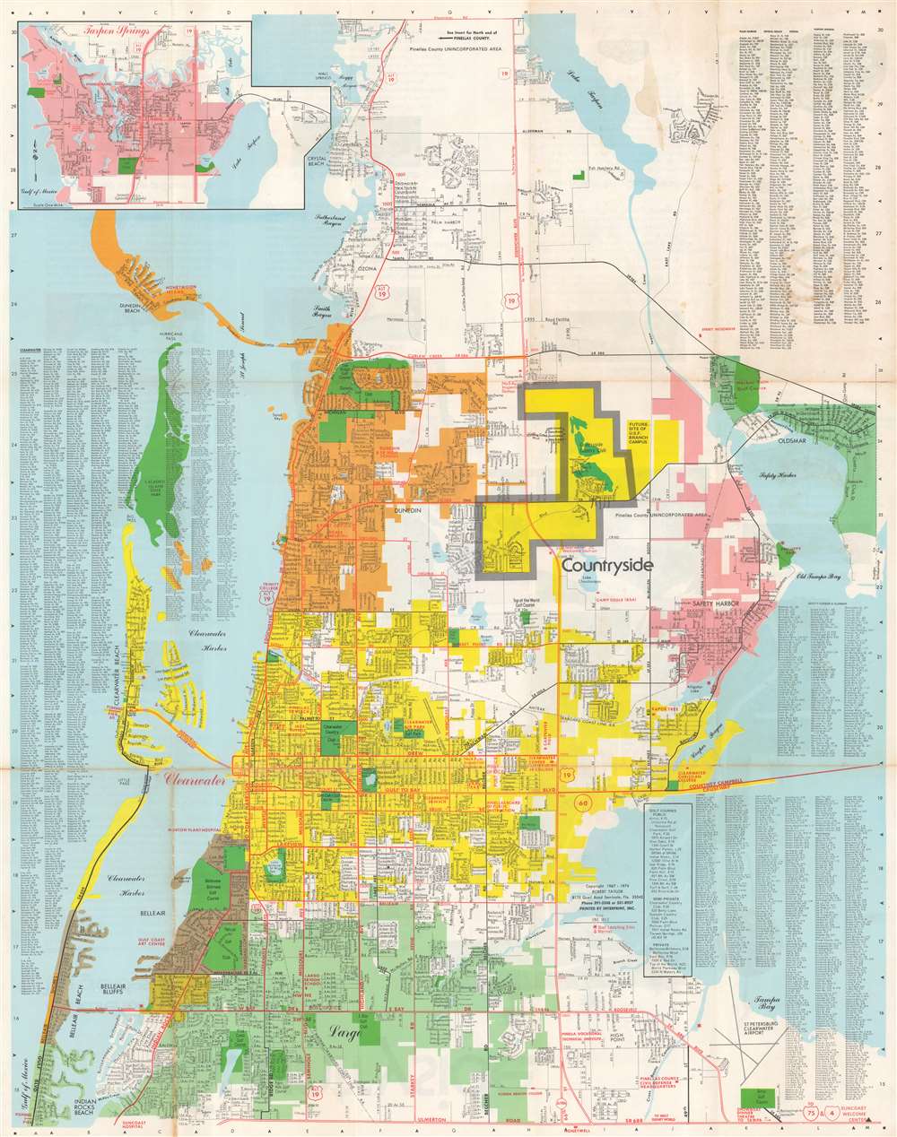
This is a 1974 Robert Taylor map of Clearwater, Largo, and Dunedin, Florida, published as a promotional piece for the new Countryside real estate development (highlighted here in yellow bordered by thick gray lines). The map depicts from Lake Tarpon to the St. Petersburg Clearwater Airport and Indian Rocks Beach. Golf courses, country clubs, and parks throughout the region are shaded green. Cities in the area are shaded different colors. Clearwater is yellow, Largo is teal, Dunedin is orange, and Safety Harbor is pink. Streets are illustrated and labeled as well, along with the Amtrak Seaboard Coast Line Railroad and several lakes. An inset of Tarpon Springs occupies the upper left, while street indexes for Clearwater, Dunedin, Safety Harbor, Largo, and other towns occupy the other three corners.
Verso Content - Map of Countryside
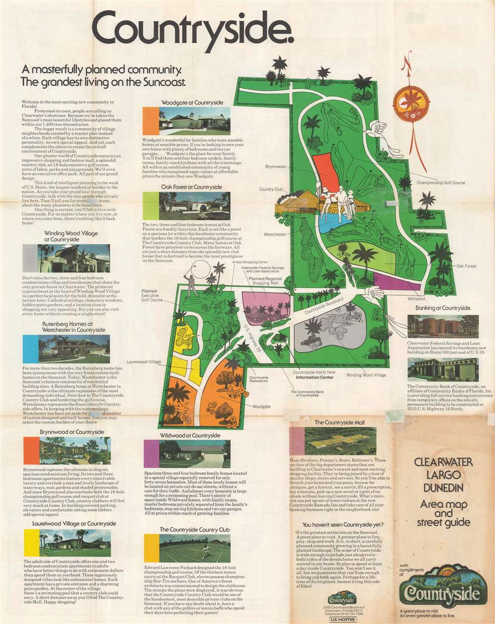
A map of the Countryside development occupies the verso. Seven different 'neighborhoods' are highlighted using various colors, while pictorial illustrations highlight golf courses, country clubs, and the development's flora. The proposed site for the Countryside Mall (which is still in operation today) is also labeled.Publication History and Census
This map was created and copyrighted by Robert Taylor and was distributed 'compliments of Countryside'. This is the only known cataloged example of the present map.Condition
Average to good. Wear along original fold lines. Toning. Areas of infill at fold intersections. Text and printed images advertising Countryside on verso.