1928 Suchy Pictorial Map of Cleveland, Ohio
Cleveland-suchy-1928$950.00
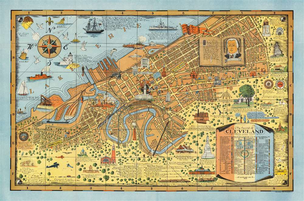

Title
The Heart of Cleveland Ohio Forest City.
1928 (dated) 25 x 38 in (63.5 x 96.52 cm) 1 : 4694
1928 (dated) 25 x 38 in (63.5 x 96.52 cm) 1 : 4694
Description
This is a striking example of Arthur Suchy's 1928 pictorial map of Cleveland, Ohio - Suchy's hometown - accompanied by its original mailer envelope. The map covers from Cleveland's waterfront on Lake Erie south to the Cuyahoga River, beyond which, space is dedicated to historical vignettes and illustrations of local landmarks. Much emphasis is given to Cleveland's 'Forest City' qualities, with tree-filled residential blocks and parks noted. At the same time, skyscrapers and smoking factories underscore Cleveland's industrial might. Among the vignettes is an illustration of Moses Cleveland, the city's founder.
20th Century Pictorial Cartography
Pictorial qualities have been common in cartography from at least from the 16th century, when publishers like Braun and Hogenberg incorporated view-like qualities and other pictorial elements into their famous city plans. Braun and Hogenberg, and similar cartographers, issued their town books to express, not necessarily the geography of their subjects, but rather the 'essence' of the town/city. As mathematics and surveying principles became more advanced, travel increased, and the ability to translate 2-dimensional cartographic perspectives into an understanding of the actual world became commonplace, maps themselves transformed. By the late 19th century most maps had become geographical tools that illustrated the region cartographically, but failed in the original raison d'être as expressed by Braun and Hogenberg, to illustrate a place's 'essence'. So, where a city map of 19th century Paris might provide a completely navigable presentation of the city, one could glean almost nothing of Paris' character from it. In the late 18th century, the first modern 'pictorial' style maps developed. These maps, like Tomas Lopez's 1788 map of Seville, attempted to provide both cartographic accuracy and pictorial elements that might convey the character of the city. In that case, Lopez incorporated pictorial vignettes to illustrate important buildings and monuments. This style became increasingly common throughout the 19th century and early 20th centuries, particularly for centers of commerce like London, Paris, and Rome, where they are often mass-produced and referred to as 'monumental' maps. The style further evolved in the early to mid-20th century, when revolutionary cartographers and illustrators like MacDonald Gill, Jo Mora, Arthur Suchy, Frank Dorn, Ernest Dudley Chase, and many others, combined vignette-style illustrations, modern printing techniques, inspiration from Japanese printmaking and manga, and from clever satirical cartographers/artists like Fred Rose, to produce maps that once again focused on revealing the essence a place, usually, but not always, at the sacrifice of cartographic precision.Publication History and Census
This map was drawn and published by Suchy in 1928. It is his third map, following only his maps of Colgate University (1927) and Swarthmore College (1927). The map was printed in Rochester, New York, by DuBois Press. The copyright was filed on July 16, 1928. Scarce.CartographerS
Arthur Bartholomew Suchy (1901 - 1995) was a 20th century commercial artist, illustrator, and pictorial mapmaker. Suchy was born in Cleveland, Ohio and studied at New York's Colgate University from 1919 to 1923, where he distinguished himself as a student politician, athlete, and sportsman. His career as an illustrator and commercial artist spanned more that 50 years, but he was most active as a mapmaker between 1920 and 1940. Other than his map of Colgate University, most of his work focuses either on his native Ohio or his adopted home, Florida. Suchy's corpus is small but striking. His first map depicts his alma mater, Colgate University (1927). In the same year he issued a similar map of Swarthmore College (1927). This is followed by his large map The Heart of Cleveland (1928). He seems to have taken a 6-year break from pictorial mapmaking to focusing on his commercial career, but issued a new pictorial map illustrating his adopted home, Miami, in 1935. A second map of Cleveland, intending to illustrate the city as it appeared in 1836, was issued in 1937. This was followed by a general map of Ohio,Buckeye State issued in 1939. His final map, illustrating Key West, appeared in 1940. Some of his latter maps, particularly his Key West map, appeared in both hand-colored 'limited edition' formats and uncolored editions for the mass market. More by this mapmaker...
Du Bois Press (1895 - 1994) was a Rochester, New York based printing concern active throughout the 20th century. The firm was founded by Abraham Ford Du Bois (March 25, 1872 - July 13, 1948) in Newark, New Jersey, in 1895. It was initially an annex company to the Newark Union, a newsweekly acquired by Du Bois in 1895. In 1910, Ford Du Bois sold the Newark Union to his brother John E. Du Bois, and relocated the Du Bois Press to Rochester, expanding its printing operations considerably. In the 1920s, the firm established a strong reputation for printing college and university yearbooks. By the mid-20th century, they were among the largest printing business in Rochester. Ford Du Bois retired in 1940, passing the business to his son, Robert Du Bois. The firm was acquired in the 1980s by Omnicom Group Inc., a Manhattan-based advertising consortium. In 1994, the Du Bois press closed its doors and sold off much of its equipment. It was pushed into bankruptcy in 1995. Learn More...
Condition
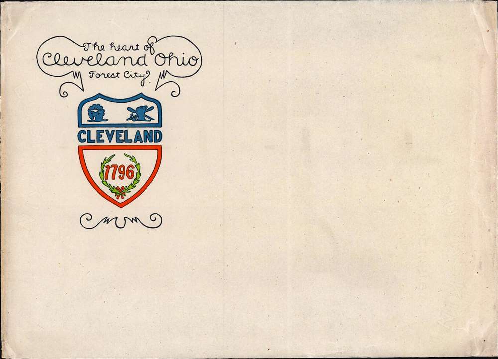
Very good. Verso repairs at fold intersections. Accompanied by original envelope.
References
Rumsey 6778.002.