This item has been sold, but you can get on the Waitlist to be notified if another example becomes available, or purchase a digital scan.
1866 Daddow Map of United States Coal Fields
CoalFieldsUS-daddow-1866$50.00

Title
Coal Fields of the United States.
1866 (undated) 9 x 12 in (22.86 x 30.48 cm) 1 : 18500000
1866 (undated) 9 x 12 in (22.86 x 30.48 cm) 1 : 18500000
Description
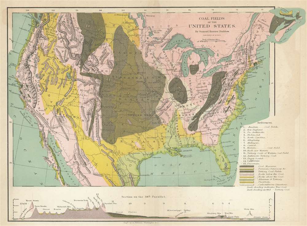
This is an 1866 Samuel Harries Daddow map of the United States illustrating its coal fields. Depicting the entire continental United States, fifteen different types of coal fields are numerically identified, including Pennsylvania Anthracite. Colors indicate other deposits, including tertiary coal fields, carboniferous limestone, and areas of uncertain deposits. A profile view of the altitudes along the 38th Parallel presents the wide range of topography from coast to coast, highlighting the Sierra Nevada Mountains, Rocky Mountains, the Great Plains, the Mississippi Valley, and the White Mountains.
Publication History and Census
This map was created by Samuel Harries Daddow for publication with his 1866 book Coal, Iron, and Oil, or the Practical American Miner. The separate map is not cataloged in OCLC.Cartographer
Samuel Harries Daddow (March 14, 1827 - March 23, 1875) was an English-American mining engineer and author. Born in Cornwall, England, Samuel immigrated to the United States where he became involved with the Pennsylvania Anthracite Boom. Along with journalist Benjamin Bannon (1807 - 1875), he published Coal, Iron, and Oil, or the Practical Miner, at the time the most lavishly expensive single volume work published in the United States. He married Esther Anne Beadle in 1856, with whom he had one child. More by this mapmaker...
Source
Daddow, S.H., Coal, Iron, and Oil, or the practical American miner. (Pottsville PA.: Bannon) 1866.
Condition
Very good. Light toning. Exhibits some offsetting.