This item has been sold, but you can get on the Waitlist to be notified if another example becomes available, or purchase a digital scan.
1835 Manuscript Map of the Cocos or Keeling Islands
CocosKeeling-manuscript-1835$175.00

Title
Coco's or Keeling Islands.
1835 (dated) 9 x 6.5 in (22.86 x 16.51 cm) 1 : 170000
1835 (dated) 9 x 6.5 in (22.86 x 16.51 cm) 1 : 170000
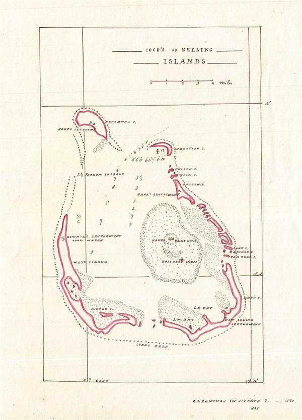
Description
This is an exceptionally detailed 1835 manuscript nautical map of the Cocos or Keeling Islands of Australia located in the Indian Ocean. The map covers the South Keeling Islands, an atoll of 24 inlets which form an incomplete ring. Throughout depth soundings are noted along with coastal features.
First discovered by Captain William Keeling in 1609, the Cocos or Keeling Islands remained largely uninhabited until the Englishman Alexander Hare settled here with his harem of forty Malay women. Hare’s settlement is identified on this map. According to the text in the bottom right, this map is based on an earlier map appearing in the published in 1830. The map accompanied the article ‘Some account of the Cocos or Keeling Islands; and of their recent settlement’.
The islands were also a part of Charles Darwin’s famous voyage aboard the HMS Beagle when In 1836, under the command of Captain Robert FitzRoy the ship, with him on board, surveyed the atolls. The findings of the survey would later support his theory of how atolls formed.
First discovered by Captain William Keeling in 1609, the Cocos or Keeling Islands remained largely uninhabited until the Englishman Alexander Hare settled here with his harem of forty Malay women. Hare’s settlement is identified on this map. According to the text in the bottom right, this map is based on an earlier map appearing in the
The islands were also a part of Charles Darwin’s famous voyage aboard the HMS Beagle when In 1836, under the command of Captain Robert FitzRoy the ship, with him on board, surveyed the atolls. The findings of the survey would later support his theory of how atolls formed.
Condition
Very good. Manuscript map. Minor spotting.