This item has been sold, but you can get on the Waitlist to be notified if another example becomes available, or purchase a digital scan.
1939 Coffee Map of the Republic of Colombia
ColombiaCoffee-nfcg-1939$125.00

Title
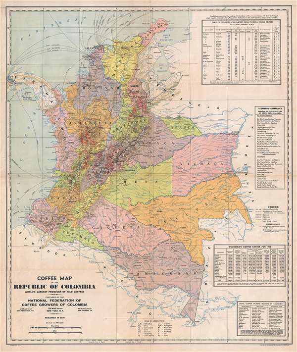
Coffee Map of the Republic of Colombia World's Largest Producer of Mild Coffees.
1939 (dated) 29 x 24.5 in (73.66 x 62.23 cm) 1 : 2750000
1939 (dated) 29 x 24.5 in (73.66 x 62.23 cm) 1 : 2750000
Description
This is an uncommon 1939 map of Colombia issued the National Federation of Coffee Growers of Colombia (Federación Nacional de Cafeteros de Colombia). The map was prepared and printed by the International Map Company of New York. It illustrates modern day Colombia with coffee plantations highlighted in read. Statistical tables to the right of the map proper include distances between principal cities, steamship companies, Colombia's coffee census for 1938, and coffee season chart.
Condition
Very good. Minor verso reinforcement along original fold lines.
References
OCLC 225460015.