This item has been sold, but you can get on the Waitlist to be notified if another example becomes available, or purchase a digital scan.
1835 Manuscript Map of Columbretes Islands near Valencia, Spain
ColumbretesRocks-manuscript-1835$125.00

Title
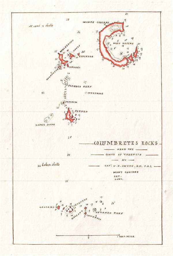
Columbretes Rocks near the Coast of Valencia.
1835 (undated) 8 x 5.5 in (20.32 x 13.97 cm) 1 : 32000
1835 (undated) 8 x 5.5 in (20.32 x 13.97 cm) 1 : 32000
Description
This is a nice c.1835 manuscript nautical map of the Columbretes Islands located near the coast of Valencia, Spain. The map covers the entire group from the small southernmost islands of Galiano, Cerquero, Baleato, and Churroco north to include the largest Illa Grossa. Throughout, depth soundings are noted along with coastal features. The map is based on an earlier map by Captain William Henry Smyth which appeared in his journal On the Columbretes, Volcanic Rocks near the Coast of Valencia, in Spain.
The Columbretes (from the Latin ‘Colubraria’ for snake) are a group of small volcanic islands of the Oropesa del Mar in Spain. The islands, known to the ancient Romans and Greeks, were famous for the large number of snakes inhabiting them. Today, the island is a wildlife reserve, but the snake population remains extinct.
The Columbretes (from the Latin ‘Colubraria’ for snake) are a group of small volcanic islands of the Oropesa del Mar in Spain. The islands, known to the ancient Romans and Greeks, were famous for the large number of snakes inhabiting them. Today, the island is a wildlife reserve, but the snake population remains extinct.
Condition
Very good. Manuscript map. Minor spotting.