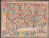
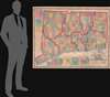
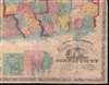
1859 Clark and Tackabury Case / Wall Map of Connecticut
Connecticut-clarktackabury-1859-2$1,800.00

Title
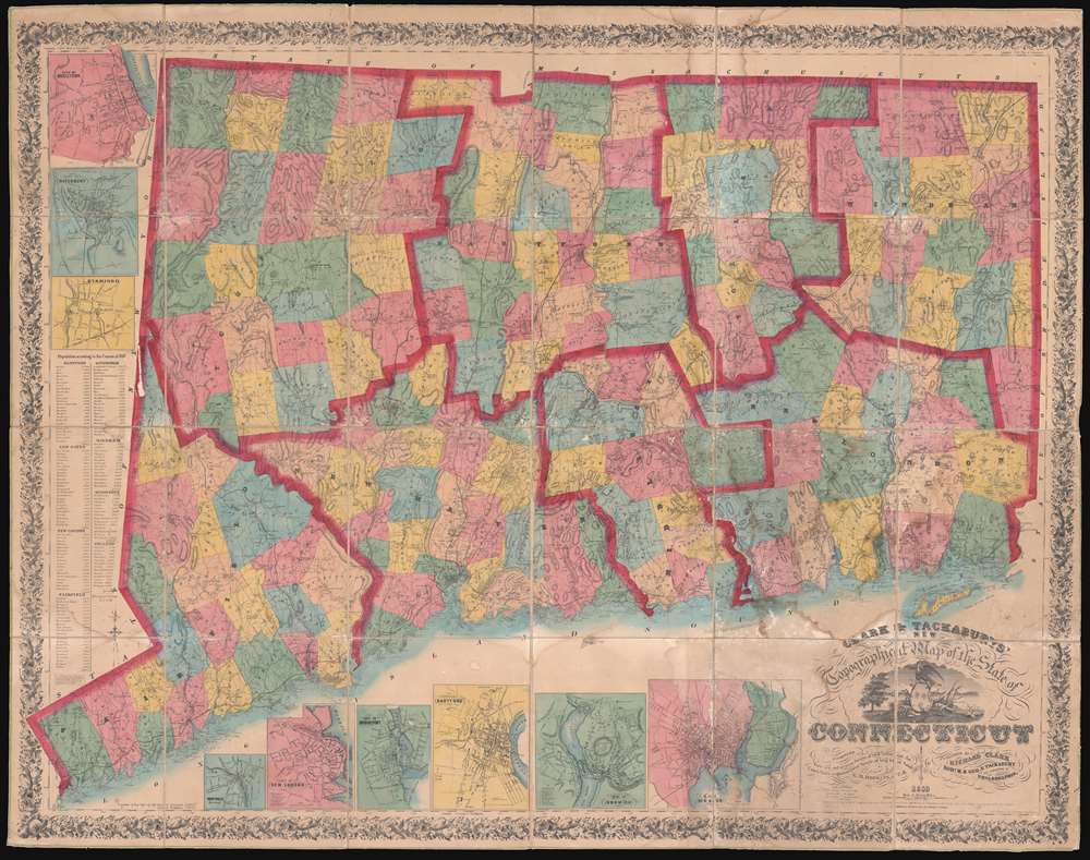
Clark and Tackabury's New Topographical Map of the State of Connecticut.
1859 (dated) 57 x 72 in (144.78 x 182.88 cm) 1 : 95000
1859 (dated) 57 x 72 in (144.78 x 182.88 cm) 1 : 95000
Description
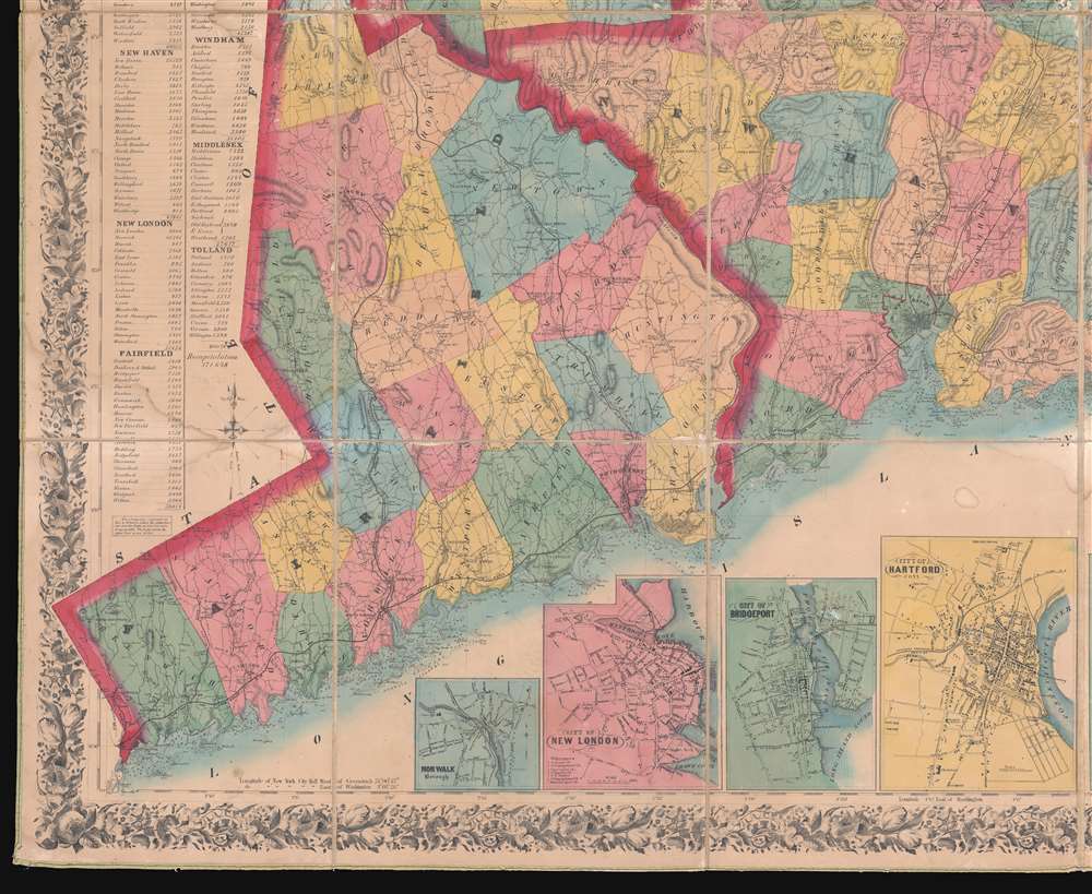
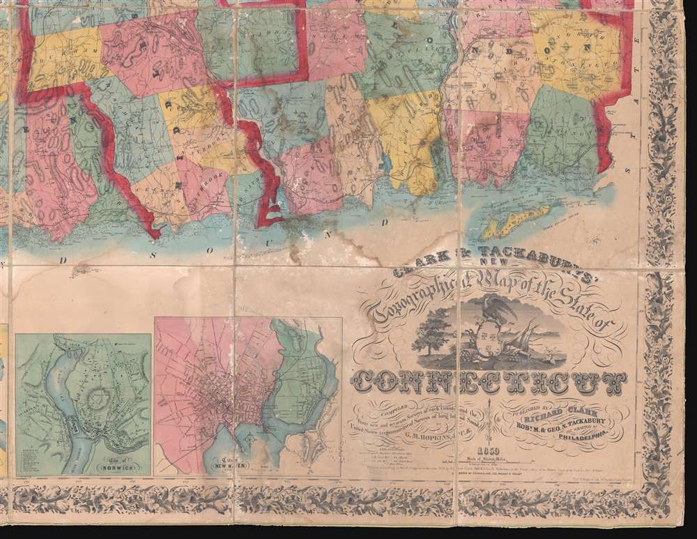
An attractive 1859 first edition example of Richard Clark and Robert and George Tackabury's important wall map of Connecticut. Drawn on a scale of 1.5 miles to the inch, this is the largest and most complete map of Connecticut to appear in the 19th century.
A Closer Look
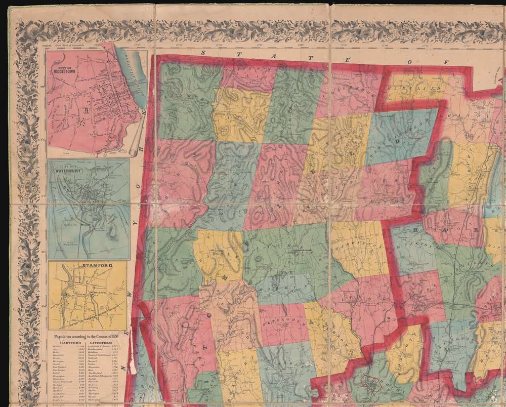
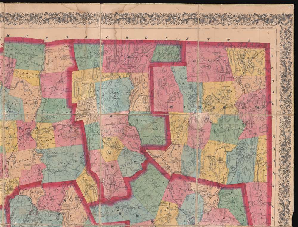
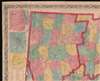
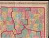
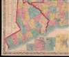
The map covers Connecticut with detail including topography by hachure, color coding by county and township, notes on railroad lines, rivers, and roads, and countless depth soundings. It identifies 'the location of all public buildings, churches, school-houses, manufacturing establishments, and private residences'. Nine insets focus on the cities of Norwalk, New London, Bridgeport, Hartford, Norwich, Middleton, Waterbury, Norwich, Waterbury, Stamford and New Haven, where Yale College is identified. To the left of the map proper are 1850 census population statistics for both counties and cities arrayed in a table.Sources
Cartographically this map is an amalgam of older maps and new private survey work ordered by G. M Hopkins and Company of Philadelphia. The countless depth soundings along the Long Island Sound are drawn from the U.S. Coast Survey.Publication History and Census
This map was prepared by Robert M. and George N. Tackabury based upon surveys performed by G. M. Hopkins. It was published by Clark and Tackabury, and printed in Philadelphia by Thomas S. Wagner Lithography. It was sold by subscription in both wall and case format from March 2, 1859. The first edition of this map is scarce - especially as here in dissected format. We note examples of this edition at 4 institutions: Yale University Library, the Connecticut Historical Society, the University of Connecticut, and the Boston Athenaeum. Scarce to the market.CartographerS
Richard Clark (fl. c. 1850 - 1865) was an American cartographer active in the middle part of the 19th century. Though he seems to have been based in Philadelphia, most of Clark's work was compiled in conjunction with other publishers and focused on Connecticut and Massachusetts. Clark is associated with several maps, but his most important are a wall map of Fairfield County, Connecticut, and Connecticut itself. Little is known of Clark's life. More by this mapmaker...
Robert M. Tackabury and George N. Tackabury (1828 - 1894) were Philadelphia based map publishers active in the middle part of the 19th century. The Tackaburys were born in New York. They published several case maps, pocket maps and atlases in conjunction with Robert Clark and Henry Francis Walling. Little else is known of this elusive duo. Learn More...
Griffith Morgan Hopkins (George M. Hopkins, G. M. Hopkins; 1834 - September 23, 1901) was an American Civil Engineer active in Philadelphia. Hopkins was born in Camden, New Jersey, and spent most of his career in Philadelphia. His earliest known map is the 1859 Clark and Tackabury map of Connecticut. He is also credited with work on the well-known Kitchell map of New Jersey (1860). In 1865, he partnered with his brother, Henry W. Hopkins (1838 - 1920), to found G.M. Hopkins and Company. This prosperous firm issued numerous plat maps and atlases of American cities and counties, most along the eastern seaboard. Hopkins retired from the firm in 1901 and died one year later. The firm was taken over by his brother, Henry, who himself retired in 1902. G. M. Hopkins went through numerous subsequent owners and remains active to this day. Learn More...
Thomas S. Wagner and M'Guigan (fl. 1846 - 1858) were Philadelphia based publishers and lithographers active in the mid 19th century. The Wagner and M'Guigan (or McGuigan) firm were general interest lithographers and as such their work consisted of portraits, bookplates, advertisements and views as well as map. The firm was also an early pioneer of color lithography and for this were awarded a Silver Medal by the Franklin Institute in the 1840s. The Wagner and M'Guigan firm succeeded the Pinkerton, Wagner and M'Guigan firm. Learn More...
Condition
Good. Original linen backing stable. Overall toning. Some surface abrasion and edge wear. Some dampstaining. Custom clamshell box.
References
OCLC 806491344. Thompson, E., Maps of Connecticut for the Years of the Industrial Revolution, #181.