
Tackabury, Robert M. and George N. Tackabury

Robert Middleton Tackabury (1826-1906) and George Neusum Tackabury (1828 - 1894) were Philadelphia-based map publishers active in the middle part of the 19th century. The Tackaburys were born in New York. They published several case maps, pocket maps and atlases in conjunction with Robert Clark and Henry Francis Walling. The firm had actually been founded by the father of Robert M. and George N. Tackabury named James Tackabury (1795-1884), with his own brother John Wesley Tackabury (1804-1877) who emigrated from Ireland to Madison County, NY in 1807. James Tackabury had three sons who all worked for the firm at different points in their life; Robert Middleton Tackabury, George Neusum Tackabury, and Rev. Samuel T. Tackabury (1832-1888). His brother John Wesley Tackabury moved from New York to London, Upper Canada (future Ontario) and may have been involved in Tackabury's output of maps and atlases of Canada in the 1860s and early 1870s (Robert and George Tackabury established an office in London in 1860). Meanwhile, the New York Tackabury's established an office in Philadelphia in the late 1850s, though it is unclear if and for how long either brother actually resided in the city. Beginning in the 1870s, the Tackabury brothers began to shift focus towards maps, atlases, and business directories of states in the American Midwest and new states/territories in the Great Plains. George Tackabury remained in Madison County, new York for the rest of his life, while brother Robert traveled widely, moving to Syracuse, New York around 1870, then to Detroit, Michigan in the mid-1870s, and seems to have moved between Madison County, Syracuse, and Detroit for several years before moving to South Dakota in the mid-1890s and briefly to Los Angeles late in life, probably for health reasons. The firm published under George's name only from the late 1870s, but its continued output of maps related to Michigan and South Dakota strongly suggests Richard's continued involement. The firm's last known publication was an 1893 updated edition of an 1884 map of the Upper Peninsula of Michigan, 'Map showing the military road lands belonging to the estate of James C. Ayer'.
Largest 19th century map of Connecticut.
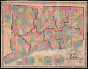
Clark and Tackabury's New Topographical Map of the State of Connecticut.
$1,800.00
Acquire
- Digital Map Information
- Suitable for large format printing
- Full resolution TIFF file
- ICC color profile embedded
- Delivered instantly via download link
An attractive 1859 first edition example of Richard Clark and Robert and George Tackabury's important wall map of Connecticut. Drawn on a scale of 1.5 miles to the inch, this is the largest and most complete map of Connecticut to appear in the 19th century. (more details)
Best mid-19th century map of Connecticut.
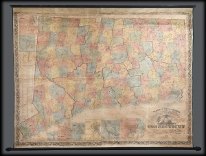
Clark and Tackabury's New Topographical Map of the State of Connecticut.
$1,500.00
Acquire
- Digital Map Information
- Suitable for large format printing
- File Size: 3.13 MB
- File Type: ZIP / TIFF
- ICC color profile embedded
- Delivered instantly via download link
A 1859 first-edition example of Richard Clark and Robert and George Tackabury's important wall map of Connecticut. When published, it was by far the best and largest map of the state obtainable. (more details)
Source of a cartographic feud.
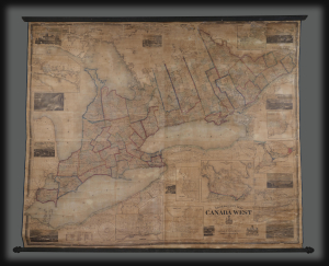
Tackabury's Map of Canada West, drawn from Government and special Local Surveys by H.F. Walling.
$4,500.00
Acquire
This is Henry Francis Walling's very large-format 1862 wall map of Canada West (formerly Upper Canada and subsequently Ontario), published by Robert M. Tackabury and George N. Tackabury. In addition to its size and magnificent level of detail, it is also significant for capturing this region in a period of political and social transformation, driven by railways, immigration, and moves towards greater political union and autonomy. (more details)