
This item below is out of stock, but another example (left) is available. To view the available item, click "Details."
Details
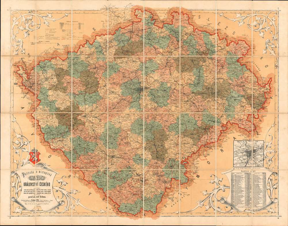
1872 Josef Erben Map of the Czech Republic / Czechia / Bohemia
$950.00
1872 Josef Erben Map of the Czech Republic / Czechia / Bohemia
Czech-erben-1872$1,250.00

Title
Politicka a Mistopisna Mapa Kralovstvi Ceskeho.
1872 (dated) 29.5 x 37.5 in (74.93 x 95.25 cm) 1 : 140000
1872 (dated) 29.5 x 37.5 in (74.93 x 95.25 cm) 1 : 140000
Description
A rare and beautiful 1872 chromolithograph map of Bohemia (today's Czech Republic) by Czech publisher Josef Erben. This map is significant as, issued during a time of Czech cultural revival and growing nationalism, it represents one of the first maps of Bohemia issued fully in Czech. As such, it is one of the first maps to employ and promote Czech cartographic terminology, which lacking established native cartographic tradition, Erben had to invent from scratch. The terminology presented here had a significant influence on other Czech and subsequent Slavic cartography, who took inspiration from Erben's vocabulary.
Czech Nationalism
The issue of this map follows closely on the Austro-Hungarian Compromise of 1867. This agreement established the dual monarchy of Austria-Hungary, but was a point of contention in Bohemia, which although included within the empire, was not recognized as a co-equal power. General dissatisfaction with the situation led to a rise in Czech nationalism and a search for Czech identify. Czech language art, literature, and cartography flourished.Chromolithography
Chromolithography is a color lithographic technique developed in the mid-19th century. The process involved using multiple lithographic stones, one for each color, to yield a rich composite effect. Oftentimes, the process would start with a black basecoat upon which subsequent colors were layered. Some chromolithographs used 30 or more separate lithographic stones to achieve the desired effect. Chromolithograph color could also be effectively blended for even more dramatic results. The process became extremely popular in the late 19th and early 20th centuries, when it emerged as the dominate method of color printing. The vivid color chromolithography produced made it exceptionally effective for advertising and propaganda imagery.Publication History and Census
This map was first issued in 1869. Published by K. Jansky in Jindrichuv Hradec and Tabor, and printed by the Institute for Lithography Bedrich Sandtner in Wenceslaus Square, in Prague. The present example, 1872, is likely the second edition, although no complete cartobibliography of this map has been undertaken. The map appears occasionally on the market, but is scarce in institutional hands. We have identified multiple examples at the Bibliotheque Nationale de France, and one in the David Rumsey collection, but no others.Cartographer
Josef Erben (April 29, 1830 - April 11, 1910) was Czech educator, cartographer, and academic. Erben was born in Kostelec nad Orlicí, Czechia, then under the Austrian Empire. He received his secondary education at grammar schools in Rychnov nad Kněžnou (1843 - 1844) and in Broumov (1841- 1842, 1845 - 1846). He then enrolled at the Faculty of Philosophy in Prague, where he was a full-time student from 1847 to 1850 and an extraordinary student in the school year 1852/53. In this same year, he transferred to the Czech Technical University in Prague. Between 1862 and 1875 he was a docent for statistics at the polytechnical institute. In 1865 he became the curator of the map department of maps in the National Museum. He corresponded widely in cartographic circles and maintained relationships with many prominent European cartographers and publishers. As it was a period of national social and cultural revival, Erben began publishing his own maps in the 1860s. At the time, it was traditional to print maps of Bohemia in German, Erban was the first to publish exclusively in Czech. As such he had to invent contemporary terminology in Czech. Erben’s terminology was highly influential on other Slavic countries, where they embraced the newly invented Slavic terms as the basis for their own terminology. He died in Prague in April of 1910, aged 79. More by this mapmaker...
Condition
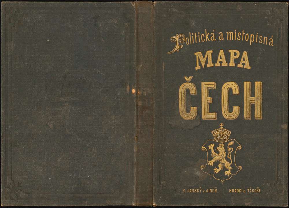
Very good. Original linen stable. Folds into original brown linen gilt stamped binder.
References
Rumsey 11758.002. OCLC 494797869, 921704981, 1177058444 (all referencing BNF holdings).