This item has been sold, but you can get on the Waitlist to be notified if another example becomes available, or purchase a digital scan.
1926 Associated Map Company Map of Dade County, Florida
DadeCounty-associatedmap-1926$112.50

Title
Map of Dade County Florida
1926 (dated) 23.5 x 17.5 in (59.69 x 44.45 cm) 1 : 262000
1926 (dated) 23.5 x 17.5 in (59.69 x 44.45 cm) 1 : 262000
Description
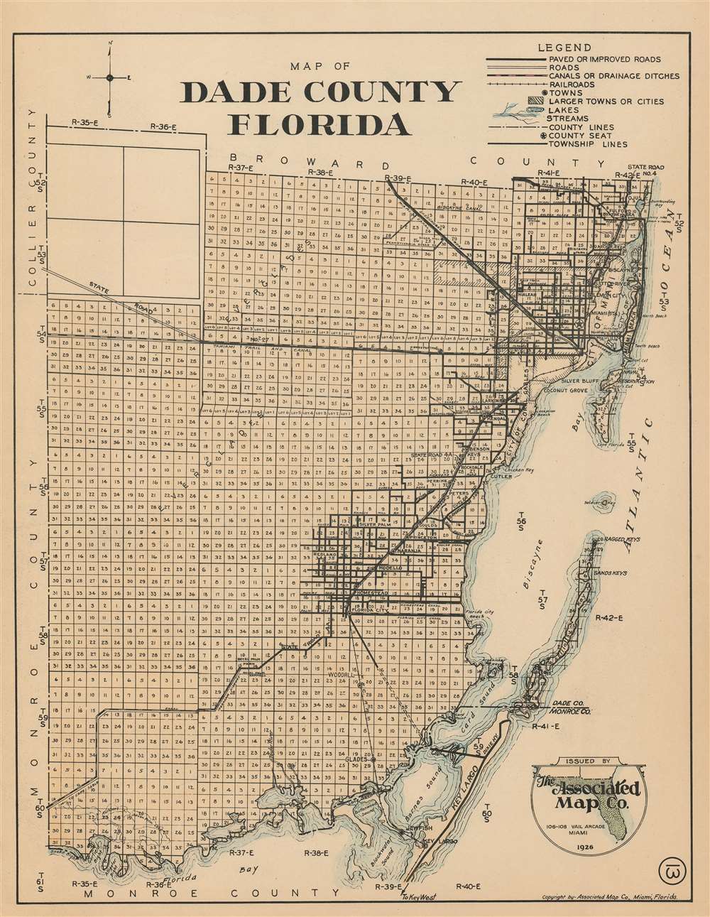
This is a 1926 Associated Map Company map of Dade County, Florida. The map depicts the region from Monroe County and Collier County to the Atlantic Ocean and from Broward County to Monroe County and Florida Bay. Highly detailed, the entire county is divided into townships with every section in each township numbered. Miami is situated in the upper right corner, with numerous streets illustrated and labeled, along with Miami Beach and Key Biscayne. The Okeechobee Road and the Miami Canal are also labeled, as are the Royal Glades Canal and the Miami Trail and Canal. Towns south of Miami along the coast are also identified, including Homestead, Modello, and Florida City. Landmarks along the coast, such as keys, bays, sounds, and beaches are noted.
Census and Publication History
This map was created and published by the Associated Map Company in 1926. This map is rare, as we have been unable to trace any other known examples.Cartographer
Associated Map Company (fl. c. 1926 - 1928) was a map publishing firm based in Miami, Florida active during the early 20th century. More by this mapmaker...
Condition
Very good. Even overall toning. Closed margin tears professionally repaired on verso. Blank on verso.