This item has been sold, but you can get on the Waitlist to be notified if another example becomes available, or purchase a digital scan.
1952 Brockway Map of Delray Beach, Florida
DelrayBeach-brockway-1952$150.00

Title
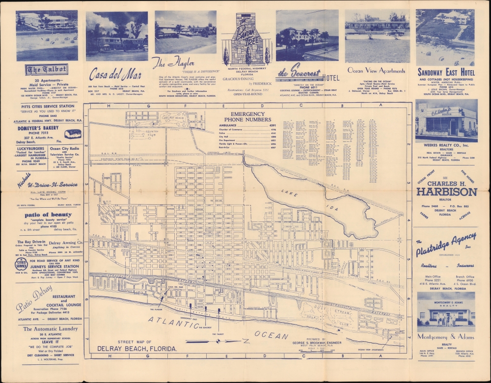
Street Map of Delray Beach, Florida. / Free Street Map Delray Beach Florida.
1952 (undated) 17.5 x 22.5 in (44.45 x 57.15 cm) 1 : 2000
1952 (undated) 17.5 x 22.5 in (44.45 x 57.15 cm) 1 : 2000
Description
This is George Brockway's c. 1952 promotional street map of Delray Beach, Florida, presenting the city in a period of rapid growth and development.
Like other coastal cities in Florida, Delray Beach saw an initial burst of development during the 'Roaring Twenties,' which slowed during the Great Depression years, then picked up again in the postwar period. Known as a resort town, the city attracted artists and writers in its early days and beachgoers and surfers afterward. It also has long had an important association with African-American history, with early Black settlers arriving from North Florida in the 1890s, when the area was known as Linton and built its first schoolhouse. At the time of this map's publication, the La France Hotel (not marked here) near the intersection of NW 2nd St. and NW 4th Ave. was one of the few hotels or boardinghouses in this part of southeastern Florida to accept Black guests and lodgers.
A Closer Look
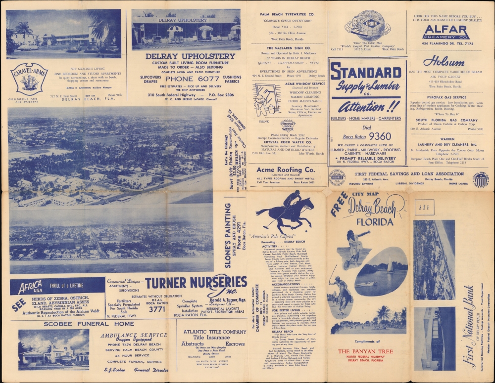
Oriented towards the west with the Atlantic Coast in the foreground, the map covers the entirety of Delray Beach ('Corporate Limits' noted with a dashed line) along with portions of neighboring Boca Raton, Highland Beach, and Gulf Stream. Like other coastal communities in southeastern Florida at the time, the street grid and urban layout were primarily determined by the coastline, the Intracoastal Waterway, the railways (the Florida East Coast and Seaboard Air Line), and, to a lesser extent, the more recent highways. These features, along with local streets, waterways, proposed roads, post offices, schools, parks, and other features, such as the local American Legion post, are noted. Special attention is paid to golf courses and beachside accommodations. An alphanumeric grid surrounds the map, corresponding to an index at the top-right. Advertisements for local businesses surround the map and continue on the verso, which also includes aerial photographs of the city along with other promotional photographs.Like other coastal cities in Florida, Delray Beach saw an initial burst of development during the 'Roaring Twenties,' which slowed during the Great Depression years, then picked up again in the postwar period. Known as a resort town, the city attracted artists and writers in its early days and beachgoers and surfers afterward. It also has long had an important association with African-American history, with early Black settlers arriving from North Florida in the 1890s, when the area was known as Linton and built its first schoolhouse. At the time of this map's publication, the La France Hotel (not marked here) near the intersection of NW 2nd St. and NW 4th Ave. was one of the few hotels or boardinghouses in this part of southeastern Florida to accept Black guests and lodgers.
Publication History and Census
This map was prepared by surveyor George S. Brockway and designed as a mailable promotional pamphlet, compliments of the Banyan Tree restaurant. It is possible that the local Chamber of Commerce was also involved in the map's production. Brockway had produced a large cadastral map of Delray Beach in 1951 (OCLC 993584854), which may have been the basis for the map seen here. The present map is not known to be held by any institution, nor does it have any history on the market.Cartographer
George Samuel Brockway (July 6, 1896 - January 22, 1974) was a Florida based civil engineer active in Palm Beach. Brockway was born in Merrimack County, New Hampshire. Brockway served in World War I (1914 - 1818) with the 17th Engineers and in World War II (1939 - 1945) as a commander of the 'Seabees' in the Pacific. He moved to Palm Beach in 1920. There, he founded the Engineering firm of Brockway, Owen and Anderson, which over time changed to 'Brockway, Weber, and Brockway', when his son George Robert Brockway (July 5, 1925 - May 15, 2008) and Roy E. Weber took over Owen and Anderson's shares. Brockway's son, George Robert, was born in West Palm Beach. He served in the U.S. Navy during World War II (1939 - 1945) and subsequently remained for 30 years in the Reserves' 'Seabees' as an engineer, achieving a captain's rank. 'Captain Bob' as he was known among friends, graduated in 1950 from the University of Florida with a degree in civil engineering. He served in various community and local government organizations as consulting engineer and surveyor. He also taught surveying at Palm Beach Community College. More by this mapmaker...
Condition
Good. Wear on old fold lines. A few verso repairs at fold intersections.