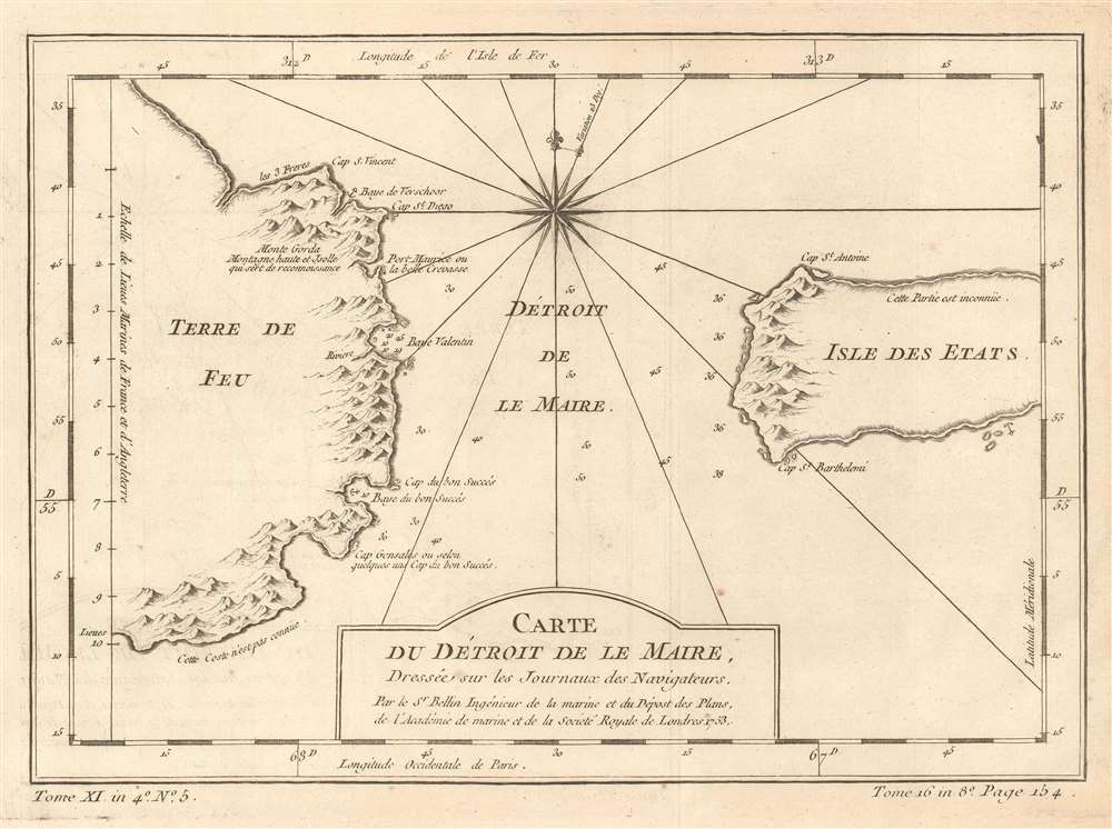
1753 Bellin Map of the Le Maire Strait, Argentina
DetroitsMaire-bellin-1753$125.00

Title
Carte du Détroit de Le Maire, Dressée sur les Journaux des Navigateurs.
1753 (dated) 8.5 x 11.5 in (21.59 x 29.21 cm) 1 : 475000
1753 (dated) 8.5 x 11.5 in (21.59 x 29.21 cm) 1 : 475000
Description
This is a 1753 Jacques-Nicolas Bellin map of the Le Maire Strait in Argentina. Situated between the Isla de los Estados (Staten Island in English, and not the one that is a borough in New York City) and Tierra del Fuego, the strait was first discovered by European explorers Jacob Le Maire and Willem Schouten in 1616 while they were attempting to find a navigable route between the Atlantic and Pacific Oceans. Their discovery of the strait only shortly preceded their discovery of Cape Horn. The strait is named after Le Maire, and, due to the bad weather and strong currents that the region is famous for, vessels tend to favor going around the east side of Isla de los Estados instead of through the Le Maire Strait. On an ecological note, the Isla de los Estados is home to one of the southernmost breeding colony of Magellanic penguins in the Atlantic.
Publication History
This map was created by Jacques-Nicolas Bellin for publication in Abbé Prévost's Histoire Générale des Voyages.Cartographer
Jacques-Nicolas Bellin (1703 - March 21, 1772) was one of the most important cartographers of the 18th century. With a career spanning some 50 years, Bellin is best understood as geographe de cabinet and transitional mapmaker spanning the gap between 18th and early-19th century cartographic styles. His long career as Hydrographer and Ingénieur Hydrographe at the French Dépôt des cartes et plans de la Marine resulted in hundreds of high quality nautical charts of practically everywhere in the world. A true child of the Enlightenment Era, Bellin's work focuses on function and accuracy tending in the process to be less decorative than the earlier 17th and 18th century cartographic work. Unlike many of his contemporaries, Bellin was always careful to cite his references and his scholarly corpus consists of over 1400 articles on geography prepared for Diderot's Encyclopedie. Bellin, despite his extraordinary success, may not have enjoyed his work, which is described as "long, unpleasant, and hard." In addition to numerous maps and charts published during his lifetime, many of Bellin's maps were updated (or not) and published posthumously. He was succeeded as Ingénieur Hydrographe by his student, also a prolific and influential cartographer, Rigobert Bonne. More by this mapmaker...
Condition
Very good. Even overall toning. Light wear along original fold lines. Light transference. Blank on verso.
References
OCLC 156052740.