This item has been sold, but you can get on the Waitlist to be notified if another example becomes available, or purchase a digital scan.
1754 Tirion Map of the East Indies
EastIndies-tirion-1754$225.00

Title
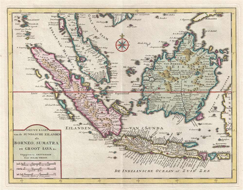
Nieuwe Kaart van de Sundasche Eilanden als Borneo, Sumatra en Groot Jata etc.
1754 (undated) 12 x 15 in (30.48 x 38.1 cm) 1 : 8000000
1754 (undated) 12 x 15 in (30.48 x 38.1 cm) 1 : 8000000
Description
This is a 1754 Isaak Tirion map of the East Indies and the Malay Peninsula, including modern day Singapore. The map depicts the region from the Nicobar Islands to Celebes, Indonesia and from Cambodia to Java. This part of the world quickly became the center of the Dutch East Indies and was one of the most valuable colonies in the Dutch Empire. Although the Dutch maintained a presence in the region from the beginning of the 17th century until independence was declared in 1945, their control over the archipelago was always tenuous at best. At the time of this map's creation, Dutch territorial conquests in the region had not spread much further than approximately half of Java and the city of Malacca, located on the Malay Peninsula.
A beautifully colored piece, myriad locations are labeled throughout, including cities, towns, and small villages situated both along the coast and inland. Numerous smaller islands are labeled, as are several small archipelagos. This map was created by Isaak Tirion and published in Amsterdam in 1754.
A beautifully colored piece, myriad locations are labeled throughout, including cities, towns, and small villages situated both along the coast and inland. Numerous smaller islands are labeled, as are several small archipelagos. This map was created by Isaak Tirion and published in Amsterdam in 1754.
Cartographer
Isaak Tirion (1705 - 1765) was a Dutch publisher in Amsterdam. Born in Utrecht, Tirion quickly rose to prominence by publishing pamphlets, historical works, and most importantly, maps and atlases. He produced several atlases and Dutch town plans. His maps are mainly based on those of Guillaume de l'Isle. Tirion eventually relocated his printing house to the prestigious Kalverstraat. In his long career, he produced eight atlases in multiple editions, some of which were published posthumously until about 1784. More by this mapmaker...
Condition
Very good. Even overall toning. Light wear along original centerfold. Blank on verso.
References
OCLC 950544512.