1831 Teesdale Map of Europe
Europe-teesdale-1831$200.00

Title
Europe.
1831 (dated) 13 x 16 in (33.02 x 40.64 cm) 1 : 14000000
1831 (dated) 13 x 16 in (33.02 x 40.64 cm) 1 : 14000000
Description
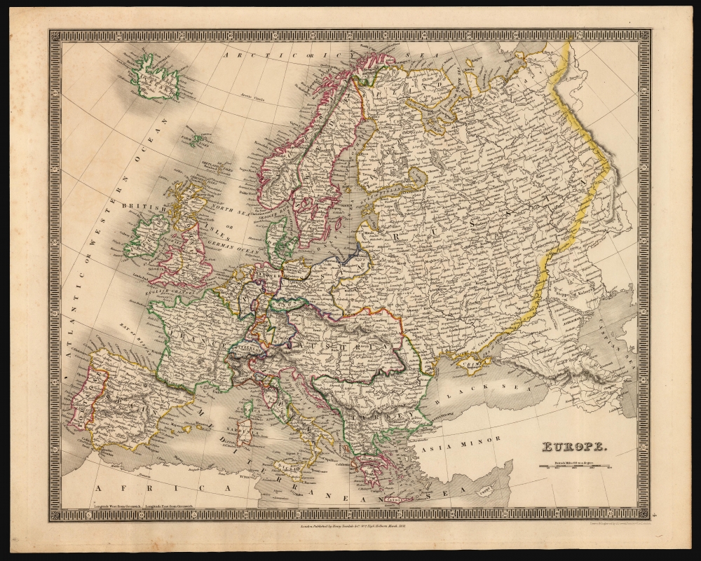
This is an 1831 Henry Teesdale and John Crane Dower map of Europe, inclusive of Iceland and reaching as far east as the Ural mountains. Political borders, highlighted with original outline color, reflect an up-to-date presentation of the European international scene.
A Closer Look
The map clearly and neatly labels regions, cities, and major rivers. Greater mountain ranges are indicated by hachure. National borders largely reflect the state of affairs following the 1814-15 Congress of Vienna. Neither Germany nor Italy have been unified, and both are dominated by the Austrian Empire. What Russia does not control of Poland is held by Prussia. The Balkans are shown here as Turkey, with the notable exception of Greece - shown separately, reflecting that country's successful war of independence from Turkey (1921 - 1929).Publication History and Census
This map was drawn and engraved by John Crane Dower and published by Henry Teesdale in 1831 in his A New General Atlas of the World. While not demonstrably rare it is neglected by institutional collections: only five separate examples of the map are listed in OCLC, none of which is the 1831 edition.CartographerS
Henry Teesdale (December 1776 - January 1856) was a British map publisher active in the first half of the 19th century. Teesdale was born in London. He was elected to the Royal Geographical Society in 1830. Teesdale initially partnered with John Hordan and William Colling Hobson as Henry Teesdale and Company, but this partnership was dissolved in 1832. Afterwards Teesdale continued to publish maps and atlases on his own account. He worked with several major British map engravers of the period including John Crane Dower, Christopher Greenwood, and Josiah Henshall, among others. His most prominent work is a large map of the world engraved by Dower. He must have enjoyed considerable commercial success because in 1845 he is registered as a partner in the Royal Bank of Scotland. Teesdale died in January of 1856 and was buried in All Souls, Kensal Green. More by this mapmaker...
John Crane Dower (1791 - February 20, 1847) was an English engraver, map publisher, and printer active in northern London during the first half of the 19th century. Dower had his office at 6 Cumming Place, Pentonville, London. He was most active as an engraver from 1820 to 1847, where he produced work for John Greenwood, William Fowler, Henry Teesdale, Thomas Moule, Geroge Bradshaw, and others. Dower passed his business on two his two sons, John James Downer, and Fredreric Jamesd Dower. Learn More...
Source
Teesdale, H., A New General Atlas of the World..., (London: Teesdale) 1831.
Condition
Very good. Few areas of marginal soiling. Else excellent with original outline color.
References
OCLC 43223157.