This item has been sold, but you can get on the Waitlist to be notified if another example becomes available, or purchase a digital scan.
1874 Tardieu Map of Central Europe (Germany, Poland, Switzerland, Austria, Hungary, Bohemia, Lithuan
EuropeCentrale-tardieu-1874$37.50

Title
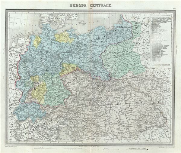
Europe Centrale.
1874 (undated) 15 x 17.5 in (38.1 x 44.45 cm) 1 : 4000000
1874 (undated) 15 x 17.5 in (38.1 x 44.45 cm) 1 : 4000000
Description
This is a fine example of Ambroise Tardieu's 1874 map of the Central Europe. It covers the German Confederation from the Baltic Sea to the Adriatic Sea and from Switzerland to the Austro-Hungarian Empire. The top right quadrant features a table listing the states of the German Confederation. Tardieu identifies various cities, roads, rivers, mountain passes and other topographical features.
The German Confederation, created in 1814, acted as a buffer zone between Austria and Prussia, its two largest and most powerful member states. Nonetheless the rivalry between the two powerful states intensified until the outbreak of the Austro-Prussian War. Prussia won the Austro-Prussian War in 1866, ultimately leading to the collapse of the German Confederation. A few years later, in 1871, most of the former Confederation states were folded into the newly proclaimed German Empire.
This map was prepared by Ambroise Tardieu and issued as plate 14 in his 1874 edition of Atlas Universel de Geographie Ancienne et Moderne.
CartographerS
Ambroise Tardieu (March 2, 1788 - January 17, 1841) was a prominent French cartographer and engraver operating in the late 18th and early 19th centuries. He was member of the large and prolific Tardieu family, which, for over 200 years, produced multiple skilled and active engravers. Tardieu's work is known for its beauty and accuracy as well as for its depth of detail. Tardieu's most important work is his version of John Arrowsmith's large format map of the United States, published in 1806. Ambroise Tardieu is eclipsed in fame by his son, artist and medical scholar, August Ambroise Tardieu. Ambroise Tardieu is also frequently confused with Jean Baptiste Pierre Tardieu, another unrelated French map and print engraver active in the early 19th century. More by this mapmaker...
Alexandre Aimé Vuillemin (1812 - 1880) was an engraver, publisher, and editor based in Paris, France in the middle of the 19th century. Despite a prolific publishing career, much of Vuillemin's life is shrouded in mystery. In 1852, he married Josephine Caroline Goret and they had at least one child, Ernestine Adèle Vuillemin, later in the same year. What is known is that his studied under the prominent French Auguste Henri Dufour (1798 - 1865). Vuillemin's most important work his detailed, highly decorative large format Atlas Illustre de Geographie Commerciale et Industrielle. Learn More...
Source
Furne, Jouvet et Cie Atlas Universel de Geographie Ancienne et Moderne (Paris), 1874.
Condition
Very good. Minor wear and toning with verso repair along original centerfold. Original platemark visible. Minor spotting.
References
Rumsey 4697.018 (1863 edition).