This item has been sold, but you can get on the Waitlist to be notified if another example becomes available.
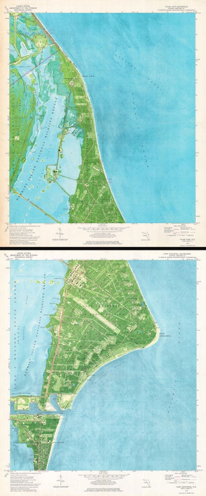
1976 U.S. Geological Survey Map of False Cape and Cape Canaveral, Florida (2 Maps)
FalseCapeCapeCanaveral-usgs-1976$250.00


Title
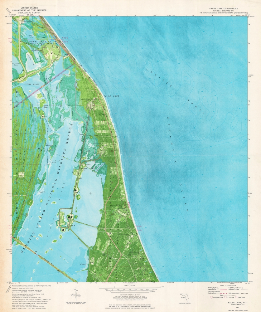
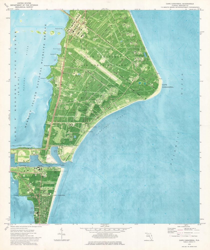
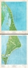
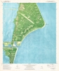
False Cape Quadrangle. Cape Canaveral Quadrangle.
1976 (dated) 26.25 x 22 in (66.675 x 55.88 cm) 1 : 24000
1976 (dated) 26.25 x 22 in (66.675 x 55.88 cm) 1 : 24000
Description
This is a set of two 1976 U.S. Geological Survey maps of Cape Canaveral and False Cape, Florida. Numerous launch complexes appear in detail, allowing for a glimpse into the region's history and role in space exploration.
A Closer Look
Depicting from the southern edge of Launch Complex 39B south along the coast to Cape Canaveral, launch complexes are illustrated and labeled all along the coastline. Cape Canaveral Air Force Station occupies most of the land on both sheets. (This area appears in more detail here than is available on Google Maps!) The U.S. Air Force Space Museum and the NASA Space Museum are both identified. John F. Kennedy Space Center is labeled along the left border of both sheets and the Merritt Island National Wildlife Refuge is identified on both sheets as well.Publication History and Census
These maps were created and published by the U.S. Geological Survey in 1976. We note five examples of the Cape Canaveral Quadrangle cataloged in OCLC which are part of the collections at Frostburg State University, the Florida Institute of Technology, the University of South Florida, the University of South Alabama, and Florida International University. The False Cape Quadrangle is not cataloged in OCLC, and we have not found any other cataloged examples. Both sheets appear on the private market from time to time.Cartographer
The Office of the Coast Survey (later the U.S. Geodetic Survey) (1807 - present), founded in 1807 by President Thomas Jefferson and Secretary of Commerce Albert Gallatin, is the oldest scientific organization in the U.S. Federal Government. Jefferson created the "Survey of the Coast," as it was then called, in response to a need for accurate navigational charts of the new nation's coasts and harbors. The first superintendent of the Coast Survey was Swiss immigrant and West Point mathematics professor Ferdinand Hassler. Under the direction of Hassler, from 1816 to 1843, the ideological and scientific foundations for the Coast Survey were established. Hassler, and the Coast Survey under him developed a reputation for uncompromising dedication to the principles of accuracy and excellence. Hassler lead the Coast Survey until his death in 1843, at which time Alexander Dallas Bache, a great-grandson of Benjamin Franklin, took the helm. Under the leadership A. D. Bache, the Coast Survey did most of its most important work. During his Superintendence, from 1843 to 1865, Bache was steadfast advocate of American science and navigation and in fact founded the American Academy of Sciences. Bache was succeeded by Benjamin Pierce who ran the Survey from 1867 to 1874. Pierce was in turn succeeded by Carlile Pollock Patterson who was Superintendent from 1874 to 1881. In 1878, under Patterson's superintendence, the U.S. Coast Survey was reorganized as the U.S. Coast and Geodetic Survey (C & GS or USGS) to accommodate topographic as well as nautical surveys. Today the Coast Survey is part of the National Oceanic and Atmospheric Administration or NOAA. More by this mapmaker...
Condition
Very good. 2 maps on 2 sheets Light wear along original fold lines. Light toning to False Cape Sheet.
References
OCLC 25792183. False Cape Quadrangle not cataloged in OCLC.