
U.S. Geodetic Survey

The Office of the Coast Survey (later the U.S. Geodetic Survey) (1807 - present), founded in 1807 by President Thomas Jefferson and Secretary of Commerce Albert Gallatin, is the oldest scientific organization in the U.S. Federal Government. Jefferson created the "Survey of the Coast," as it was then called, in response to a need for accurate navigational charts of the new nation's coasts and harbors. The first superintendent of the Coast Survey was Swiss immigrant and West Point mathematics professor Ferdinand Hassler. Under the direction of Hassler, from 1816 to 1843, the ideological and scientific foundations for the Coast Survey were established. Hassler, and the Coast Survey under him developed a reputation for uncompromising dedication to the principles of accuracy and excellence. Hassler lead the Coast Survey until his death in 1843, at which time Alexander Dallas Bache, a great-grandson of Benjamin Franklin, took the helm. Under the leadership A. D. Bache, the Coast Survey did most of its most important work. During his Superintendence, from 1843 to 1865, Bache was steadfast advocate of American science and navigation and in fact founded the American Academy of Sciences. Bache was succeeded by Benjamin Pierce who ran the Survey from 1867 to 1874. Pierce was in turn succeeded by Carlile Pollock Patterson who was Superintendent from 1874 to 1881. In 1878, under Patterson's superintendence, the U.S. Coast Survey was reorganized as the U.S. Coast and Geodetic Survey (C & GS or USGS) to accommodate topographic as well as nautical surveys. Today the Coast Survey is part of the National Oceanic and Atmospheric Administration or NOAA.
Rare First Edition of the Geological Survey's Mapping of Nantucket.
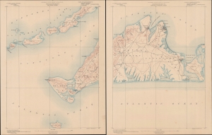
Massachusetts Gay Head Sheet / Massachusetts Martha's Vineyard Sheet.
$600.00
Acquire
- Digital Map Information
- Suitable for large format printing
- Full resolution TIFF file
- ICC color profile embedded
- Delivered instantly via download link
A two-sheet 1887 U.S. Geological Survey map of Martha's Vineyard and other nearby islands, surveyed and published in 1887 by the U.S. Geological Survey. These sheets constitute the first 'preliminary edition' of this map, which continued to be the standard map of Martha's Vineyard by the Geological Survey until 1919. (more details)
Beautiful geological map of Cape Ann and Rockport, Massachusetts.
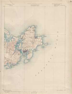
Massachusetts. Gloucester sheet.
$150.00
Acquire
- Digital Map Information
- Suitable for large format printing
- File Size: 7.57 MB
- File Type: ZIP / TIFF
- ICC color profile embedded
- Delivered instantly via download link
This is a lovely example of the 1890 U.S. Geological Survey map of Cape Ann. Extends eastward from Manchester and Essex to include Gloucester, Rockport, Lanesville and Annisquam. Offers copious topographical detail as well as some submarine detail as well as towns, ... (more details)
The Grand Canyon of Yellowstone.
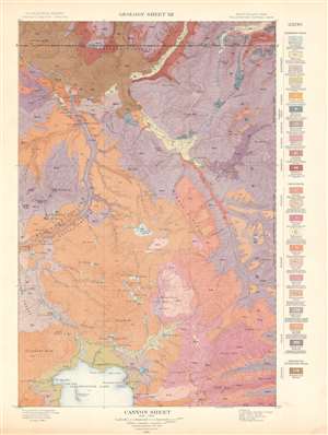
Canyon Sheet. Geology Sheet XII.
$250.00
Acquire
- Digital Map Information
- Suitable for large format printing
- File Size: 28.56 MB
- File Type: ZIP / TIFF
- ICC color profile embedded
- Delivered instantly via download link
This is a 1904 Arnold Hague's U.S. Geological Survey geological map of the spectacular Grand Canyon of the Yellowstone in Yellowstone National Park, Wyoming. The map depicts the entire Canyon Region and the Absaroka Range from the Yellowstone Lake northward, along the Yellowstone River, as far as the Hellroaring Creek in Montana. Many well-known Yellowstone sites are noted, including Elephant Back, Mirror Plateau, Sherman Volcano, and Fossil Forest, as well as various springs, peaks, creeks, and lakes. Twenty-two different colors highlight differing geological formations throughout the region and correspond with a legend situated along the right border. (more details)
A topographic map of Travertine Terrace, Yellowstone National Park.
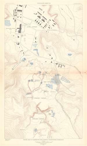
Detail Map of Mammoth Hot Springs Travertine Terraces. Topography Sheet XX.
$250.00
Acquire
- Digital Map Information
- Suitable for large format printing
- File Size: 23.7 MB
- File Type: ZIP / TIFF
- ICC color profile embedded
- Delivered instantly via download link
This is a 1904 Arnold Hague and U.S. Geological Survey topographic map of spectacular Mammoth Hot Springs Travertine Terraces of Yellowstone National Park, Wyoming. Centered on Cleopatra Spring in Minerva Terrace, the map depicts the Travertine Terraces from the Painted Pool on the White Elephant in Highland Terrace to McCartney Cave in Hotel Terrace. It also identifies Liberty Cap on Hymen Terrace. Contour lines highlight the region's unique topography with elevation noted every 500 feet. Roads and buildings are illustrated, including the Mammoth Hot Springs Hotel. (more details)
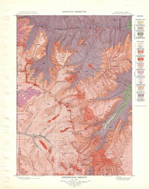
Ishawooa Sheet. Geology Sheet XV.
$250.00
Acquire
- Digital Map Information
- Suitable for large format printing
- File Size: 16.15 MB
- File Type: ZIP / TIFF
- ICC color profile embedded
- Delivered instantly via download link
A fine example of Arnold Hague's 1904 geological survey map of the spectacular Ishawooa Region in the Yellowstone National Park, Wyoming. Centered on Ishawooa Cone, the map covers the Absaroka Range from the Thorofare Plateau and Ash Mountain to North Fork ... (more details)
Home of the world's largest geysers - the Steamboat Geyser.
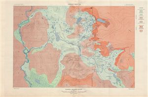
Norris Geyser Basin. Geology Sheet XXI.
$250.00
Acquire
- Digital Map Information
- Suitable for large format printing
- File Size: 26.84 MB
- File Type: ZIP / TIFF
- ICC color profile embedded
- Delivered instantly via download link
A fine example of Arnold Hague's 1904 topographical survey map of the spectacular Norris Geyser Basin in Yellowstone National Park, Wyoming. Centered on Tantalus Creek and the Reservoir (100 Spring Plain), the map covers the basin Gibbon River to Nuphar ... (more details)
The geological wonder of Yellowstone.
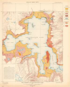
The Shores of Yellowstone Lake. Geology Sheet XXVII.
$250.00
Acquire
- Digital Map Information
- Suitable for large format printing
- File Size: 31.23 MB
- File Type: ZIP / TIFF
- ICC color profile embedded
- Delivered instantly via download link
A fine example of Arnold Hague's 1904 geological survey map of the shores of Yellowstone Lake in Yellowstone National Park, Wyoming. Centered on the Yellowstone Lake, the largest mountain lake in the United States, the map details the lake, its shores, and adjacent terraces and slopes. The map is part of Hague's study of the region's unique geology and related geothermal activity. A legend situated on the upper right identifies the various geological formations and matches them with the corresponding colors used here. A note in the lower left cites an 1889 geological survey of Yellowstone Lake. It also provides a short history of Yellowstone Lake's formation. (more details)
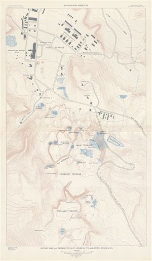
Detail Map of Mammoth Hot Springs Travertine Terraces. Topography Sheet XX.
$250.00
Acquire
- Digital Map Information
- Suitable for large format printing
- File Size: 17.9 MB
- File Type: ZIP / TIFF
- ICC color profile embedded
- Delivered instantly via download link
A fine example of Arnold Hague's 1904 topographical survey map of the spectacular Mammoth Hot Springs Travertine Terraces in Yellowstone National Park, Wyoming. Centered on the Cleopatra Spring in Minerva Terrace, this detailed map covers the ... (more details)
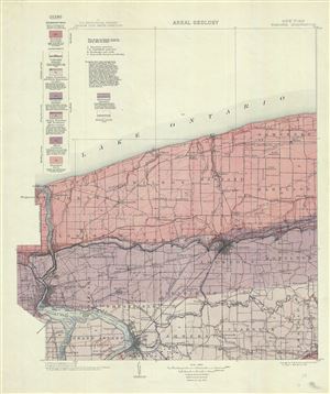
New York. Niagara Quadrangle. Areal Geology.
$175.00
Acquire
- Digital Map Information
- Suitable for large format printing
- File Size: 12.61 MB
- File Type: ZIP / TIFF
- ICC color profile embedded
- Delivered instantly via download link
This is a fine 1913 U.S. Geological Survey map depicting the areal geology of the Niagara County (including the Niagara River and the Niagara Falls), New York. The map shows the distribution of the different types of rocks or geological ... (more details)
Visually represents the extent of survey work completed by the U.S. Coast and Geodetic Survey along the U.S. coastline.
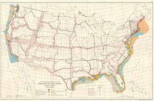
U.S. Coast and Geodetic Survey. Condition of Field Work United States. June 30, 1926.
$200.00
Acquire
- Digital Map Information
- Suitable for large format printing
- File Size: 14.95 MB
- File Type: ZIP / TIFF
- ICC color profile embedded
- Delivered instantly via download link
This is a 1926 U.S. Coast and Geodetic Survey map of the United States. The map depicts the continental U.S. from the Pacific Ocean to the Atlantic Ocean and from the Dominion of Canada to Mexico and the Caribbean Sea.. Created for the ... (more details)
Details survey work completed around Puerto Rico and the U.S. Virgin Islands
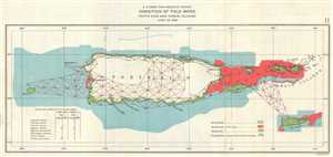
U.S. Coast and Geodetic Survey Condition of Field Work Porto Rico and Virgin Islands June 20, 1926.
$175.00
Acquire
- Digital Map Information
- Suitable for large format printing
- File Size: 1.33 MB
- File Type: ZIP / TIFF
- ICC color profile embedded
- Delivered instantly via download link
This is a 1926 U.S. Coast and Geodetic Survey map of Puerto Rico and the Virgin Islands. The map depicts the island of Puerto Rico (Porto Rico) and the Virgin Islands. Culebra Island and Vieques Island, districts of Puerto Rico, and ... (more details)
Island paradises!
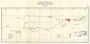
U.S. Coast and Geodetic Survey Progress of Field Work Porto Rico and Virgin Islands Fiscal Year 1926.
$125.00
Acquire
- Digital Map Information
- Suitable for large format printing
- File Size: 1.15 MB
- File Type: ZIP / TIFF
- ICC color profile embedded
- Delivered instantly via download link
This is a 1926 U.S. Coast and Geodetic Survey map of Puerto Rico and the Virgin Islands. The map depicts the island of Puerto Rico (Porto Rico) and the Virgin Islands. Culebra Island and Vieques Island, districts of Puerto Rico, and ... (more details)
Automobile Tourism in Historic Virginia.
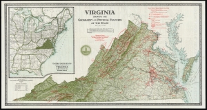
Virginia Showing the Geography and Physical Features of the State.
$350.00
Acquire
- Digital Map Information
- Suitable for large format printing
- Full resolution TIFF file
- ICC color profile embedded
- Delivered instantly via download link
This large, colorful map of Virginia was produced in 1929 for the Virginia Conservation Commission to promote tourism. Its publication coincided with the rise of automobile culture and statewide ambitions to capitalize on the great American road trip. (more details)
Palawan on the eve of World War II.
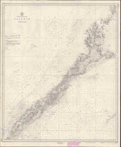
Philippine Islands : Palawan.
$800.00
Acquire
- Digital Map Information
- Suitable for large format printing
- File Size: 15.62 MB
- File Type: ZIP / TIFF
- ICC color profile embedded
- Delivered instantly via download link
This is a 1938 U.S. Coast and Geodetic Survey (USCGS) nautical chart or maritime map of the island of Palawan in the Philippines, published just before World War II (1939 - 1945). With tensions rising in the Asia-Pacific sphere, the U.S. government recognized that updating its charts was critical. (more details)
One of the largest youth camps in the world.
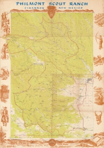
A celebrated aspect of outdoor recreation for the Boy Scouts of America, this is a c. 1960 Boy Scouts of America pictorial map of the Philmont Scout Ranch in New Mexico. Thousands of Scouts visit the ranch annually, experiencing the wonders of America at this National High Adventure Base. (more details)
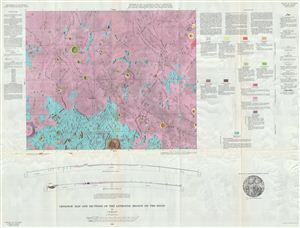
Geologic Map of the Letronne Region of the Moon by C. H. Marshall.
$350.00
Acquire
- Digital Map Information
- Suitable for large format printing
- File Size: 46.87 MB
- File Type: ZIP / TIFF
- ICC color profile embedded
- Delivered instantly via download link
A stunning full color 1963 Geologic Map of the Letronne Region of the Moon by the U.S. Geological Survey. Letronne is a lava-flooded remnant of a lunar crater which forms a bay along the southwestern shore of the Oceanus ... (more details)
Details Aristarchus Crater, the brightest large formation on the moon.
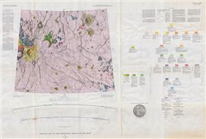
Geologic Map of the Aritarchus Region of the Moon by H. J. Moore.
$400.00
Acquire
- Digital Map Information
- Suitable for large format printing
- File Size: 55.57 MB
- File Type: ZIP / TIFF
- ICC color profile embedded
- Delivered instantly via download link
This is the U.S. Geological Survey's stunning full color geologic map of the Moon's fascinating and mysterious Aristarchus region. Deep in the dark expanse of the Ocean of Storms ('Oceanus Procellarum'), sits ... (more details)
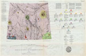
Geologic Map of the Timocharis Region of the Moon by M. H. Carr.
$350.00
Acquire
- Digital Map Information
- Suitable for large format printing
- File Size: 52.64 MB
- File Type: ZIP / TIFF
- ICC color profile embedded
- Delivered instantly via download link
A stunning full color geologic map of the Timorcharis Region of the Moon by the U.S. Geological Survey. Timocharis is a prominent lunar impact crater located on the Mare Imbrium. The lack of prominent rays, ... (more details)
Landing site of Luna 21 and Apollo 17.
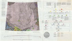
Geologic Map of the Mare Serentatis Region of the Moon by M. H. Carr.
$400.00
Acquire
- Digital Map Information
- Suitable for large format printing
- File Size: 50.71 MB
- File Type: ZIP / TIFF
- ICC color profile embedded
- Delivered instantly via download link
A stunning full color geologic map of the Moon's Mare Serenitatis, or ‘Sea of Serenity' - better known to us as the ‘right eye' of the Man in the Moon. The map's ghostly purple, punctuated by small, ... (more details)
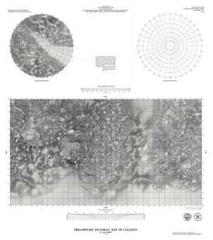
This is an attractive 1979 U.S. Geological Survey's pictorial map of Callisto, a moon of the planet Jupiter. This map was compiled from images from Voyager 1 and 2 and is centered on Callisto's and the ... (more details)
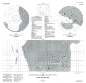
This is an impressive 1987 U.S. Geological Survey map of Io, the innermost moon of the planet Jupiter. This relief map depicts the many peaks, volcanoes, plateaus and mountains on the surface of the ... (more details)
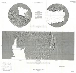
A beautiful 1988 digital image map of Rhea, the second largest moon of the planet Saturn issued by the U.S. Geological Survey. It depicts the surface of the satellite based on images from Voyager 1 ... (more details)
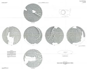
This is a fine example of the U.S. Geological Survey's 1988 map or photomosaics of Rhea, Saturn's second largest moon. The map features six equal-area photomosaics on the Lambert azimuthal ... (more details)
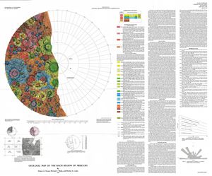
This is a beautiful example of the U. S. Geological Survey's 1990 map of the Bach Quadrangle of the planet Mercury. This geologic map, based on the images from Mariner 10, depicts half of ... (more details)
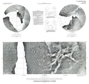
A fine example of the U.S. Geological Survey's 1992 map or photomosaic of Dione, moon of the planet Saturn. This map, based on the images from Voyager 1 and 2, includes photomosaics of ... (more details)
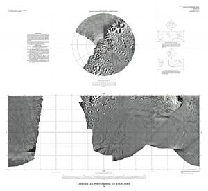
This is a fascinating 1992 U.S. Geological Survey map or photomosaic of Enceladus, the sixth largest moon of the planet Saturn. An inset in the upper half of the map features the North ... (more details)
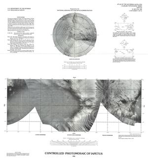
A fine 1992 U.S. Geological Survey map or photomosaic of Iapetus or Japetus, the third largest moon of the planet Saturn. The North Polar Region is featured in the upper half of the ... (more details)
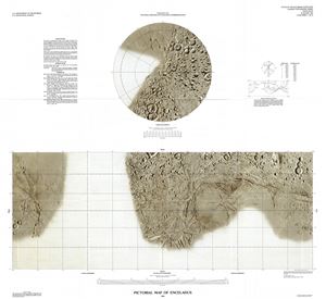
This is a fine example of the U.S. Geological Survey's 1992 pictorial map of Enceladus, the sixth largest of Saturn's moons. An inset in the upper half of the map features the North ... (more details)
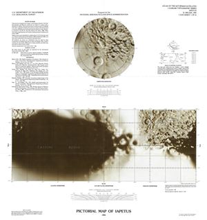
A fine 1992 U.S. Geological Survey map of Iapetus or Japetus, the third largest moon of the planet Saturn. A large portion of this map depicts the large dark area of Iapetus, the ... (more details)
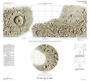
This is a beautiful 1992 U.S. Geological Survey map of Mimas, moon of the planet Saturn. The large crater Herschel, named after William Herschel, the astronomer who discovered ... (more details)
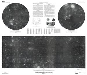
This is a beautiful 2002 example of the U. S. Geological Survey map or photomosaic of Callisto, the moon of the planet Jupiter. This map of the third largest moon in our Solar ... (more details)