
1946 Close Nautical Chart or Map of North Atlantic Coast of America

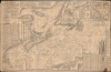
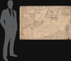
Fishermen and Yachtmen's Chart Cape Cod to Newfoundland.
Postwar Rebound of Atlantic Fishing Industry.
- Digital Map Information
- Suitable for large format printing
- Full resolution TIFF file
- ICC color profile embedded
- Delivered instantly via download link
Postwar Rebound of Atlantic Fishing Industry.
This is a 1929 / 1946 Albert Close nautical chart / map of the Atlantic Coast of North America, covering from Cape Cod to Newfoundland. Intended for fishermen, this information-dense chart was published in the immediate aftermath of World War II (1939 - 1945) and reflects the gradual return to a peacetime fishing economy.A Closer Look
The chart covers from the northern portion of the Gulf of St. Lawrence off northern Newfoundland to as far south as Newport, Rhode Island, and as far east as the North Atlantic off the coast of St. John's, Newfoundland. It features a remarkable density of navigational information, including soundings, shoals, banks, bottoms, hazards, lights, tides, and anchorages. Numerous notes refer to good areas for catching a variety of fish, including cod, hake, halibut, and cusk. Ten compass roses with magnetic variations and multiple local tide indicators are included. Nearly twenty insets appear with more detail on specific areas, along with profile views of the coast at different points, information on magnetic courses and distances, bearings, tides, a French-English glossary of important terms, and information on the greatest fishing grounds.The chart attempts to be an all-in-one nautical solution, and its density of data makes it noteworthy, but we suspect it also limits its practical use as a navigation tool.
Return to Peacetime conditions
One of the more noticeable features of the map is a pastedown at the top about the reinstatement of lights, buoys, etc. that were destroyed or deactivated during World War II, a process expected to take 3-4 years. During the war, the fishing industries of New England and Canada's Maritime Provinces faced severe operational disruptions. Both the U.S. and Canadian navies requisitioned dozens of large, deep-sea trawlers and schooners for coastal patrol, minesweeping, and auxiliary duties, drastically reducing local fleet capacity. Remaining crews contended with constant danger from German U-boat operations, which actively targeted shipping lanes in the Northwest Atlantic and the Gulf of St. Lawrence. Coupled with labor shortages as fishermen entered military service or defense manufacturing, the fishing industry's capabilities dropped significantly. However, because fish served as a vital, unrationed protein source for Allied troops and civilian populations, demand and prices soared. Unintentionally, this reduced offshore fishing pressure provided depleted groundfish stocks a brief but crucial reprieve.The immediate postwar period triggered a rapid era of modernization and economic rebound. Government subsidies and demobilization programs facilitated the return and refitting of requisitioned vessels, alongside the construction of larger, diesel-powered steel trawlers. Crucially, war-born military technologies such as radar, LORAN navigation systems, and sonar were adapted for commercial use, allowing captains to locate fish schools and navigate hazardous coastal waters with unprecedented precision. This initial postwar boom revitalized coastal economies from Massachusetts to Nova Scotia. However, the rapid surge in technological efficiency and fleet capacity ultimately laid the groundwork for severe long-term pressures on Atlantic fish stocks.
Publication History and Census
This chart was privately published by the British eccentric Albert Close, with corrections to January 1929, here updated to March 1946, as a handwritten annotation at bottom-left and the pastedown 'Important Notice to Mariners' at the top indicate. Seven institutions, mostly in Canada, hold editions of this chart, but only the British Library holds the 1929 first edition.Cartographers
Albert Close (fl. c. 1904 - 1961) was an eccentric British-Canadian publisher of nautical charts that collaborated with map publishers on both sides of the Atlantic, especially Edward Stanford. Close was primarily based in Ilford, in East London, a suitable location for a publisher with a nautical focus. Rather than being a hydrographer himself, Close compiled information from a wide range of published surveys, appealing to fishermen and other frequent travelers in the North Atlantic and North Sea. Close is perhaps best known for his meticulously detailed World-War I-era map The Naval War in the North Sea. He also appears to have been a frequent author of Anti-Catholic screeds. Also, he was well-known for repeatedly petitioning the Royal Commission on Awards to Inventors during the 1920s, claiming to have invented an important electric anti-submarine net used against German U-boats during World War I (1914 - 1918). After being barred from the meetings of the Commission for 'creating disturbances,' Close became a minor news item throughout Britain in 1922 - 1923 when he tried on at least three occasions (succeeding twice) to sneak into a meeting of the Commission wearing a disguise and loudly present a petition. Close was also involved in politics, standing unsuccessfully for Parliament as a Labour candidate against Sir Auckland Geddes, who was the British Ambassador to the U.S. in the early 1920s. Further Details...
Mortimer Co. (c. 1887 - 1935) was a Canadian publisher of maps and books based in Ottawa. They maintained a specialty in publishing government works as well as books and maps relating to sport, tourism, mining, railways, and Canadian geography and patriotism, such as Alphabet of First Things in Canada and the The Canadian Parliamentary Guide. Further Details...
Condition
Good. Mounted on linen. Edge wear. Unrepaired edge tears. Light dampstaining. Stain in lower right corner.
References
OCLC 556354243, 556772006.