1728 Stocklein Map of Egypt and the Red Sea
FlightFromEgypt-stocklein-1728$450.00

Title
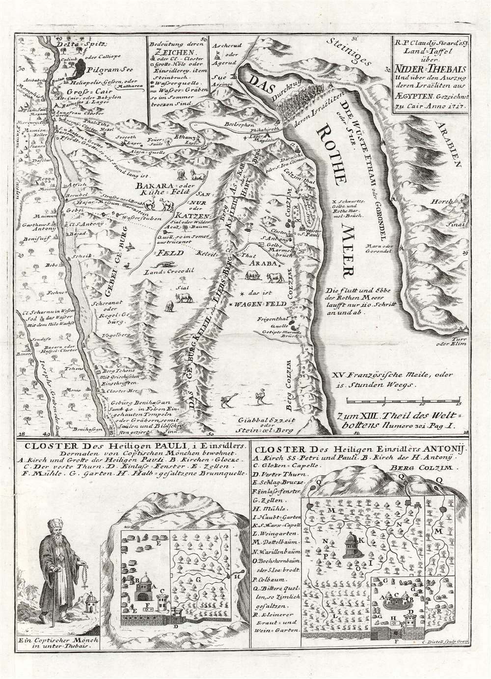
Land-Taffel über NIder-Thebais und über den Auszug deren Israëliten aus AEgypten.
1728 (undated) 16 x 11.5 in (40.64 x 29.21 cm)
1728 (undated) 16 x 11.5 in (40.64 x 29.21 cm)
Description
This is a c. 1728 Joseph Stocklein map of northeastern Egypt and the Red Sea. This beautifully engraved map illustrates the course followed by the Israelites as they fled captivity in Egypt. The tale, as recounted in Exodus, is one of the most dramatic in the Bible, including such events as Moses' parting of the Red Sea, illustrated at top center. The map's coverage extends from Nile River east to the Red Sea. Cities and oases are identified, including Cairo, Memphis, and Heliopolis. Vignettes of African animals, including crocodiles and ostriches, adorn the map as well. The route the Israelites traveld in their trek to the Red Sea is noted. In the lower quadrants supplementary maps illustrate the 'Cloister of St. Pauli' and the 'Cloister of Saint Einsidles Antonij.
Publication History and Census
This map was created and published by Joseph Stocklein c. 1728. It was engraved by Christoph Dietell in Graz. It is not cataloged in OCLC.CartographerS
Joseph Stöcklein [Stoecklein] (July 30, 1676 – December 28, 1733) was a Jesuit priest, missionary, and scholar active in the late 17th and early 18th centuries. He was born in Oettingen, Germany and joined the Jesuit order in Vienna around 1700. He served as a priest in military encampments where he became popular as a preacher. Afterwards he became the head of the Jesuit library in Graz, Switzerland, a position he maintained for six years. During this tenure he began work on his opus, the Welt-Bott, a vast compilation of Jesuit missionary letters and narratives translated into vernacular German intended both to glorify the priesthood and share valuable information about the world. Today this work is exceedingly rare. More by this mapmaker...
Christoph Dietell (March 8, 1690 - December 1, 1764) was an Austrian copperplate and letter engraver, and art dealer, active in the 18th century. Dietell was born in Upper Palatinate, Bavaria but relocated to Vienna at a young age. His father, Stephan Dietl, was also a copper plate engraver. Christoph Dietell studied at the University of Vienna as a 'civis academicus' (historian), and did copperplate engraving for the university. By 1732 he was located in Graz, where he became known as a map and landscape engraver, which secured both secular and ecclesiastical business. He died in Graz in 1764. Franz Ambrosius Dietell, his brother, was also a noted Vienna copperplate engraver. Learn More...
Condition
Very good. Closed tear and reinstated margin along left border.