
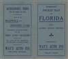
1915 Hammond Pocket Map of Florida


This item has been sold.
Florida.
Distributed by the Way's Auto Inn from Orlando.
- Digital Map Information
- Suitable for large format printing
- Full resolution TIFF file
- ICC color profile embedded
- Delivered instantly via download link
Distributed by the Way's Auto Inn from Orlando.
This is a 1915 C. S. Hammond map of Florida, for distribution by Way's Auto Inn in Orlando. Major roads are illustrated and cities, towns, and villages throughout the state are labeled. An inset in the lower-left focuses on the Florida Panhandle from Alabama to West Bay. An index along the left presents the most recent population data for fifty-five Florida cities, given in alphabetical order.Publication History and Census
This map was created and published by C.S. Hammond and Company in 1915. The present example was issued for and distributed by the Way's Auto Inn of Orlando, Florida.Cartographer
Caleb Stillson Hammond (November 27, 1862 - December 14, 1929) was an American map publisher and printing entrepreneur active in New York City during the late 19th and early 20th centuries, and the founder of C. S. Hammond and Company. Born in Rush, New York, he gained experience in the map trade as a sales representative for Rand McNally before establishing his own publishing concern in Brooklyn in 1900 and incorporating it in 1901. Early cartographic publications included folded maps of Panama and of Florida's steamship routes and railroad connections, both issued in 1903, followed by Hammond's Atlas of New York City and the Metropolitan District in 1907. These publications established two enduring branches of the business: maps of places attracting public attention and commissioned cartography for commercial customers. The firm developed an extensive range of world, historical, school, and thematic atlases, as well as separate maps and globes, and supplied cartographic material for other publishers' encyclopedias, dictionaries, religious works, and textbooks. Its metropolitan mapping included street and transit maps, freight-delivery maps, and maps of railroad terminal facilities. Hammond died in New York City on December 14, 1929; the business continued under family ownership and relocated to Maplewood, New Jersey, in the early 1950s. His grandson, Caleb D. Hammond, Jr. (1915 - 2006), became president in 1948. The company's assets were acquired by Langenscheidt Publishers in 1999, and in December 2002, the American Map Corporation, part of the Langenscheidt Publishing Group, donated the Hammond archives to the Library of Congress. Further Details...
Condition
Good. Exhibits light wear along original fold lines. Exhibits wear and infill where once attached to accompanying binder.