This item has been sold, but you can get on the Waitlist to be notified if another example becomes available.
1965 Monroe County Advertising Map of the Florida Keys and Key West
FloridaKeys-monroecounty-1965$50.00

Title
Your Treasure Map to 'Sea' Florida Keys and Key West for the Vacation Thrill of Your Life!
1965 (undated) 17.75 x 23 in (45.085 x 58.42 cm)
1965 (undated) 17.75 x 23 in (45.085 x 58.42 cm)
Description
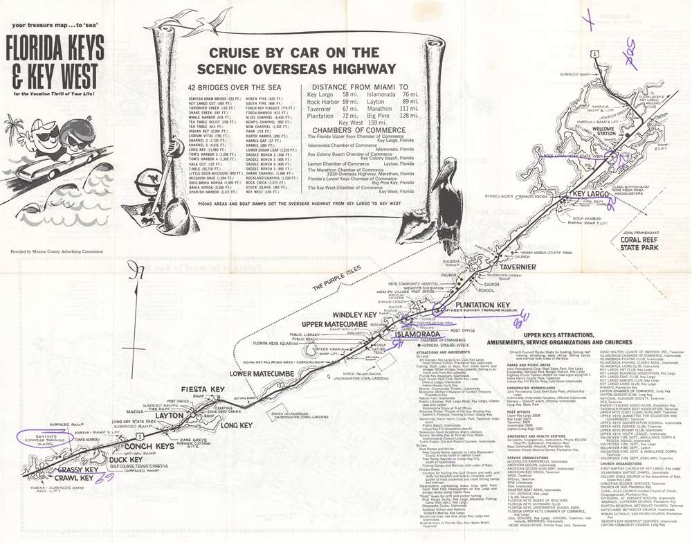
This is a c. 1965 Monroe County Advertising Commission map of the Florida Keys. Printed on both sides, the map marks stops along the Overseas Highway from Homestead to Key West, naming major Keys en route. The Florida Keys Aquarium, Santini's Porpoise Training School, the Long Key Fishing Club, and the site of Zane Grey's former cottage rank among highlighted sites. Boat ramps, underwater coral gardens, campgrounds, golf courses, and movie theaters, more traditional tourist sites, also appear. A scroll occupies most of Florida Bay and names the forty-two bridges on the Overseas Highway, with distances. An index for the Upper Keys is included.
Verso Content
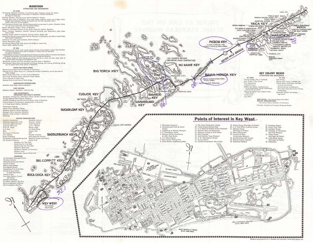
An inset map focusing on M Key West is printed on the verso, with a detailed index for the island. A map of the Lower Keys, from Key Colony south to Key West traverses the sheet diagonally from the upper right to the lower left. Indexes of the Greater Marathon Area, the Lower Keys Area, and the Key Colony Area occupy the upper left.Publication History and Census
This map was created by E. J. Schaeffer and Associates and was published by the Monroe County Advertising Commission. An example is cataloged in OCLC and is part of the institutional collection at the University of Illinois at Urbana Champaign.Condition
Good. Exhibits light wear along original fold lines. Verso repairs to fold separations. Manuscript notations in purple ink present on both recto and verso underlining location names and providing mileage between islands. Map of the Lower Keys and Key West on verso.
References
Library of Congress Call Number 77695917. OCLC 10298934.