This item has been sold, but you can get on the Waitlist to be notified if another example becomes available.
1962 Florida Agricultural Experiment Stations Soil Map of Florida
FloridaSoilMap-experiment-1962$125.00

Title
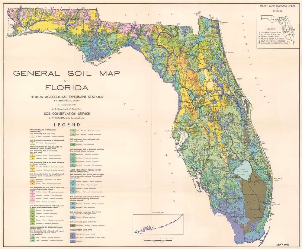
General Soil Map of Florida.
1962 (dated) 27.75 x 33.5 in (70.485 x 85.09 cm) 1 : 1000000
1962 (dated) 27.75 x 33.5 in (70.485 x 85.09 cm) 1 : 1000000
Description
This is a 1962 Florida Agricultural Experiment Stations and U.S. Department of Agriculture Soil Conservation Service soil map of Florida. Fourteen different colors are used to differentiate between thirty-seven identified soil types. Each soil type colored is identified with its corresponding number. Each color represents a different general soil type, while the numbers identify specific soil types within each general category. This information is provided in a key in the lower left. Apart from geological data, major cities, state and federal highways, and other details are included. An inset map along the bottom border focused on the Florida Keys. A second inset situated in the upper right illustrates the six major land resource areas of Florida.
Publication History and Census
This map was created by the Florida Agricultural Experiment Stations in cooperation with the U.S. Department of Agriculture Soil Conservation Service. This map is well represented in institutional collections including the Touchton Map Library at the Tampa Bay History Center.Condition
Very good. Verso repairs to fold separations.
References
Tampa Bay History Center Touchton Map Library 1996.051.7325. OCLC 19400493.