
1691 Johann Hoffmann Map of France: Sole Known Proof State Example


This item has been sold.
New Inventirte Land Carte Eines theil des Königreichs Franckreichs und darinn gelegenen Vornemsten Stätt und Vestungen: Samt deßen Conquesten Lothring, Franche Conte, Elsas, Pfaltz am Rhein, Mosel-Strohm und in NiderLand: Wie auch des angrentzende Saphoyen, Piemont, Schweitz, Schwartzwald, Würtenberg, Pfaltz am Rhein, und Wetterau, und angelegnen Ländern.
Documenting and propagandizing a scorched-earth campaign in the Nine Years' War.
- Digital Map Information
- Suitable for large format printing
- File Size: 39.6 MB
- File Type: ZIP / TIFF
- ICC color profile embedded
- Delivered instantly via download link
Documenting and propagandizing a scorched-earth campaign in the Nine Years' War.
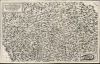
This is a 1691 proof state of Johann Hoffman's large, beautiful, and rare separately-issued map of France's frontiers during the Nine Years' War (1688 - 1697), produced as part of an anti-French propaganda scheme at the height of Louis XIV's scorched earth campaign. As described in the map's title, the map portrays part of France, 'Including its Conquests of Lorraine, Franche-Comté, Alsace, the Palatinate on the Rhine, the Moselle-Strohm, and the Netherlands...' The map details the heavily-fortified French border extending from the port of Dunkirk to the German frontier along the Rhine River, then to the frontiers of Switzerland, Piedmont, and Savoy: a defensive front stretching from the English Channel to the Mediterranean.A Closer Look
The map is oriented to the west; a simple compass rose in the lower left indicates north to the right. The southern limit of the map skirts the Mediterranean, including Marseilles, Maguelone, and Montpellier; the map reaches as far north as Bruges and Ostend in Belgium, then the Spanish Netherlands. The map's eastern reach ends at Dieppe, and it spans as far as Lindau and Ulm in Germany, Genoa and Milan in Italy, and Chur in Switzerland. As large as it is, the map is packed with detail. Hundreds of cities, towns, and fortresses are elegantly depicted, clearly representing the degree of each town's defenses. Rivers, lakes, and pictorially represented forests and mountains are superbly detailed throughout. The limit of French-held territory is marked with a dotted line. In the lower right-hand corner of the map, an inset plan displays the French, Vauban-designed fortress of Mont Royal commanding the Moselle River upstream from Coblenz.The map's simple border contains no gradations, although a later state of the map includes latitude and longitude, and the cardinal directions. The body of the map includes a regular grid - not intended to correspond either to latitude or longitude, but rather to aid in the location of specific features. Each square of the map ruled off by the grid contains a reference number, ranging from 2 to 68. (We speculate that the numbers had been assigned prior to the engraving of the title cartouche, which occupies most of the square corresponding to the number '1'.)
The Prelude to the Nine Years' War
France's prelude to the war was primarily defensive in nature. French territorial gains, dictated by several treaties over the course of the 17th century, resulted in a poorly defined, irregular, and sometimes contradictory frontier. French policy thereafter was first to consolidate the border, sometimes by treaty and sometimes by force of arms. Then, having set a defensible border, France set about defending cities and building fortifications in order to make that border impregnable. The map clearly shows the result of France's long campaign of fortification: the chief cities of the French Mediterranean are depicted with strong defenses, but the dotted-line border with the Spanish Netherlands and the Rhine Palatinate contains a disproportionate number of heavily-defended cities, and very many stand-alone fortresses.Mont Royal
One of these fortresses stands out: situated on a peninsular mountain set in an ox-bow of the Moselle River, the fort of Mont Royal is depicted both on the map, overlooking the city of Trarbach and controlling the river upstream from its confluence with the Rhine at Coblentz. This powerful and strategically-placed fortress was designed by Louis XIV's military architect Vauban; its construction began in 1687. Whatever its importance to the French, it was sufficiently alarming to Imperial interests that it warranted its depiction in a dedicated inset at the lower right corner of the map - the only to be so treated here! It was, in miniature, a representation of the entire French threat: its geographical position made it impregnable, but its size provided space for twelve thousand soldiers and three thousand horses, projecting French power well within reach of Cologne, Frankfurt am Main, and the rest of the lower Rhine. It represented such a threat that, in the Peace of Rijswijck at the close of the war, Mont Royal was singled out for removal. In accordance with the treaty, the French destroyed the fortress in 1698.The War Begins
During the period in which France was consolidating her borders, she watched for opportunities to extend them. A chance came in 1687. The Empire under Leopold I (1640 - 1705) had been engaged in the east, contending with the Ottoman Empire. Leopold's capture of Belgrade heralded the end of a period of Imperial distraction. At the same time, a succession crisis in Cologne offered France a competing claim to the lower Rhineland. Seeing a chance, the French moved to the offensive, crossing the Rhine to lay siege to Philippsburg and invade the Rhineland. Philippsburg fell in October of 1687 (its possession by the French is reflected on the map.) The hope was to intimidate Germany into accepting French claims to the region, but instead, a war of attrition ensued. The map reflects the state of affairs after the 1689 declaration of war by the Holy Roman Empire, which halted and began to roll back the French advance. Mainz - which had fallen in the initial French offensive - is shown outside French territory, reflecting its June 1689 recapture by the Holy Roman Empire-aligned Duke of Lorraine. With the mobilization of powerful German princes against France in the Rhineland and the transfer of Imperial troops to Southern Germany from the Ottoman War, France no longer had a free hand.Scorched Earth
Robbed of a swift victory, Louis XIV switched to a scorched-earth policy in the Rhine-Neckar in order to prevent a counter-invasion into French territory. Heidelberg, Mannheim, Oppenheim, Worms, Speyer, and Bingen were sacked among the twenty towns, and many villages and castles were sacked. Mannheim, which was flattened and not rebuilt until 1698, is shown with no spires or walls visible on the map.Printed Responses to Ruined Cities
In 1691, the same year Hoffmann printed this map, he publishedDie Jammer-gedrückte, hülffleistend erquickte, und Kronen-beglückte Rhein- und Neckar-Pfalz, des dieser Zeit neuburgisch-durchleuchtigen Chur-Hauses : wie solche, samt andern benachbarten Ländern ... von denen alles-verheerenden Franzosen, so übel zugerichtet, und jämmerlich verwiestet worden ... : zugleich auch deren Kronen-beglückten, Zustand und Welt-erhabnes Glor-Steigen durch die beyde Majest. Krönungen und Königs-Wahl zu Augspurg, mit vorgestellet, und alles ausführlich beschrieben, auch mit schönen Kupffern benebenst der piemontesisch-irrländisch- und hungarischen Läufften Anzeig...This extremely rare book was published by Theophil Wahrmund (a pseudonym of Gottlieb Hosmann, an author about whom virtually nothing is known.) It is a contemporary account of the early phases of the War of the Palatine Succession (1688 - 1697), with descriptions of the devastation visited by the French upon the Rhine-Neckar-Pfalz region.
[The Palitinates of the Rhine and the Neckar, now of the illustrious Neuburg Electoral house: oppressed by misery, refreshed with aid: how it and its neighboring lands was so badly afflicted and miserably laid waste by the all-devastating French; simultaneously, its condition blessed and exalted through the two Majesties' coronations and royal election at Augsburg, presented and thoroughly described, also with beautiful copper engravings; together with a report on the Piedmontese, Irish, and Hungarian campaigns.]
Separately Published - but Related
The map is printed from a single, unusually large plate, necessitating two sheets of folio paper to be joined prior to printing. The join between the two sheets appears in a different location on each of the three examples of this map that we have studied, and on none of them is there any evidence of having been printed from separate plates. Each of the examples we have seen displays a different pattern of folding, supporting the idea that while some examples of the map may have been added to composite atlases at a later date (or simply have been folded for storage) the map was not initially intended for inclusion in an atlas, or a book; we see no evidence, for instance, that this map was ever bound in Hosmann/Wahrmund's book. That said, the inclusion of the grid numbers on the map, absent a corresponding legend, suggests that the map was intended for reference to another work: a pamphlet now lost, or perhaps Hosmann's book. Since both were published by the same firm in the same year, addressing precisely the same topic, a connection is reasonable. Scrutiny of the 864-page book may reveal whether a direct connection between the two works existed. Both can be regarded as works of propaganda to support Emperor Leopold I and the Grand Alliance in thwarting the aggressions of Louis XIV.Publication History and Census
This map was engraved by Engelhard Nunzer in 1691 and published that year by Johann Hoffman in Nuremberg. We are aware of two states. A second state includes Nunzer's imprint and adds latitude and longitude grades to the border, along with the cardinal directions. There are two examples of that second state in OCLC, listed by the Staatliche Bibliothek Regensburg and the Landesbibliothek Rheinland-Pfalz. We have seen only one example of the map appear on the market, also a second state. Our example lacks the additional engraving in the border and the engraver's imprint; it is therefore likely a proof state. In this state, this is the sole surviving example.Cartographers
Johann Hoffmann (1629-1698) was a German publisher of books and maps, based in Nuremberg. Nothing is known of his background apart from his work. His cartographic output mostly consisted of pirate editions of the Sanson and DuVal quarto atlases, but he did produce several notable maps during his career: 1664 Neűe Ungarisch- und Türckische Grosse Land-Charte, plans of Nuremberg and Vienna, and a unique and up-to-date 1691 map focusing on French military successes in the Alsace-Lorraine region. Most of his career was spent in Nuremberg, but he appears to have traveled earlier on. His 1677 map of the Alsace from Basel to Speyer was a collaboration with Swiss mathematician and cartographer Georg Friedrich Meyer (1645 - 1693), and was produced in Basel; it is not known whether this was a limited tenure or was representative of an extended period spent there. Further Details...
Engelhardt Nunzer (fl. 1690 - 1733) was a German draughtsman, painter, and printmaker, active in Nuremberg. He is known to have engraved Johann Hoffmann's 1691 map of the border of France and Germany, a plan of Nuremberg, and a 1728 depiction of the German city of Hall after a devastating fire. Further Details...
Condition
Very good. Three marginal mends at left and right with no loss; reinforced wear at juncture of folds. Else excellent.
References
OCLC 633474199 (second state). Not in Rumsey.