This item has been sold, but you can get on the Waitlist to be notified if another example becomes available, or purchase a digital scan.
1950 Geological Map of Ibiza, Balearic Islands, Spain
GeologicalIbiza-unknown-1950$250.00

Title
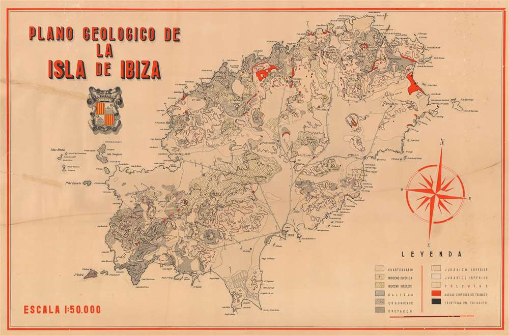
Plano Geologico de la Isla de Ibiza
1950 (undated) 27.5 x 42 in (69.85 x 106.68 cm) 1 : 50000
1950 (undated) 27.5 x 42 in (69.85 x 106.68 cm) 1 : 50000
Description
This is a c. 1950 geological map of Ibiza, Spain, one of the Balearic Islands. The map depicts the entire island, from the Isla de es Vedrà to Illa Tagomago and from the Punta des Moscarter to the Torre de ses Portes. Highly detailed, geological formations from numerous different periods in Earth's history are identified, including layers from the Miocene, Cretaceous, Jurassic, and Triassic periods. Each geological formation is signified by a different pattern of shading, allowing for easy differentiation between the various formations. Cities, towns, and villages are also identified, including Ibiza and San José. Myriad points long Ibiza's coast are labeled, as are numerous small islands in the surrounding waters.
This map's creator and publisher are both unknown, as the map itself is unsigned and bears no publication information. That said, we have not been able to find any references to it in any institutional collections or on the private market, making it a rare find.
This map's creator and publisher are both unknown, as the map itself is unsigned and bears no publication information. That said, we have not been able to find any references to it in any institutional collections or on the private market, making it a rare find.
Condition
Good. Even overall toning. Some foxing. Closed tears extending 5.5 inches and 8 inches from left margin professionally repaired on verso. Blank on verso.