This item has been sold, but you can get on the Waitlist to be notified if another example becomes available.
1961 Geological Map of Rhodesia and Nyasaland (Zimbabwe)
GeologicalRhodesiaNyasaland-surveys-1961$275.00

Title
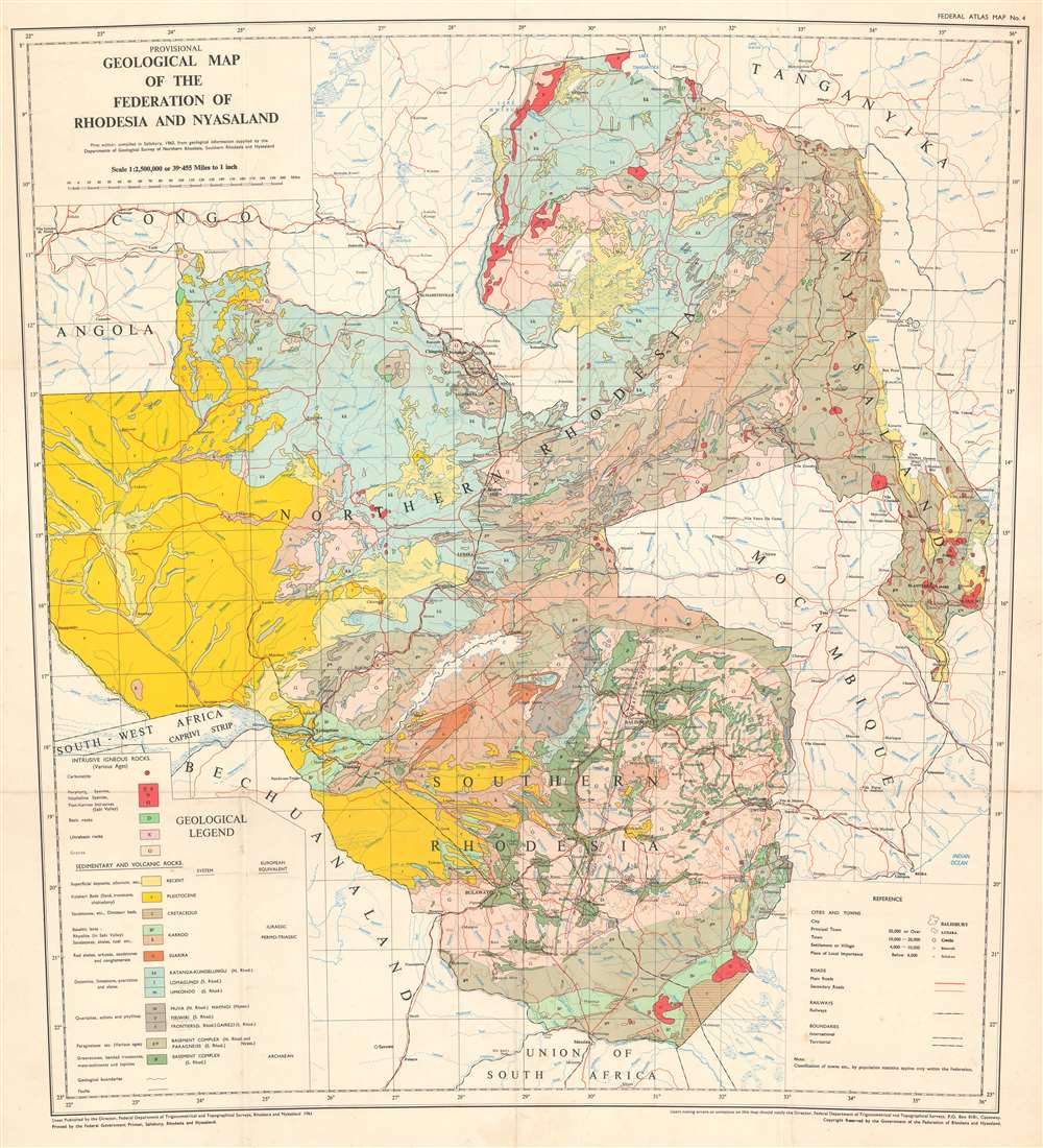
Provisional Geological Map of the Federation of Rhodesia and Nyasaland.
1961 (dated) 28 x 25.5 in (71.12 x 64.77 cm) 1 : 2500000
1961 (dated) 28 x 25.5 in (71.12 x 64.77 cm) 1 : 2500000
Description
This is a 1961 Government of the Federation of Rhodesia and Nyasaland geological map of Rhodesia and Nyasaland, which encompasses the modern-day countries of Malawi, Zambia, and Zimbabwe. Presented on a conic projection, the map depicts geological data in region from the Zambezi River to Lake Malawi (Lake Nyasa) and from Lake Tanganyika to South Africa. Twenty different geological formations are identified using fourteen colors which are delineated in the geological legend. The legend is divided between intrusive igneous rock formations and sedimentary and volcanic rock formations. Cities, towns, and villages throughout the Federation and in neighboring countries are labeled, with populations.
Publication History and Census
This map was created and published by the Federal Department of Trigonometrical and Topographical Survey of Rhodesia and Nyasaland in 1961. It is well represented in institutional collections but rare on the market.Condition
Very good. Light wear along original fold lines. Light soiling. Verso reinforcements at fold intersections.
References
OCLC 14195776.