
1946 State Department Map of Germany and Austria Occupation Zones


This item has been sold.
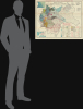
Occupation Zones in Germany and Austria (March 1946).
Evolution of Occupation.
Choose a Collection:
- Digital Map Information
- Suitable for large format printing
- File Size: 57.1 MB
- File Type: ZIP / TIFF
- ICC color profile embedded
- Delivered instantly via download link
This Item
Enquire
Evolution of Occupation.
This is a fascinating, large-format 1946 map of Central Europe prepared by the Department of State's Division of Map Intelligence and Cartography. It demonstrates the shifting borders of the region just before, during, and after World War II (1939 - 1945) as well as the early postwar Allied Occupation Zones.A Closer Look
The map covers much of Central Europe, focusing on the lands claimed as part of Greater Germany (Grossdeutschland) at the height of Nazi expansionism in 1944, including territories belonging to Fascist Italy that the Germans occupied after the Kingdom of Italy's surrender in September 1943. It elegantly depicts the borders of wartime Greater Germany, as well as Germany's pre-1937 borders and postwar borders, along with Allied Occupation Zones. Likewise, German states (länder) and their internal subdivisions are indicated with numbers and color-shading, while the Allied Occupation Zones are outlined, hinting at the future division of Germany. The occupation zones of Austria are similarly denoted, with Vienna jointly administered like Berlin. Additionally, the westward shift of Poland's border to the Oder-Neisse Line (agreed to at the Potsdam Conference), to compensate for land ceded to the Soviet Union in the east, is also indicated. American military districts and their capitals are recorded, including the jointly-administered (with the British) Bremen Enclave, created to provide the otherwise landlocked American Zone with a port.The Evolution of Occupation
In the months following Germany's surrender in May 1945, the Allied powers (the United States, the United Kingdom, the Soviet Union, and France) implemented the plans for the occupation and administration of defeated Germany agreed to at the Tehran and Yalta Conferences and other wartime meetings. The Potsdam Conference in late July - early August 1945 fleshed out these plans, most extensively with regard to the administration of occupied Germany and the borders of Poland, though these were still not completely settled (the map refers to them as 'approximate') and would not be finalized until a 1990 Polish-German border treaty. Germany was divided into four military occupation zones, each governed by one of the Allied powers, with Berlin also divided into four sectors despite being located well within the Soviet Zone, the root of several later crises. The Allied Control Council was established in Berlin to coordinate policies across the zones and to oversee the denazification, demilitarization, and democratization of Germany. Initially, the Allies intended to treat Germany as a single economic and political unit under joint administration, but practical and ideological differences soon made this goal increasingly difficult to sustain.By late 1946 and 1947, tensions between the Western Allies and the Soviet Union deepened, reflecting the emerging Cold War divide. The U.S. and British zones were merged in early 1947 to form the 'Bizone,' later joined by the French zone to create the 'Trizone,' establishing a foundation for West German recovery and integration under the Marshall Plan. Meanwhile, the Soviet zone developed along socialist lines, with land reform, nationalization of industry, and suppression of non-communist political movements. Already by April 1948, tensions around Berlin were becoming intense, resulting in a Soviet blockade the following month that lasted nearly a year and was only overcome by the monumental effort to airlift supplies into West Berlin. These divergent paths culminated in 1949 with the creation of two separate German states: the Federal Republic of Germany (FRG) in the west and the German Democratic Republic (GDR) in the east. Austria followed a similar initial occupation pattern, divided into four zones and a jointly administered Vienna, but unlike Germany, it was reestablished as a neutral, unified republic in 1955 after the withdrawal of foreign troops.
Publication History and Census
This map was prepared in March 1946 by the Department of State's newly-created Division of Map Intelligence and Cartography, a short-lived office (closed by 1948) that combined the Office of Strategic Services' Map Division and the Cartographic Branch of the Department of State. This map was one of a series of maps of Germany prepared by the division for reference in the early months of the occupation. At least one other map from March 1946 was prepared (also offered by us, GermanyOccupation-statedept-1946), covering the same area but with a different presentation. Both maps are quite scarce, with the present map being listed among the holdings of seven institutions in the OCLC, including, in the United States, the University of California, Santa Cruz, the University of Wisconsin - Milwaukee, the University of Michigan, and Pennsylvania State University.Condition
Very good. Light wear and toning along original fold lines.
References
OCLC 40733909, 556468219, 556468908.