This item has been sold, but you can get on the Waitlist to be notified if another example becomes available, or purchase a digital scan.
1759 Tindal Map of Ghent, Belgium
Ghent-tindal-1759$100.00

Title
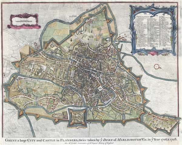
Ghent a large City and Castle in Flanders, twice taken by Duke of Marlborough Viz. in Year 1706 and 1708.
1759 (undated) 15 x 19 in (38.1 x 48.26 cm) 1 : 12000
1759 (undated) 15 x 19 in (38.1 x 48.26 cm) 1 : 12000
Description
A beautifully colored c. 1759 map of the city of Ghent in Belgium. This map was created for Nicolas Tindal's The Continuation of Mr. Rapin's History of England. Paul de Rapin (1661-1725) was a French historian who wrote a comprehensive history of England and Nicolas Tindal (1687-1774) translated de Rapin's work and, because de Rapin finished his work at the death of James II, Tindal continued the work to the reign of George II. Tindal's work was very popular at the time. He enlarged the volumes for their second edition, adding notes, genealogical tables, and maps of his own creation. The cartouche in the upper-right corner details 81 locations of interest within Ghent.
This map was included in Tindal's The Continuation of Mr. Rapin's History of England
This map was included in Tindal's The Continuation of Mr. Rapin's History of England
Source
Tindal,N. The Continuation of Mr. Rapin's History of England; from the Revolution to the Present Times (London), 1759.
Condition
Good. Upper-left corner repair. Slight blurring at center.
References
OCLC 793030720.