This item has been sold, but you can get on the Waitlist to be notified if another example becomes available, or purchase a digital scan.
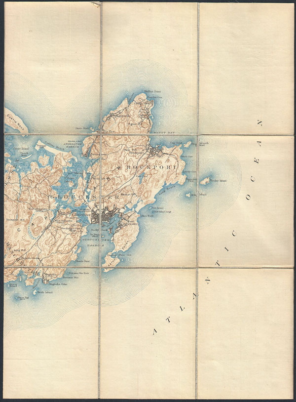
1887 Pocket Map Version of the U.S. Geological Survey Map of Gloucester and Rockport, Massachusetts
Gloucester-usgs-1887$100.00

Title
Massachusetts Muskeget Sheet.
1887 (undated) 17.75 x 13.75 in (45.085 x 34.925 cm)
1887 (undated) 17.75 x 13.75 in (45.085 x 34.925 cm)
Description
This is a rare example of the c. 1887 U.S. Geological Survey map of Cape Ann. Extends eastward from Manchester and Essex to include Gloucester, Rockport, Lanesville and Annisquam. Offers copious topographical detail as well as some submarine detail as well as towns, railroads, and some individual buildings. This map was originally dissected and mounted on linen by the Old Corner Book Store of 27-29 Bromfield Street, in Boston Massachusetts.
Cartographer
The Office of the Coast Survey (later the U.S. Geodetic Survey) (1807 - present), founded in 1807 by President Thomas Jefferson and Secretary of Commerce Albert Gallatin, is the oldest scientific organization in the U.S. Federal Government. Jefferson created the "Survey of the Coast," as it was then called, in response to a need for accurate navigational charts of the new nation's coasts and harbors. The first superintendent of the Coast Survey was Swiss immigrant and West Point mathematics professor Ferdinand Hassler. Under the direction of Hassler, from 1816 to 1843, the ideological and scientific foundations for the Coast Survey were established. Hassler, and the Coast Survey under him developed a reputation for uncompromising dedication to the principles of accuracy and excellence. Hassler lead the Coast Survey until his death in 1843, at which time Alexander Dallas Bache, a great-grandson of Benjamin Franklin, took the helm. Under the leadership A. D. Bache, the Coast Survey did most of its most important work. During his Superintendence, from 1843 to 1865, Bache was steadfast advocate of American science and navigation and in fact founded the American Academy of Sciences. Bache was succeeded by Benjamin Pierce who ran the Survey from 1867 to 1874. Pierce was in turn succeeded by Carlile Pollock Patterson who was Superintendent from 1874 to 1881. In 1878, under Patterson's superintendence, the U.S. Coast Survey was reorganized as the U.S. Coast and Geodetic Survey (C & GS or USGS) to accommodate topographic as well as nautical surveys. Today the Coast Survey is part of the National Oceanic and Atmospheric Administration or NOAA. More by this mapmaker...
Source
Prepared in this format by the Old Corner Book Store, 27-29 Bromfield Street, Boston.
Condition
Very good condition. Disected and mounted on linen in nine sheets.