1906 Garrison Map of Goldfield, Nevada Mining Claims
GoldfieldNevada-garrison-1906$1,200.00

Title
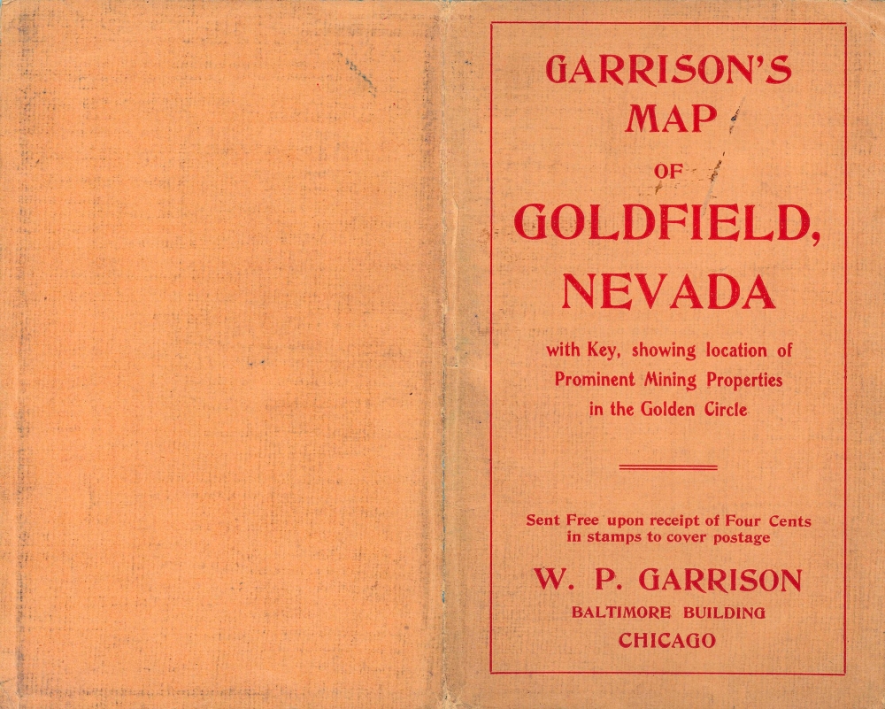
Garrison's Map of Goldfield.
1906 (undated) 16.5 x 27 in (41.91 x 68.58 cm)
1906 (undated) 16.5 x 27 in (41.91 x 68.58 cm)
Description
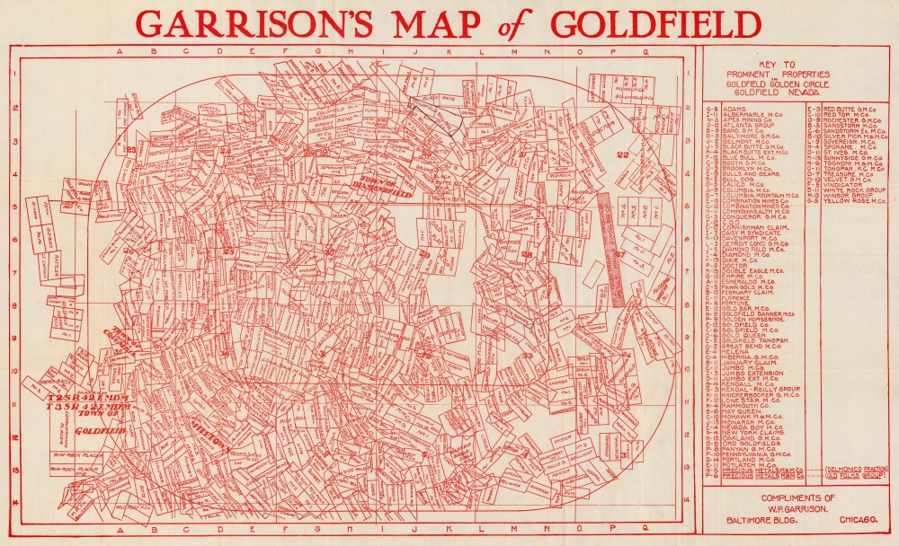
This is a 1906 Wilkie P. Garrison map of Goldfield, Nevada mining claims.
A Closer Look
A veritable jumble of overlapping claims, each claim is identified by name. Some are given specific names, among which are 'Berlin', 'Troy', 'Hoboe', 'Tramp', 'Albatross', and 'Blue Bull'. Others are known simply as 'No. 1', No. 2', etc. Claims owned by companies usually bear the company's name over all the associated claims, such as the Goldfield Bulls and Bears Mining Company and the Goldfield Treasure Mining Company. The towns of Goldfield, Diamondfield, Columbia, and Milltown are labeled but not officially delineated. A 'key to prominent properties' appears outside the right border and lists the properties in alphabetic order, providing grid locations to help viewers find specific properties.Goldfield, Nevada
Situated south of Tonopah on U.S. Highway 95, Goldfield was founded in 1902 when gold was discovered. Just two years later, Goldfield produced 30% of Nevada's gold production that year, worth some $2,300,000. Goldfield grew to become the largest town in Nevada from 1903 until 1910, reaching its peak population of over 20,000 in 1906, they year this map was issued. It became the county seat in 1907 and produced $8.7 million in gold that year. The following year gold production fell to $4.88 million. By 2010, the population was only 4,838, with ore production continuing to fall. The largest mining company left town in 1919 and in 1923 an unattended moonshine still led to a city-wide fire. As of 2020, Goldfield had a population of just 225.Publication History and Census
This map was created and published by Wilkie P. Garrison in 1906. This is the only known cataloged example.Cartographer
Wilkie P. Garrison (1871 - c. 193x) was an American businessman. Born in Canada, Garrison's parents moved the family to central Saskatchewan in 1885. He became a member of the Royal Canadian Mounted Police two years later and served with distinction. However, he did not serve as a mounted policeman for long. He left the force to prospect for minerals in the Peace River country before immigrating to the United States in 1890. His first stop in the United States was in Colorado where hhe mined and used Denver as his 'headquarters'. By 1902 Garrison was in Chicago and held the position of President of the Illinois Colorado Oil, Gas and Coal Company. By 1906, Garrison was operating 'special excursions' for investors to Goldfield, Nevada, from Chicago. Then, by 1910, Garrison had relocated to Pasadena, where he operated real estate companies and owned real estate there and in San Diego, likely having earned his wealth in Goldfield, and continued to have success through at least 1914, when he advertised homes for sale in Los Angeles and Pasadena, orange and lemon groves, alfalfa ranches, and farm land in the Saskatoon Phoenix. Intriguingly, Wilkie Garrison appears in th3e 1930 U.S. Census back in Chicago as the proprietor of a lumber company. More by this mapmaker...
Condition
Very good. Light wear along original fold lines. Verso repairs to fold separations.