1790 Map of the Kiev Governorate
GouvernementKiew-unknown-1790$2,000.00

Title
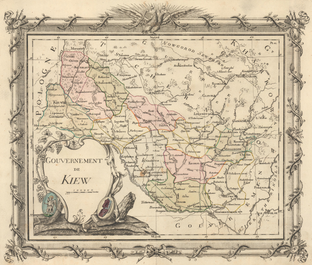
Gouvernement de Kiew.
1790 (undated) 11.75 x 13.75 in (29.845 x 34.925 cm)
1790 (undated) 11.75 x 13.75 in (29.845 x 34.925 cm)
Description
This is a previously unrecorded c. 1790 map of the Kiev Viceroyalty, today the heart of Ukraine, then a province of the Russian Empire. When this map was issued, the region was an ethnically diverse community of Ukrainians, Russians, Poles, Jews, and a small number of Greeks and Armenians, with Russian imperial culture slowly displacing the city’s older Polish-Lithuanian influences. These influences persist as an undercurrent in the current Russo-Ukrainian War.
A Closer Look
The Kiev Viceroyalty, as illustrated here, covers a broad territory north and east of the Dnieper River. It includes parts of adjacent Kharkov, Chernihiv, and Yekaterinoslav. Kyiv (Kiew) is situated near the left border. 11 uyezds (counties) are named. The Arms of Kiev, which feature the Archangel Michael, appear in the lower left below the title. The map is surrounded by an elaborate border decorated with a janiform eagle, a representation of the Russian Empire that signifies the sovereignty of the Tsar over both religious and secular spheres.The Kiev Viceroyalty
The Kiev Viceroyalty (Namestnichestvo Kieyvskoe) was an administrative division of the Russian Empire that existed from 1781 to 1796, created as part of Catherine the Great’s provincial reforms to replace the earlier Kiev Governorate established in 1708. Formed on November 30, 1781, it incorporated territories in central Ukraine, including Kiev, and was governed by a viceroy (namestnik) under imperial authority. The viceroyalty was short-lived: in 1796, Emperor Paul I (1754 - 1801) abolished the viceroyalty system, reorganizing it into a modernized Kiev Governorate.Publication History and Census
This map was created and published by an unknown cartographer as Plate 41 in an unknown atlas c. 1790. The elaborate Russo-centric surround, language, and engraving style suggest this map was issued for a French-printed atlas of the Russian Empire. Only recorded example.Condition
Very good. Light wear along original centerfold. Light soiling.