This item has been sold, but you can get on the Waitlist to be notified if another example becomes available, or purchase a digital scan.
1908 Bemis and Lowman Map or City Plan of Seattle, Washington
GreaterSeattle-vonbabo-1908$62.50

Title
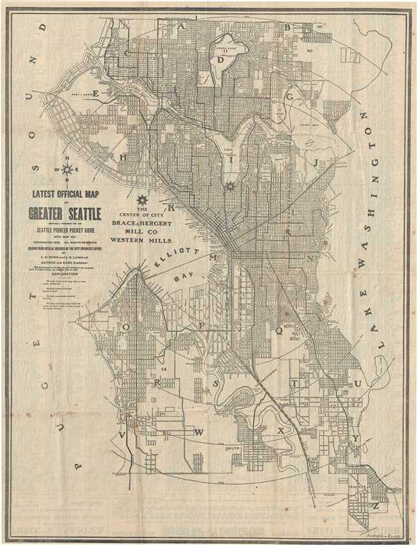
Latest Official Map of Greater Seattle.
1908 (dated) 21.5 x 16.5 in (54.61 x 41.91 cm) 1 : 42600
1908 (dated) 21.5 x 16.5 in (54.61 x 41.91 cm) 1 : 42600
Description
This is a nice 1908 map or plan of the city of Seattle, Washington published y Arthur von Babo. Covers the entire city in incredible detail noting streets, parks, lakes, bridges, street car lines, rivers, and other important topographical features. The map was prepared for the Seattle Pioneer Pocket Guide and was drawn from official records in the city engineer’s office by L. H. Bemis and J. M. Lowman. Published by Arthur von Babo.
Condition
Very good. Minor Foxing. Some wear along original fold lines with minor loss along fold intersections. Professionally flattened and backed with archival tissue.