This item has been sold, but you can get on the Waitlist to be notified if another example becomes available.
1968 Dolph Map Company City Plan or Map of Tampa, Florida
GreaterTampa-dolph-1968$75.00


Title
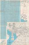
Map of Greater Tampa Florida. / City Map of Greater Tampa and Hillsborough County, Florida.
1968 (undated) 36.5 x 23.75 in (92.71 x 60.325 cm) 1 : 36200
1968 (undated) 36.5 x 23.75 in (92.71 x 60.325 cm) 1 : 36200
Description
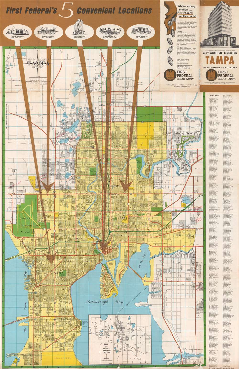
This is a c. 1968 Dolph Map Company city plan or map of Tampa, Florida, produced for the First Federal Savings and Loan Association of Tampa. As befits the map's purpose, five large brown arrows emphatically point out the five First Federal of Tampa locations around the city. Charming views of each branch appear near the top border at the end of each arrow. Tampa itself is shaded yellow, with city streets illustrated and labeled. City parks are colored green, along with Tampa International Airport and the University of South Florida. City property, including baseball fields, hospitals, the city's industrial park, the shopping center, and its housing projects are shaded a bright yellow. Orange highlights major thoroughfares. Tampa's many suburbs appear in the white areas surrounding the city itself. An inset map of Limona, Brandon, and Valrico is situated along the bottom border and a street index appears outside the right border.
Verso Content
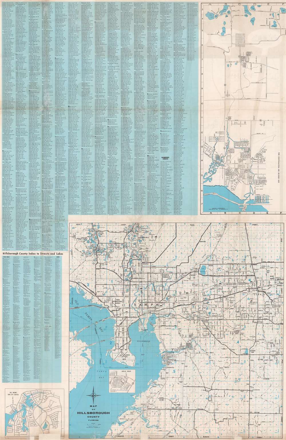
A map of Hillsborough County occupies at least a third of the verso and an extension of the map on the recto is situated in the upper right quadrant. A small map of Del Webb's Sun City Center is included in the lower right corner. A continuation of the Tampa street index from the recto and a smaller street index of Hillsborough County appears on the rest of the verso.Publication History and Census
This map was created by the Dolph Map Company for the First Federal Savings and Loan Association of Tampa c. 1968. At least one other map bearing the same title and much of the same content was published around the same time period, thus making identifying cataloged examples of the present map very difficult. We note three OCLC references for maps with this title published by the Dolph Map Company, but it is unclear if they represent examples of the present edition or the later edition with the same title.Cartographer
Frank B. Dolph (October 3, 1897 - November 26, 1975) was an American businessman and map publisher. Born in Great Neck, Long Island, New York, Dolph served as a Navy storekeeper during World War I. He began selling maps in 1919 after returning from England, likely for the George F. Cram Company, where he ultimately became an administrative aide. He also worked for the Rand McNally Company for some time before he founded his own map publishing firm, Dolph and Stewart, with his friend, sometime in the 1920s. Dolph and Stewart made maps throughout the 1920s and 1930s until they sold the firm in 1945 when Dolph decided to return to Florida. Dolph opened a new map publishing business, the Frank B. Dolph Map Co. in Ft. Lauderdale and published city plans of cities throughout the United States. Many of his maps were distributed by Chambers of Commerce or sold at newsstands. Real estate developers greatly appreciated his maps, those published by both the Dolph and Stewart Company and the Frank B. Dolph Company. Dolph retired as president of his firm around 1965, when he handed the business off to his son, Frank B. Dolph, Jr. Dolph worked with cartographer Theodore M. Politano for decades while operating the Frank B. Dolph Map Company. More by this mapmaker...
Condition
Good. Exhibits wear along original fold lines. Verso repairs to fold separations. Exhibits areas of infill along bottom border. Map of Hillsborough County on verso.
References
OCLC 5481693.