This item has been sold, but you can get on the Waitlist to be notified if another example becomes available, or purchase a digital scan.
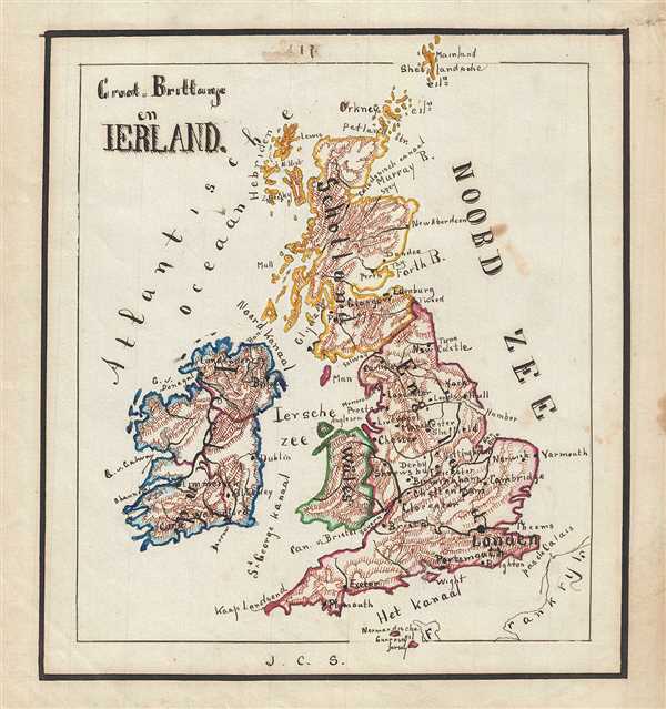
1871 Sikkel Manuscript Map of the British Isles (England, Scotland, Ireland)
GrootBrittanje-sikkel-1871$100.00

Title
Groot-Brittahje en Ireland.
1871 (undated) 9 x 8.5 in (22.86 x 21.59 cm)
1871 (undated) 9 x 8.5 in (22.86 x 21.59 cm)
Description
This is an attractive and whimsical 1871 manuscript map of the British Isles by J. C. Sikkel. Entirely hand-drawn, it covers Ireland, England, Wales, and Scotland including the Shetland Islands. Beautifully shows topography and notes several important cities, towns, rivers, islands, etc. Features wonderful and whimsical overall presentation. This map was drawn in 1871 by J.C. Sikkel as part of Der Atlas Geheele Aarde.
Condition
Very good. Minor spotting.