This item has been sold, but you can get on the Waitlist to be notified if another example becomes available, or purchase a digital scan.
1948 Polá de Toroella Large Map fo Guatemala and Belize
GuatemalaBelize-poladetorroella-1948$475.00

Title
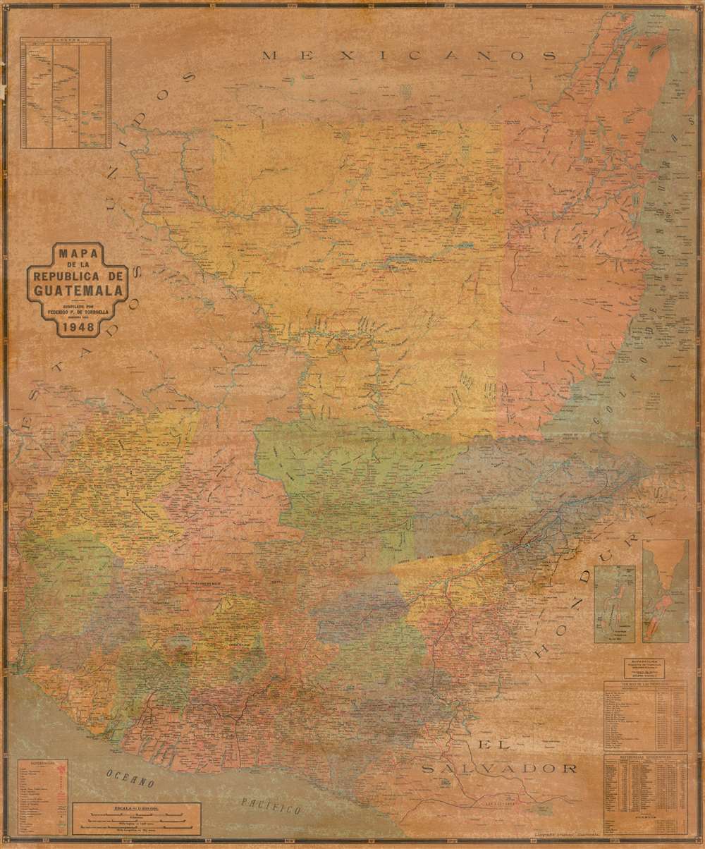
Mapa de la Republica de Guatemala.
1948 (dated) 37 x 30.5 in (93.98 x 77.47 cm) 1 : 600000
1948 (dated) 37 x 30.5 in (93.98 x 77.47 cm) 1 : 600000
Description
This is a rare large format map of Guatemala and Belize issued by Federico Polá De Torroella in 1948. The map covers all of Guatemala from the Gulf of Honduras to the Pacific and from Mexico to El Salvador. An inset in the upper left illustrates comparative heights of volcanoes, mountains, and depths of lakes. Twin insets in the lower left highlight Turneffe Atoll and Ambergris Caye, today popular with Scuba Divers as a jumping point for the legendary Great Blue Hole! In thi scorner there is also a key with geographical data and demographic references.
Publication History and Census
This map was compiled by Federico Polá De Torroella in 1948. It was printed in Guatemala by Litografía Arimany. The map was first issued in 1939, with reissues appearing, at least, in 1942, 1946 and 1948 (present example). This map is cited in about 10 institutional collections in various editions but is exceedingly scarce on the market with no identifiable market history.Cartographer
Federico Polá De Torroella (1904 - March 10, 1977) was a Mexican civil engineer and cartographer active in Mexico and Guatemala in the middle of the 20th century. He worked with the Pan-American Sanitary Bureau throughout Central America, helping to map the region and research disease and sanitation. He was born in Coahuilla, Mexico and died in Mexico City, Mexico. More by this mapmaker...
Condition
Average. Map backed on original linen. As all known examples, exhibits browning and spotty toning associated with old varnish. Minor edge damage.
References
Library of Congress, G4810 1948 .P6