1855 Woodford Wall Map of Hartford County, Connecticut
HartfordCounty-smith-1855-2$3,000.00


Title
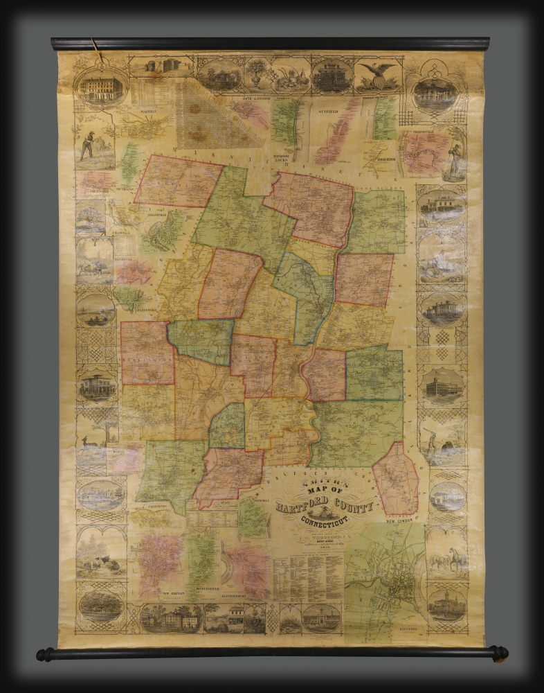
Smith's Map of Hartford County Connecticut.
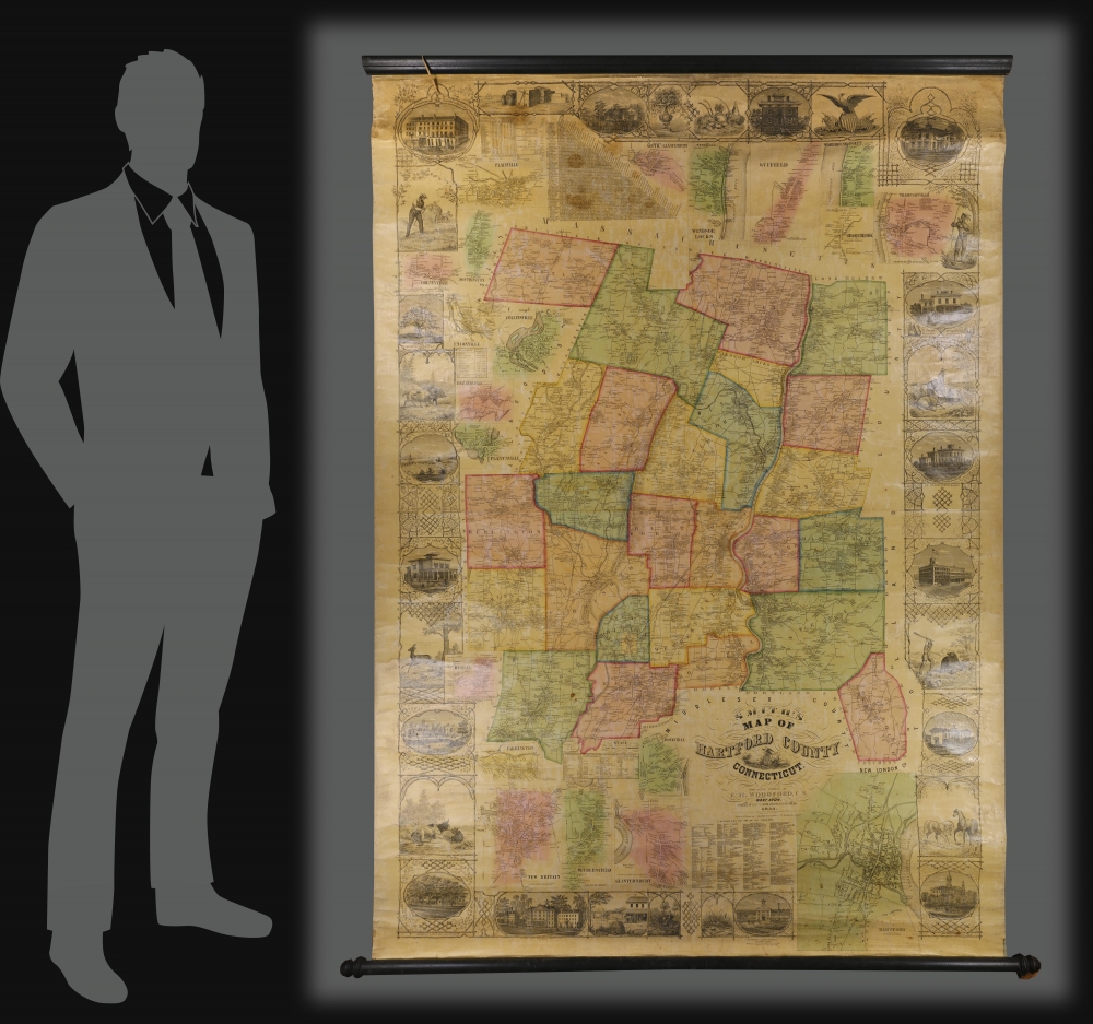
1855 (dated) 69.6 x 47 in (176.784 x 119.38 cm) 1 : 63360
1855 (dated) 69.6 x 47 in (176.784 x 119.38 cm) 1 : 63360
Description
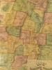
This is a rare 1855 wall map of Hartford County, Connecticut, by Edgar M. Woodford, a native of the county, based in West Avon.
A Closer Look
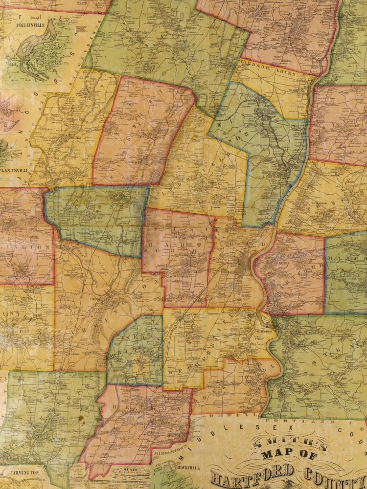
Centered on the city of Hartford and the Connecticut River, this map covers the county and is color coded by township. Important landmarks, businesses, and the mansions of prominent citizens are depicted in views framing the map. These include the State House in Hartford, State Normal School in New Britain, Connecticut Literary Institution in Suffield, the home of Col. A. G. Hazard in Enfield, the elegant Residence of Wm. H. Jones with View of Silk Factory, the Charter Oak, wildlife, and an Indian Warrior. Property holders and homes are identified throughout. Twenty inset maps surround the central map, including large and detailed town plans of Hartford, Farmington, Rockyhill, New Britain, Wethersfield, Glastonbury (Glastenbury), South Glastonbury (Glastenbury), Windsor Locks, Thompsonville, Broad Brook, Warehouse Point, Plainville, Cheneyville, Southington, Unionville, Collinsville, Hazardville, Plantsville, and BerlinPublication History and Census
This map was drawn based upon surveys completed by Edgar M. Woodford in 1855. It was engraved and printed by Wagner and McGuigan, and published by H. and C.T. Smith, both Philadelphia firms. OCLC lists ten examples in institutional collections. Scarce on the market.Cartographer
Edgar Maurice Woodford (April 15, 1824 – October 1, 1862) was a mid-19th century American abolitionist, civil engineer, surveyor, and map publisher active in New England. Woodford was born on his family farm in Avon, Connecticut. Although self-taught as a surveyor, he rose to become the official Hartford County surveyor. He was described by a nephew as 'a great strapping man,' who would come 'over the hills with his [surveying] instruments over his shoulder, crying for fear his work would not come out right.' Woodford produced numerous county surveys in Connecticut, Maine, and Massachusetts. Typically Woodford worked with other cartographers, but from time to time, he published independently, including his maps of Belfast and Frankfort, Maine, as well as Belknap, New Hampshire. As an abolitionist Woodford was part of the 1856 'Connecticut Colony in Kansas,' an attempt to colonize Kansas with enough abolitionist New Englanders to sway the vote and force Kansas to enter the Union as a Free State. When the Civil War broke out he enlisted in the Seventh Connecticut Volunteer Infantry, where he was assigned the rank of Quartermaster. It was during the war when he passed away in Hilton Head Island, South Carolina, of 'congestive fever,' an archaic term for malaria. He is interred in the soldiers cemetery at Hilton Head. More by this mapmaker...
Condition
Good. Minimal toning. Varnished over by publisher. Original linen backing stable; some visible wear in upper border images with minor loss. Original rollers.
References
OCLC 793203850. Stephenson, Land Ownership Maps: A Checklist of Nineteenth Century County Maps in the Library of Congresss, #60. Thompson, E., Maps of Connecticut for the Years of the Industrial Revolution, #164. Library of Congress, Map Division, G3783.H3G46 1855 .W6 TIL. Ristow, W., American Maps and Mapmakers: Commercial Cartography in the Nineteenth Century, p. 388.