This item has been sold, but you can get on the Waitlist to be notified if another example becomes available, or purchase a digital scan.
1931 Ruth Taylor White Pictorial Map of the Island of Hawaii, 'The Big Island'
Hawaii-taylor-1931$225.00

Title
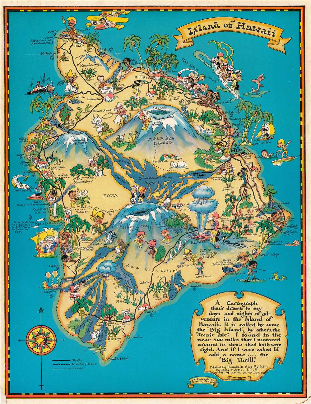
Island of Hawaii.
1931 (undated) 15 x 11.5 in (38.1 x 29.21 cm)
1931 (undated) 15 x 11.5 in (38.1 x 29.21 cm)
Description
This is a scarce 1931 Ruth Taylor White pictorial map of the island of Hawaii, commissioned by the Hawaii Tourist Bureau. The volcanoes Mauna Kea, Mauna Loa, and Kilauea dominate the island, with Kilauea is illustrated in mid-eruption. Dated lava flows are illustrated alongside lava tubes, and other formations. White blends Hawaii's tourist appeal with history and indigenous culture, noting the birthplace of Kamehameha I, the arrival of Captain Cook, and Captain Cook's monument.
Publication History and Census
This map was drawn by Ruth Taylor White, published by the Hawaii Tourist Bureau, and printed by the Honolulu Star-Bulletin. We note a single cataloged example of the 1931 edition, part of the David Rumsey Map Collection.Cartographer
Ruth D. Taylor White (March 1896 - 20??), a.k.a. Ruth Taylor Day, was an American pictorial mapmaker, what she liked to call 'carto-graphy'. Ruth was born Oregon to the painter John S. Taylor (1858 - 1927). Her interest in cartographic mapmaking was probably inspired by her sister Della Taylor Hoss (1900 - 1997), also an important pictorial cartographer. One of her first published works was a cover of The Stanford Illustrated Review, where her brother Frank attended university. Frank was an accomplished journalist and writer, and Ruth provided the illustrations for two of his books, popular works about the national parks, ’Oh Ranger!’ A Book About the National Parks and Grand Canyon Country. In the spring of 1930, White traveled to Hawaii, where she received a commission from the Hawaii Tourist Bureau to create pictorial maps of the Hawaiian Islands. Sets of five maps began appearing in 1931, with maps of Kauai, Oahu, Maui, Hawaii, and the island chain as part of the set. These were most likely handed out to visitors by the Bureau. White’s most famous work, a pictorial atlas entitled, Our USA: A Gay Geography was published in 1935 and was filled with ‘cartography’ of each state, which she published with her brother as Ruth Taylor. White is also known for her map of Treasure Island, the site of the Golden Gate International Exposition. A third sister, Bernice Taylor Fitzgerald, was also an artist, but did not make maps. Ruth was still an active artist as late as 1997. There is no record of her death, suggesting she may well be a centenarian. More by this mapmaker...
Condition
Very good. Both bottom corners recornered.
References
Rumsey 9072.000.