
White, Ruth D. Taylor
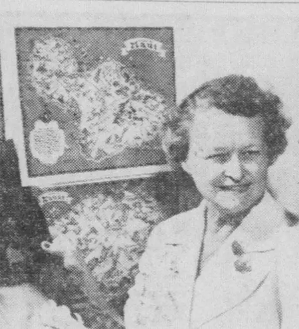
Ruth D. Taylor White (March 1896 - 20??), a.k.a. Ruth Taylor Day, was an American pictorial mapmaker, what she liked to call 'carto-graphy'. Ruth was born Oregon to the painter John S. Taylor (1858 - 1927). Her interest in cartographic mapmaking was probably inspired by her sister Della Taylor Hoss (1900 - 1997), also an important pictorial cartographer. One of her first published works was a cover of The Stanford Illustrated Review, where her brother Frank attended university. Frank was an accomplished journalist and writer, and Ruth provided the illustrations for two of his books, popular works about the national parks, ’Oh Ranger!’ A Book About the National Parks and Grand Canyon Country. In the spring of 1930, White traveled to Hawaii, where she received a commission from the Hawaii Tourist Bureau to create pictorial maps of the Hawaiian Islands. Sets of five maps began appearing in 1931, with maps of Kauai, Oahu, Maui, Hawaii, and the island chain as part of the set. These were most likely handed out to visitors by the Bureau. White’s most famous work, a pictorial atlas entitled, Our USA: A Gay Geography was published in 1935 and was filled with ‘cartography’ of each state, which she published with her brother as Ruth Taylor. White is also known for her map of Treasure Island, the site of the Golden Gate International Exposition. A third sister, Bernice Taylor Fitzgerald, was also an artist, but did not make maps. Ruth was still an active artist as late as 1997. There is no record of her death, suggesting she may well be a centenarian.
Pictorial map of Oahu.
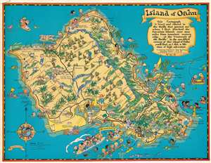
Island of Oahu.
$220.00
Acquire
- Digital Map Information
- Suitable for large format printing
- File Size: 54.06 MB
- File Type: ZIP / TIFF
- ICC color profile embedded
- Delivered instantly via download link
This is a 1931 Ruth Taylor White pictorial map of Oahu, Hawaii, commissioned by the Hawaii Tourist Bureau. Oahu appears as a tropical paradise were travelers arriving by ocean liner are greeted with leis, before moving on to the beaches and interior. Pineapples dot the center of the island and sugar cane is planted near the coasts. Mountain peaks, gulches, and valleys are labeled. Schofield Barracks and the Pearl Harbor naval base are noted. (more details)
The NEW Overland Trail.
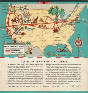
United Air Lines. A Gay Geography of the Main Line Airway.
$500.00
Acquire
- Digital Map Information
- Suitable for large format printing
- Full resolution TIFF file
- ICC color profile embedded
- Delivered instantly via download link
This is a lively c. 1938 pictorial map brochure for United Airlines drawn by Ruth Taylor White, based on her 1935 book Our U.S.A. - A Gay Geography . The maps show the airline’s Central Mid-Continent Route (or Main Line Airway) linking New York and San Francisco, with adjoining lines branching off in the Midwest and western United States. In the days before music and movies were available to airline passengers, this brochure would have provided badly-needed entertainment to fill the hours of cross-country flight time. (more details)