
This item below is out of stock, but another example (left) is available. To view the available item, click "Details."
Details
1943 Seitosha Japanese Co-prosperity Sphere Map of Hawaii
$475.00
1943 or Showa 18 Japanese Coprosperity Sphere Map of Hawaii
Hawaii3-showa18-1943$237.50

Title
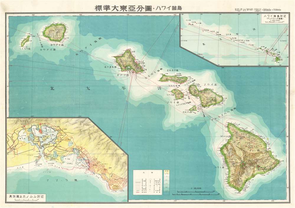
標準大東亞分圖 : ハワイ誻島 / Standard Map of the Great East Co-Prosperity Sphere. Hawaiian Islands.
1943 (dated) 20.5 x 29.25 in (52.07 x 74.295 cm) 1 : 850000
1943 (dated) 20.5 x 29.25 in (52.07 x 74.295 cm) 1 : 850000
Description
This is a rare 1943 Showa 18 map Japanese World War II (WWII) map of Hawaii from the Greater East Asian Co-Prosperity Sphere series. The map details the major Hawaiian Islands with an inset of Honolulu and Pearl Harbor, and another detailing the farther Hawaiian Islands. Oceanic Depths are illustrated with blue shading. Flight and shipping routes appear in red. The inclusion of the map in the Greater East Asian Co-Prosperity Sphere series implies that the Japanese held imperial ambitions for the archipelago.
The Greater East Asia Co-Prosperity Sphere
The Greater East Asia Co-Prosperity Sphere (大東亜共栄圏) was an imperial concept created and promulgated for occupied Asian populations during 1930-45 by the Empire of Japan. The concept was announced by Hachirō Arita on June 29, 1940. The Co-Prosperity Sphere was intended as a self-sufficient 'bloc of Asian nations led by the Japanese and free of Western powers.' It covered Southeast Asia, Eastern China, Manchuria, Japan, the East India Islands, and parts of Oceania. The idea promoted the cultural and economic unity East Asians, Southeast Asians, and Oceanians.Publication History
This map was created by the Japanese during World War II and issued as part of a 20 map Series of Great East Asia Maps. The Co-Prosperity Sphere map series was published by the Japan Publishing and Distribution Company, Ltd. (日本出版配給株式會社).Condition
Very good. Wear along original fold lines. Blank on verso. Accompanied by original sleeve.