This item has been sold, but you can get on the Waitlist to be notified if another example becomes available.
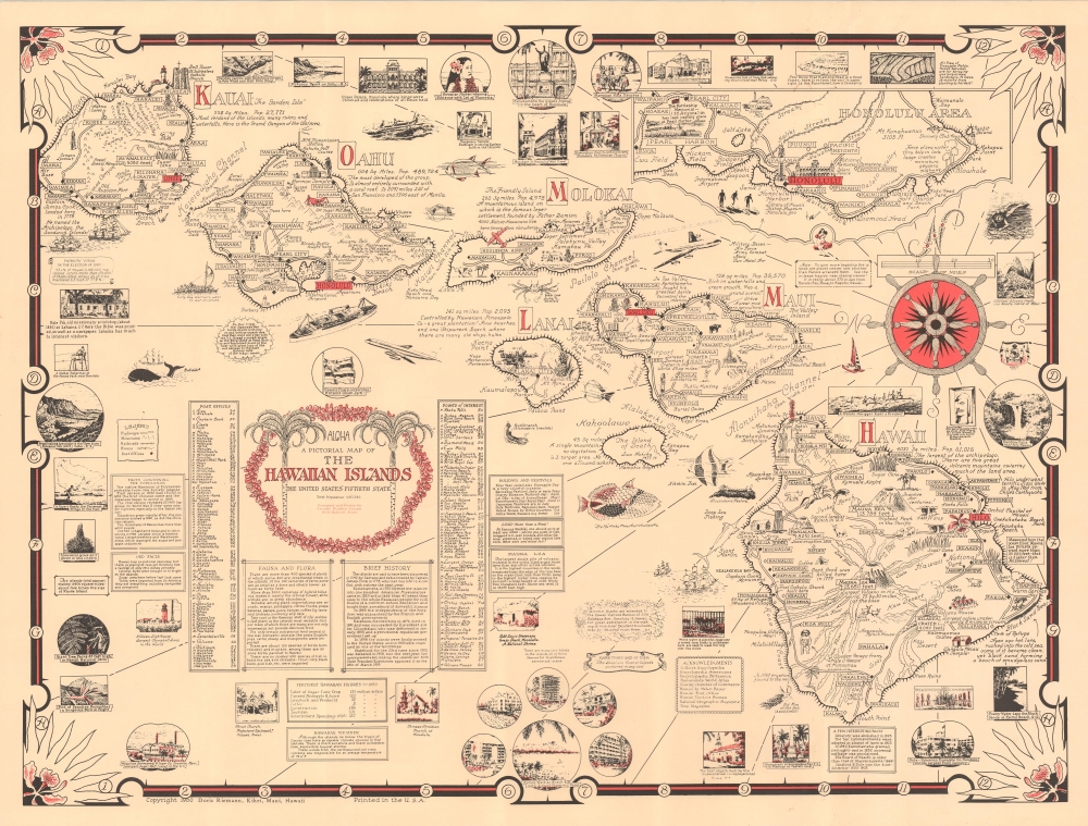
1960 Ernest Dudley Chase Pictorial Map of the Hawaiian Islands
HawaiianIslands-chase-1960
Title
1960 (dated) 19 x 25 in (48.26 x 63.5 cm) 1 : 670000
Description
A Closer Look
The map details the major Hawaiian Islands, with dense textual and pictorial elements celebrating Hawaiian culture, history, folklore, and natural beauty. Volcanoes, lava flows, natural wonders, indigenous artifacts, regional activities (hunting, fishing, surfing), and important modern landmarks (airports, Mormon Temple, etc.) are illustrated pictorially. Surrounding the map are vignette illustrations of significant sites and aquatic fauna. To either side of the decorative cartouche, coordinate tables identify several hundred locations.Doris Riemann
This map was commissioned and published by Doris Riemann in Hawaii. According to Clark Fair of the 'Mouth of Kenai' blog:Russ and Doris Riemann, who came to Alaska in 1953 when Russ agreed to take over the managerial duties for a floundering Alaska News Agency, which was headquartered in Anchorage. In the late 1950s, the Riemanns parlayed their knowledge of the wholesale distribution of reading materials into a new retail establishment - The Book Cache - which would become Alaska's preeminent bookselling business for the next three decades. Among its many retail outlets, The Book Cache included popular and profitable stores in the Carrs Mall in Kenai and the Central Peninsula Mall in Soldotna. When the Riemanns sold the business in the late 1980s, The Book Cache chain comprised 17 outlets, including two in Maui, Hawaii.
A New State
In 1960, Hawaii was still adjusting to its new status as the 50th state of the United States, having officially joined the union in 1959. The islands were experiencing a period of rapid growth and modernization as tourism began to flourish, spurred by the development of new hotels and infrastructure. This influx of visitors helped transform Hawaii's economy from one primarily based on agriculture - such as sugar and pineapple plantations - to one increasingly focused on tourism and services. The cultural landscape of Hawaii in 1960 was a vibrant blend of Native Hawaiian traditions and the influences of the many different ethnic groups that had settled in the islands over the years.Publication History and Census
This map was drawn and compiled by Ernest Dudley Chase from his offices in West Harwich, Massachusetts, and published in Kihei, Maui, Hawaii, by Doris Riemann. There are at least three variant editions: this one, published in Hawaii by Riemann; a variant with a yellow background, published by Chase in Massachusetts; and a third monochrome variant also published by Chase, likely later. In its various editions, we see just 3 examples in OCLC. This edition, published in Hawaii, may be the first and is the scarcest.Cartographer
Ernest Dudley Chase (July 26, 1878 - August 25, 1966) was an American illustrator of greeting cards and pictorial maps active in the first half of the 20th century. From his studio in Winchester, Massachusetts, Chase became famous for his elaborately illustrated pictorial maps. He was born in Lowell, Massachusetts, and attended the Lowell Textile School and the Vesper George Art School. He took work with Butterfield Printing Company in 1900. In 1906, he moved to the W. T. Sheehan Printing Firm. He began producing postcards and greeting cards on his own account in 1908. This initial imprint was Des Arts Publishers, but later, he changed it to Ernest Dudley Chase Publishers. Chase is best known today for his distinctive pictorial maps, most of which he published privately, characterized by dense vignette images of important locations. The biographical pamphlet A Meticulous Maker of Maps describes Chase's attention to detail wherein, pursuing a 'passion for perfection' by stippling his images 'dot-by-dot, with tiny pens' under a magnifying glass. His impressive corpus includes nearly 50 maps focusing on various parts of the United States and Europe, as well as other international locations and novelty pieces. Most are thematic, focusing on topics such as wonders of the world, stamps, aviation, and war. Others, such as his map of The United States as viewed by California and Loveland are satirical. All, in their original editions, are coveted by a dedicated following of modern collectors. More by this mapmaker...

