1919 H. E. Newton Wall Map of the Hawaiian Islands (Hawaii Territory)
HawaiiLarge-newton-1919$8,000.00

Title
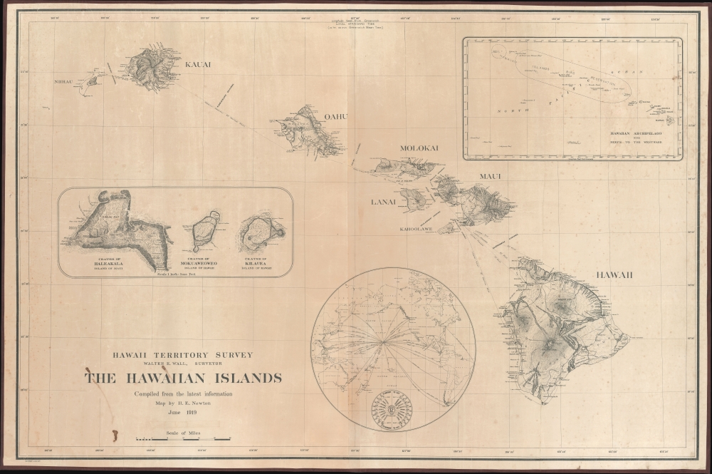
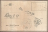
Hawaii Territory Survey. The Hawaiian Islands Compiled from the latest information Map by H. E. Newton June 1919.
1919 (dated) 40 x 60 in (101.6 x 152.4 cm) 1 : 475000
1919 (dated) 40 x 60 in (101.6 x 152.4 cm) 1 : 475000
Description
A singular survivor from the first Hawaiian Territorial Survey, this is Henry E. Newton's 1919 map of the Hawaiian Islands, here in a previously unknown double-sized presentation issue. This is the most important map of Hawaii issued during the territorial period and the foundation for most subsequent maps of the archipelago into the late 20th century.
A Closer Look
At an unprecedented scale (1:475000), this massive map covers the Hawaiian archipelago in detail, including the eight major islands and smaller surrounding islands. The map details topography by hachure, with some elevations noted, as well as ports, roads, trails, lighthouses, national parks, and inter-island routes. Insets focus on the Hawaiian Islands Bird Reservation, just to the northeast of the main group, and the three major volcanic craters: Haleakala (Maui), Mokuaweoweo (Hawaii), and Kilauea (Hawaii). A tertiary inset highlights Hawaii's strategic location at the center of the Pacific, with milage and travel lines to major ports defined. There is, as well, a world-time reference centered on Honolulu. A pastedown covers part of the map's scale - likely mirroring the '1 inch = 60000 Feet' scale, which appears on the smaller government report issue, here obscured as the correct scale in these terms would be '1 inch = 39500 Feet'.Hawaiian Territorial Survey
The Hawaiian Territory Survey, established in the late 19th century, was a critical initiative for mapping and understanding the geographical, natural, and cultural landscapes of the Hawaiian Islands following their annexation by the United States in 1898. First under William D. Alexander, then under Walter E. Wall, the new survey supplanted and superseded the 1870s Hawaiian Government Survey. This comprehensive effort aimed to facilitate land management, development, and planning in the newly acquired territory. It involved detailed mapping of the islands' topographies, natural resources, and land uses, significantly contributing to agricultural, urban, and infrastructural development. The survey's findings and maps became foundational tools for government and private sector planning, helping to shape the islands' economic growth and environmental management strategies well into the 20th century. The Territorial Survey continued its work until Hawaii became a state in 1959.Publication History and Census
The only known example. The OCLC identifies a half-sized variant (133468723), measuring about 25 x 38 in (63 x 96 cm / 1:750000) in 11 institutions, including the University of Hawaii. Based on the size of the text, it is likely that this is the original proof printing, which was then reduced for the smaller government report issue. Of this larger issue, we see no other examples.CartographerS
Herbert Ellsworth Newton (September 2, 1882 - January 30, 1963) was a Hawaiian surveyor and engineer. Born in Maui County, Hawaii, Newton attended school in the islands before joining the Hawaiian Territorial Survey as a 'rodman' in November 1900. (Rodmen transport and set up survey equipment and prepare the job site.) He worked for the Hawaiian Territorial Survey for nearly 50 years and was the chief cadastral engineer when he retired on July 1, 1950, at the time the longest continual service with the Hawaii Territorial government. He made the first official map of the Hawaii Territory in 1919. He married Minnie Hutchison in June 1906, and they had three children. More by this mapmaker...
Walter Eugene Wall (October 13, 1867 - July 23, 1944) was an American surveyor. Born in Yreka, California, he arrived in Honolulu with his parents in 1880. His father was the architect in charge of the construction of the Iolani Palace. He began working at the Hawaiian Government Survey in 1889 and was appointed Territorial Surveyor General in 1901. He worked for the survey for more than 35 years. Wall attended the Ponahou School where he was known for his athletics, introducing the curveball (referenced as 'curve pitching in baseball' in his obituary) to Hawaii. He married Edith Louise Dietz on June 22, 1903. He died in 1944 in Honolulu. Learn More...
Condition
Good. Some spotting and uneven surface toning. Two sheets, joined by publisher.
References
cf. OCLC 133468723 (Half Size Variant).