This item has been sold, but you can get on the Waitlist to be notified if another example becomes available.
1986 Maguire and Strabala 'Hemingway' Pictorial Literary Map of the World
HemingwayAdventure-maguirestrabala-1986$125.00

Title
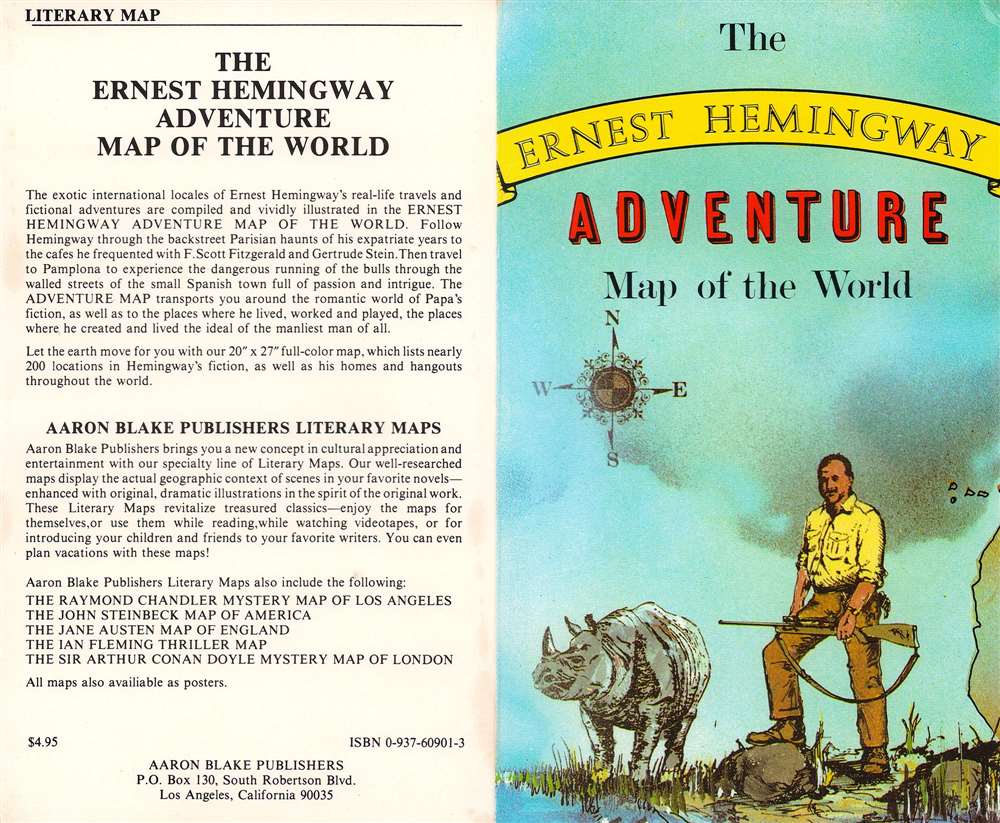
The Ernest Hemingway Adventure Map of the World.
1986 (dated) 19.75 x 26.5 in (50.165 x 67.31 cm) 1 : 29400000
1986 (dated) 19.75 x 26.5 in (50.165 x 67.31 cm) 1 : 29400000
Description
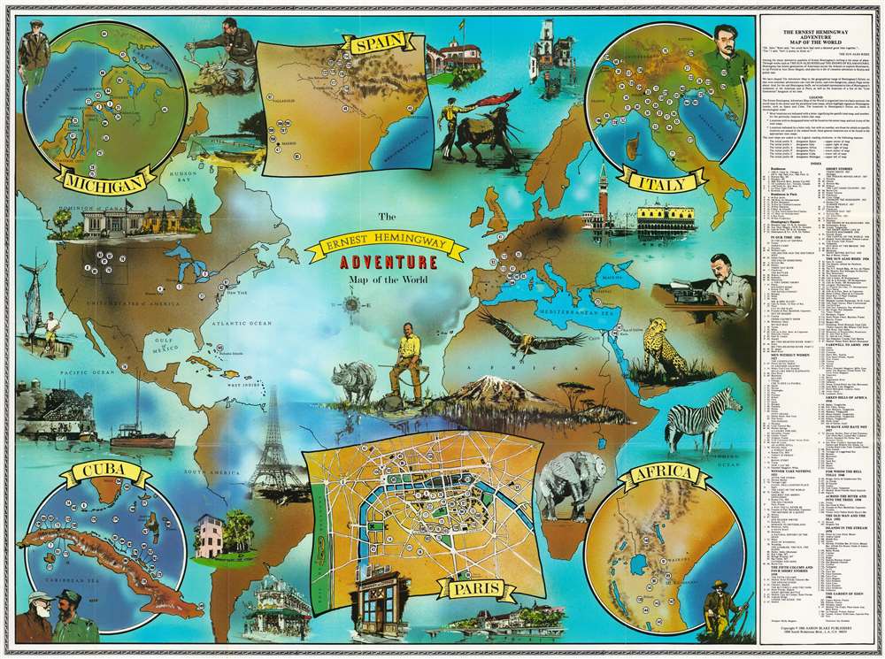
This is Molly Maguire and Jay Strabala 1986 'Ernest Hemmingway' literary map of the world, highlighting residences, haunts, and literary sites. Coverage extends from the Americas to the Middle East with six inset maps situated along the borders. 190 numerically identified locations are scattered across the map marking important places in Hemingway's life or works. Illustrations of some, including Mount Kilimanjaro, Havana Harbor, Venice, and several Parisian sites (such as the Eiffel Tower, Shakespeare and Company, and the Seine River) create the sense of worldwide adventure. Beginning in the upper left, the inset maps detail Michigan, Spain, Italy, Cuba, Paris, and Africa. Portraits of 'Papa' Hemingway appear close to each of these insets. An index along the right lists Hemingway's residences (his residences in Paris are separated out), and sites in his books, including The Sun Also Rises, A Farewell to Arms, For Whom the Bell Tolls, and The Old Man and the Sea.
A Wonderful Series of Literary Maps
Aaron Blake published a series of literary maps in the mid to late 1980s. Some focused on specific cities (such as New York, Paris, and Los Angeles), some on specific authors (Ernest Hemingway, Ian Fleming, Jane Austen), and others on geographic regions (the American South, Latin America). Every map is visually striking in its own way and a great addition to any bibliophile's collection.Publication History and Census
This map was designed by Molly Maguire, illustrated by Jay Strabala, and published by Aaron Blake in 1986. This map is well represented in institutional collections, appearing in just over two dozen collections across the United States.Condition
Very good. Light wear along original fold lines.
References
OCLC 456332533.