
1965 Dolph Map of Hollywood, Florida and Vicinity

This item has been sold.
Dolph's Map of Hollywood and Vicinity Florida. / Dolph's Map of Hollywood and Eastern Broward County Florida.
Suburban South Florida. Seminole Reservation.
Suburban South Florida. Seminole Reservation.
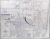
This is a c. 1965 Frank Dolph map of Hollywood, Florida, and environs. It captures the area in a period of rapid postwar growth, evidenced by new housing developments, infrastructure, and public buildings.A Closer Look
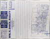
This map depicts Hollywood in its entirety, as well as the smaller nearby communities of Dania, Hallandale, Pembroke Park, Hollywood Ridge Farms, Miramar, and Davie, as well as portions of Pembroke Pines, Cooper City, Fern Crest Village, and Fort Lauderdale. The Dania Seminole Indian Reservation is located near the center; nearly 500 acres in size, it is one of six reservations governed by the federally recognized Seminole Tribe of Florida. Streets are labeled throughout and are also listed in an index on the verso, corresponding to a grid surrounding the map. Many of the east-west streets in downtown Hollywood are named after presidents or generals, particularly of the U.S. Civil War. Running north-south are Interstate 95 towards the right and the 'State Parkway' (Florida Turnpike) towards the left.In addition to roads, golf courses, schools, hospitals, cemeteries, waterways, parks, racetracks, airports, and other public institutions and landmarks are indicated. A large arrow points to the location of Wm. H. Sheck Realty, which sponsored the map. The verso includes a map of eastern Broward County with survey lines and city limits traced.
Publication History and Census
This map was prepared by the Dolph Map Company. It is undated, but from context likely dates to between 1963 and 1965, a date which is also consistent with advertisements for Wm. H. Sheck Realty (which appears to have been a short-lived operation). Notably, the name 'Fort Lauderdale Hollywood International Airport' indicates a date after 1963, but the continued designation of a 'Colored H.S.' would point to a date before 1966, when South Broward High School was integrated. The OCLC (5415715) catalogs multiple Dolph maps of Hollywood and vicinity from this era together, but none exactly matches the present printing (generally being sponsored by the local Chamber of Commerce rather than Sheck Realty).Cartographer
Frank B. Dolph (October 3, 1897 - November 26, 1975) was an American businessman and map publisher. Born in Great Neck, Long Island, New York, Dolph served as a Navy storekeeper during World War I. He began selling maps in 1919 after returning from England, likely for the George F. Cram Company, where he ultimately became an administrative aide. He also worked for the Rand McNally Company for some time before he founded his own map publishing firm, Dolph and Stewart, with his friend, sometime in the 1920s. Dolph and Stewart made maps throughout the 1920s and 1930s until they sold the firm in 1945 when Dolph decided to return to Florida. Dolph opened a new map publishing business, the Frank B. Dolph Map Co. in Ft. Lauderdale and published city plans of cities throughout the United States. Many of his maps were distributed by Chambers of Commerce or sold at newsstands. Real estate developers greatly appreciated his maps, those published by both the Dolph and Stewart Company and the Frank B. Dolph Company. Dolph retired as president of his firm around 1965, when he handed the business off to his son, Frank B. Dolph, Jr. Dolph worked with cartographer Theodore M. Politano for decades while operating the Frank B. Dolph Map Company. Further Details...
Condition
Good. A few archival verso repairs to old fold separations.