This item has been sold, but you can get on the Waitlist to be notified if another example becomes available, or purchase a digital scan.
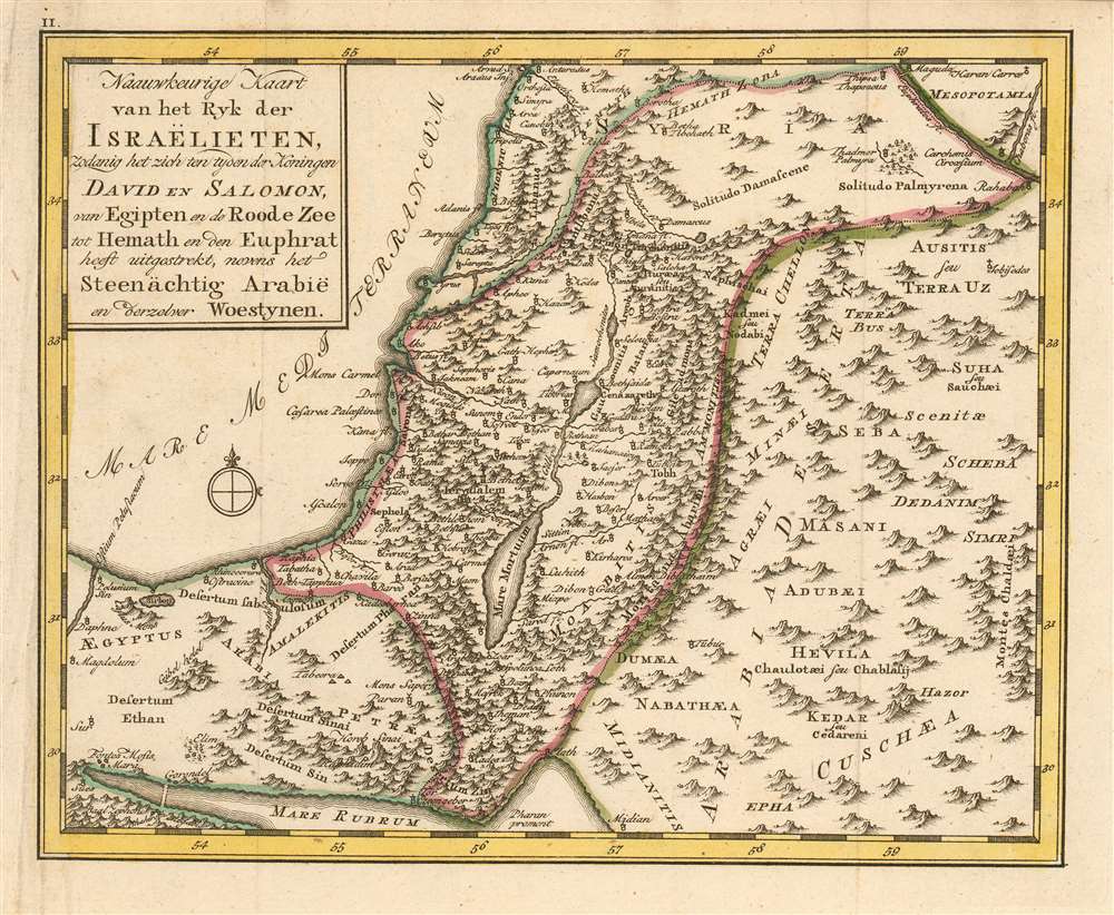
1780 Schley Map of the Holy Land during the Regins of Kings David and Solomon
HolyLand-schley-1780$250.00

Title
Naauwkeurige kaart van het ryk der Israëlieten, zodanig het zich ten tyden der Koningen David en Salomon, van Egipten en de Roode Zee tot Hemath en den Euphrat heest uitgestrekt, nevens het Seenächtig Arabië en berzelver Woestynen.
1780 (undated) 7 x 8.5 in (17.78 x 21.59 cm) 1 : 4103827
1780 (undated) 7 x 8.5 in (17.78 x 21.59 cm) 1 : 4103827
Description
This rare 1780 map of the Holy Land presents the region showing the kingdom of Israel during the reigns of King David and King Solomon. The map extends from the Mediterranean Sea and the Red Sea to the upper Euphrates River. The map's topography is shown pictorially and for the most part fancifully. The place names are drawn from Biblical sources, as is appropriate for a map intended to accompany a book of Biblical geography, but the map also draws from ancient geographers such as Pliny, and Josephus.
Publication History and Census
This map was engraved by Jacob van der Schley for Martinus de Bruyn's Bybelsche huis en zak-Atlas, an atlas of fifteen maps intended to accompany Johan Jacob Schmidt's 1776 Bybelsche Geögraphicus . The atlas was not produced until 1780 and was relegated to a small, solitary edition. Consequently all of the maps of the atlas are rare. OCLC shows only nine examples of the zak-Atlas in institutional collections. Only one example of this map appears in OCLC, catalogued as an anonymous work at the National Library of Israel.Cartographer
Jacob Van der Schley (1715 - 1779) was a prominent Amsterdam engraver and draftsman based out of Amsterdam. Schley apprenticed under portrait engraver Bernard Picart, whose style he imitated. He is said to have completed several of Picart's portraits following his master's death. While Schley is primarily known for his work as a portraitist and illustrator, he also has a considerable cartographic corpus. He is known to have worked with Bellin, Hondt, and Provost, among others. More by this mapmaker...
Source
De Bruyn, Martinus Bybelsche huis en zak-AtlasAmsterdam, 1780.
Condition
Very good condition; some creasing to left margin, else excellent with original outline color.
References
OCLC 1010285848. Not in Laor.