This item has been sold, but you can get on the Waitlist to be notified if another example becomes available, or purchase a digital scan.
1958 U.S. Air Force Aeronautical Chart or Map of Hong Kong
HongKongIsland-usaf-1958$75.00

Title
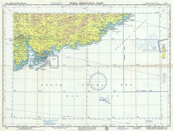
Hong Kong Island China-Hong Kong and New Territories-Macau.
1958 (dated) 22 x 29 in (55.88 x 73.66 cm) 1 : 1000000
1958 (dated) 22 x 29 in (55.88 x 73.66 cm) 1 : 1000000
Description
This is an uncommon 1958 U.S. Air Force aeronautical chart or map of Hong Kong. It covers the region from Da'ao Inlet and Donshan Bay east to Huangmao Hai (Sea), focusing on Hong Kong. It notes danger areas, prohibited areas, important cities, rivers, roads, straits, banks, railways, topography and other data essential for the air pilot. Verso features legends and a world aeronautical chart index. This chart was published by the Aeronautical Chart and Information Center and issued as chart no. 614. First issued in 1946, this is the eight edition revised to Nov. 1958.
Condition
Very good. Minor wear and toning along original fold lines. Minor edge wear.