This item has been sold, but you can get on the Waitlist to be notified if another example becomes available, or purchase a digital scan.
1892 Proof State U.S. Navy Map of Honolulu Harbor, w/manuscript corrections
Honolulu-wiltse-1892$1,450.00


Title
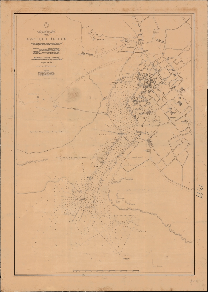
North Pacific Ocean, Hawaiian Islands, Oahu, Honolulu Harbor.
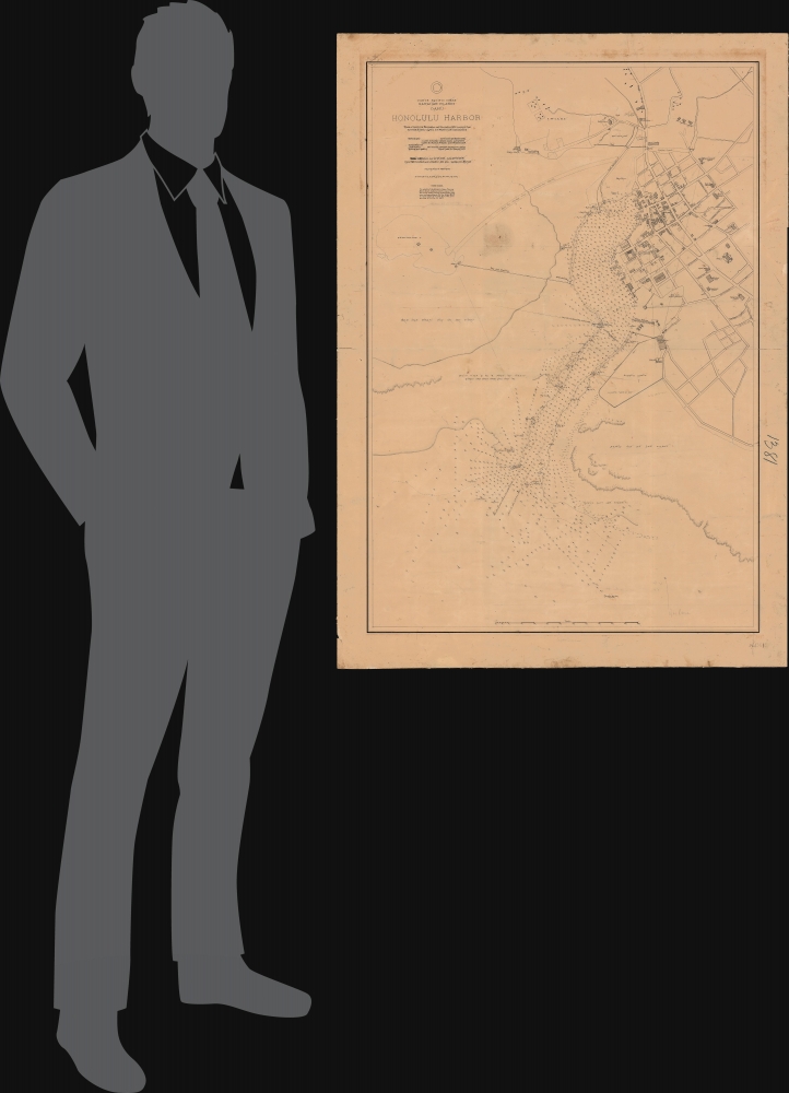
1892 (dated) 44 x 31 in (111.76 x 78.74 cm) 1 : 3600
1892 (dated) 44 x 31 in (111.76 x 78.74 cm) 1 : 3600
Description
A fascinating 1892 proof-state of the first U.S. survey of Honolulu Harbor, Hawaii, completed under Captain Gilbert Wiltse in 1892. Replete with manuscript corrections and annotations, this map offers unique insight into the processes behind U.S. Navy Hydrographic office survey publication. Historically, this map appeared within the context of potential U.S.-Hawaiian Annexation and the 1893 Hawaiian Revolution - in which Wiltse played a role.
Meanwhile, a group of American and European anti-monarchists formed the 'Annexation Club', with the intent to overthrow the monarchy in anticipation of U.S. Annexation. In January 1893, the President of the United States, Benjamin Harrison, was an ardent expansionist and eager to make the annexation a reality. It is likely that Harrison's administration was in touch with Annexation Club members as early as 1892 and fully supported their agenda. Although undocumented, it is likely that the Wiltse survey, offered here, was planned in anticipation of such action. Certainly, existing correspondence with the Secretary of the Navy Benjamin F. Tracy indicates that he was initially sent there in mid-1892 to protect American interests.
Keen to prevent the new constitution, the Annexation Club overthrew Liliuokalani on January 17, 1893. Still in Honolulu Harbor, Wiltse landed 162 marines to protect the U.S. consulate and other assets during the uprising - but he, too, generally supported the revolution. The next day, the 'Committee of Safety' issued their proclamation declaring martial law, deposing the queen, and establishing the Provisional Government until such time as union with the U.S. could be attained. Both U.S. government minister John L. Stevens and Captain Wiltse supported the revolutionaries, and by midnight, all 17 foreign consuls in Honolulu recognized the new government.
Back in Washington, Harrison surrendered the presidency to Grover Cleveland, who was anti-expansionist and rejected annexation. Cleveland criticized the involvement of the American military in the coup but took no substantive action to restore the Hawaiian monarchy. The new pro-annexation government in Honolulu continued to push for its goals. Meanwhile, Cleveland was replaced by William McKinley. While not an ardent expansionist, when the Spanish-American War broke out in 1898, Hawaii became an extremely valuable naval asset, and the push for annexation gained new momentum. It was formally annexed on August 12, 1898.
Hawaiian Revolution
This map was surveyed and published against the backdrop of political instability in Hawaii and the drive for its annexation into the United States by a cadre of powerful Caucasian Honolulu businessmen. Hawaiians, for their part, were dissatisfied with the restrictive 'Bayonet Constitution' forced at gunpoint on King Kalakaua in 1887. That constitution stripped the monarchy of much of its authority and transferred power to American, European, and native Hawaiian elites. Queen Liliuokalani, who succeeded Kalakaua in 1891, announced in 1893 that she would propose a new constitution more favorable to the Hawaiian monarchy.Meanwhile, a group of American and European anti-monarchists formed the 'Annexation Club', with the intent to overthrow the monarchy in anticipation of U.S. Annexation. In January 1893, the President of the United States, Benjamin Harrison, was an ardent expansionist and eager to make the annexation a reality. It is likely that Harrison's administration was in touch with Annexation Club members as early as 1892 and fully supported their agenda. Although undocumented, it is likely that the Wiltse survey, offered here, was planned in anticipation of such action. Certainly, existing correspondence with the Secretary of the Navy Benjamin F. Tracy indicates that he was initially sent there in mid-1892 to protect American interests.
Keen to prevent the new constitution, the Annexation Club overthrew Liliuokalani on January 17, 1893. Still in Honolulu Harbor, Wiltse landed 162 marines to protect the U.S. consulate and other assets during the uprising - but he, too, generally supported the revolution. The next day, the 'Committee of Safety' issued their proclamation declaring martial law, deposing the queen, and establishing the Provisional Government until such time as union with the U.S. could be attained. Both U.S. government minister John L. Stevens and Captain Wiltse supported the revolutionaries, and by midnight, all 17 foreign consuls in Honolulu recognized the new government.
Back in Washington, Harrison surrendered the presidency to Grover Cleveland, who was anti-expansionist and rejected annexation. Cleveland criticized the involvement of the American military in the coup but took no substantive action to restore the Hawaiian monarchy. The new pro-annexation government in Honolulu continued to push for its goals. Meanwhile, Cleveland was replaced by William McKinley. While not an ardent expansionist, when the Spanish-American War broke out in 1898, Hawaii became an extremely valuable naval asset, and the push for annexation gained new momentum. It was formally annexed on August 12, 1898.
A Closer Look
The chart offers large-scale detail of both the city and harbor of Honolulu, at the time still a relatively small town with basic services and a limited street grid surrounding the harbor and palace. The map notes existing streets as well as important private and government structures. There are thousands of depth soundings throughout, noted in fathoms.Manuscript Annotations
Most text, including soundings, is crossed out in pencil, likely reflecting a checking or correction system prior to the map being sent for re-engraving and publication. Other annotations in red pen are intended corrections, most of which are indeed represented in the 1893 official printing. These include the correction of typographical and engraving errors, adding new information, and updating existing content. The chart was officially published by the U.S. Navy Hydrographic Office in September 1893 - 'September' is also written in pencil in the lower margin.Publication History and Census
This map was prepared in 1892 under the command of U.S. Navy Captain Gilbert Conwall Wiltse. The present example is a unique proof of which no comparable exists. The subsequent official chart, issued in September 1893, survives in but a single example at the University of Wisconsin. The basic outline presented here served as the structural underpinning of all subsequent U.S. Hydrographic Office charts of Honolulu Harbor through the 1960s.CartographerS
United States Hydrographic Office (1866 - 1962) was a brach of he U.S. Navy that prepared and published maps, charts, and nautical books to aid in navigation. Before the establishment of the Hydrographic Office in 1866, U.S. navigators were almost entirely dependent on British charts. There had been a few private enterprises that had prepared and published charts, but none had been able to do so profitably. The Office was established 'for the improvement of the means of navigating safely the vessels of the Navy and of the mercantile marine, by providing, under the authority of the Secretary of the Navy, accurate and cheap nautical charts, sailing directions, navigators, and manuals of instructions for the use of all vessels of the United States, and for the benefit and use of navigators generally.' This way the Navy Department could furnish navy and merchant ships with charts illustrating the results of surveys and explorations undertaken by naval officers. The charts were priced to cover the cost of paper and printing alone, not preparation. Its main objective was to survey foreign coasts, as the Coast and Geodetic Surveys were responsible for surveying domestic waters. The Hydrographic Office was transferred from the Department of the Navy to the Department of Defense in 1949 and was replaced by the Naval Oceanographic Office in 1962. More by this mapmaker...
Gilbert Conwall Wiltse (November 29m 1838 - April 26, 1893) was an American naval officer active throughout the 19th century. Wiltse was born in New York and graduated from the Naval Academy in 1855. He served as a midshipman in the Brazilian Station from 1859 - 1861, at which point he was made lieutenant. During the American Civil War (1861 - 1865), he was recalled and was present at the March 8 and 9, 1862 Hampton Roads engagement of the CSS Virginia, with the USS Congress and the USS Cumberland. He also served in the West Indies and as part of the 1863 - 1864 blockading squadron. He was commissioned Lieutenant Commander on March 3rd, 1865. He served in New York and the North Atlantic between and 1885. In 1891, he was put in command of the Boston, and sent around South America into the Pacific. On this voyage, Wiltse had a stroke. Although he appeared to recover, he was never again a strong commander and give indication of mental instability. The Boston was shortly thereafter sent to Hawaii, both to protect American interests there and to survey Honolulu Harbor. Wiltse was in Honolulu when the Hawaiian Revolution broke out and was dispatched with a contingent of marines to defend the U.S. Consulate. He supported the revolution and, according to some reports boldly asserted that he had 'taken Hawaii for the United States'. He returned to New York City immediately after, believing he would be me with parades and presidential accolades. Such might have happened if Harrison remained president, but Grover Cleveland did not support annexation and turned Wiltse away. In fact, the U.S. flags Wiltse so proudly raised over Hawaii were taken down shortly thereafter. It is said that when he heard this new he collapsed into a fit and, aged 54, died of 'congestion of the brain'. Learn More...
Condition
Average. Even toning and some staining. Replete with manuscript corrections. Laid on original linen.
References
cf. University of Wisconsin, American Geographical Society Library Digital Map Collection, Nautical charts HO 1381.