1835 Manuscript Map of the Western Hoshungabad, Madhya Pradesh, India
Hoshungabad-manuscript-1835$250.00

Title
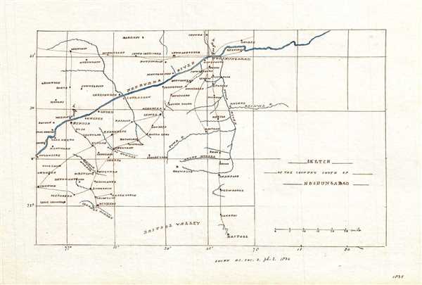
Sketch of the Country South of Hoshungabad.
1835 (dated) 6 x 8.5 in (15.24 x 21.59 cm) 1 : 1000000
1835 (dated) 6 x 8.5 in (15.24 x 21.59 cm) 1 : 1000000
Description
This is a beautiful 1835 manuscript map of the western portion of the Hoshangabad District in modern day Madhya Pradesh, India. The map covers from the Narmada River south as to Baitool (Betul) and from west from the Tawa River. Several rivers, towns and villages are noted. According to the text along the bottom margin, this map is based on a map issued in 1834 as plate 2 in the Journal of the Asiatic Society of Bengal. Established in 1784 as a center for Asian studies. The Society exists today as The Asiatic Society, and is located in Kolkata, India.
Condition
Very good. Manuscript map. Minor spotting.