This item has been sold, but you can get on the Waitlist to be notified if another example becomes available.
1967 Tallandier Pictorial Map of Hawaii
IlesHawaii-tallandier-1967$50.00

Title
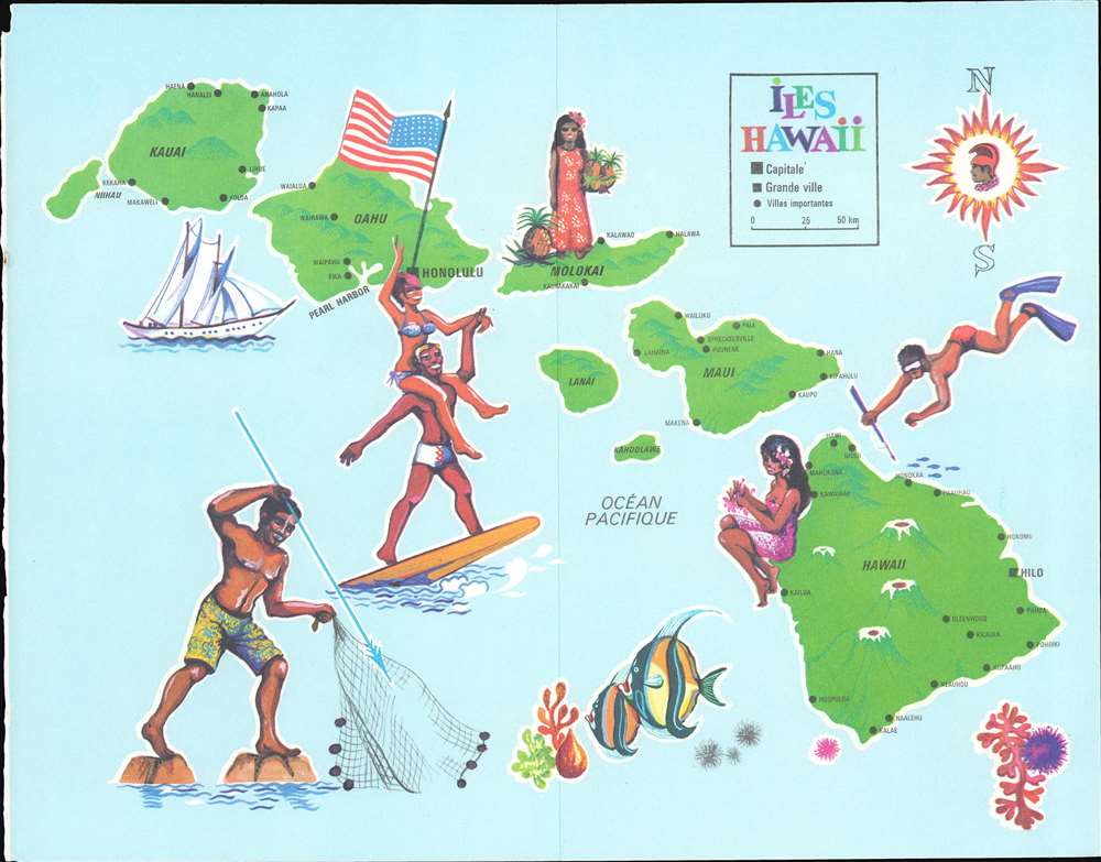
Iles Hawaii.
1967 (dated) 8.25 x 10.5 in (20.955 x 26.67 cm)
1967 (dated) 8.25 x 10.5 in (20.955 x 26.67 cm)
Description
This is a 1967 Tallandier pictorial map of Hawaii. The map depicts and labels the islands of Hawaii, Maui, Molokai, Oahu, Kauai, Lanai, Kahoolawe, and Nihau. Cities and towns are labeled as well, including Honolulu and Hilo, as well as Pearl Harbor. Hawaii's three largest volcanoes are illustrated. Pictorial vignettes highlight life in the islands, including spearfishing, surfing, and making leis. A young woman holds pineapples on Molokai, a fruit long been associated with Hawaii.
Publication History
This map was created under the direction of Sanford Berg, printed by the Imprimerie de Sceaux, and was published by Tallandier.Condition
Very good. Exhibit light wear and toning along original centerfold. Blank on verso.