
This item below is out of stock, but another example (left) is available. To view the available item, click "Details."
Details
1930 Philip Tourist Map of India (w/ Monuments)
1930 (undated) $800.00
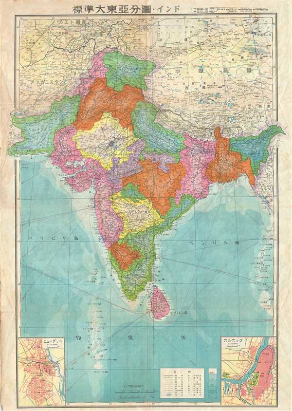
1943 or Showa 18 World War II Era Japanese Map of India and Pakistan (pre-independence)
India2-showa18-1943$125.00

Title
India.
1943 (undated) 30 x 21 in (76.2 x 53.34 cm) 1 : 7000000
1943 (undated) 30 x 21 in (76.2 x 53.34 cm) 1 : 7000000
Description
This is a beautiful 1943 or Showa 18 large format map of India, issued by the Japanese during World War II. It covers all of India and Pakistan in great detail, and includes Sri Lanka. The map offers superb detail regarding topographic and political features and notes cities, roads, and trade routes on air, sea and land. Shading is used to display oceanic depths. Includes two insets in the lower quadrants.
This map was issued while India was in the midst of its struggle for freedom. The British Raj however, was still in control of the country, which led to India's participation in World War II.
This map was created by the Japanese during World War II and issued as part of a 20 map Series of Great East Asia Maps, detailing parts of Asia and the Pacific. All text is in Japanese.
Condition
Very good. Minor wear along original fold lines. Minor toning and spotting. Accompanied by original cover no. 19.